


 Deutsch
 Nederlands
Kufstein Via Ferrata

A classic amongst the via ferratas on the Wilder Kaiser massif – ideal as a 2-day tour.
Access time3,5
Via ferrata
Difficulty levelD
Via ferrara length675,0 m
We are sorry, your requested page is not available. You can start a new search on this page!
A classic amongst the via ferratas on the Wilder Kaiser massif – ideal as a 2-day tour.
Access time3,5
Via ferrata
Difficulty levelD
Via ferrara length675,0 m

Hikers, young and old alike, will find in this wild romantic gorge natural playgrounds such as bridges and balancing beams by streams and ponds.
Hiking starting point Tourist Info, Scheffau (738 m)
Hiking starting point Tourist Info, Scheffau (738 m)
Hiking
Easy
1:15 h
3,5 km
130 Elevation gain

Onto the Hausberg mountain with panoramic views of the Wilder Kaiser and Hartkaiser mountains and back via the Ranhartalm.
Hiking starting point Tourist Info, Ellmau (800 m)
Hiking starting point Tourist Info, Ellmau (800 m)
Hiking
Easy
8:00 h
22,8 km
1020 Elevation gain

Over hill and dale through idyllic nature up to the Rauhen Kopf.
Astberg Bergstation
Astberg Bergstation
Hiking
Intermediate
4:45 h
13,1 km
620 Elevation gain

Pull on your walking boots and join us on a hike across Tirol! The first stage of the Eagle Walk provides a truly spectacular start to what is set to be an unforgettable journey from east to west. We begin our adventure in the Kaiser Mountains with their craggy grey peaks towering above lush green meadows. Some of the most famous mountains in this part of Tirol include the Maukspitze, Ackerlspitze, Regalpspitze and Törlspitze, all of which are over 2,000 metres high. The hike begins at the Gasthaus Rummlerhof, a guesthouse to the north-west of the centre of St. Johann. Upon arrival at your destination, the Gaudeamushütte, you can raise your glass and to a successful day and sing: "Gaudeamus igitur - Let us be happy!". Alternatively, why not add an extra challenge and take on the 400 vertical metres up to the Gruttenhütte?
Rummlerhof, St.Johann in Tirol
Gaudeamushütte
Hiking
Intermediate
5:00 h
13,0 km
1060 Elevation gain
 Closed
Varied and challenging loop over the Scheffauer summit.
Kaindlhütte, Scheffau (1,293 m)
Scheffauer (2,111 m)
Hiking
Difficult
8:30 h
13,0 km
1400 Elevation gain
Eventful hike for families with a great panoramic view and playgrounds for children.
Brandstadlbahn summit station, Scheffau (1,643 m)
Hexenwasser theme park, Söll (1,150 m)
Hiking
Intermediate
4:00 h
11,0 km
350 Elevation gain

A gentle walk to ancient farmsteads with a refreshment stop in a welcoming inn.
Hiking starting point Tourist Info, Scheffau (738 m)
Hiking starting point Tourist Info, Scheffau (738 m)
Hiking
1:30 h
3,8 km
70 Elevation gain

Up to the best box seat: the Wilder Kaiser within reach!
Hiking starting point Going center (former tourist information Going) (764 m)
Hiking starting point Going center (former tourist information Going) (764 m)
Hiking
4:30 h
10,7 km
360 Elevation gain
 Open
OpenAccess time0,75
Via ferrata
Difficulty levelB-C
Via ferrara length200,0 m

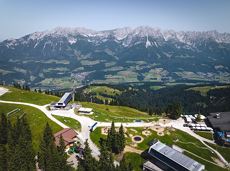
Culinary tour on the Hohe Salve
Bergstation Rabennest (1.150 m)
Bergstation Rabennest (1.150 m)
Hiking
Easy
1:30 h
4,0 km
160 Elevation gain

Going, Hüttling - Schleierwasserfall - Obere Regalm - Baumgartenköpfl (Bergsteigergrab) - Gaudeamushütte - Ellmauer Tor - Hintere Goinger Halt - Jubiläumssteig - Gruttenhütte - Kaiser-Hochalm - Steiner-Hochalm - Hinterschießling Alm - Rehbachklamm - Scheffau, Dorf
Hiking starting point Hüttling, Going (820 m)
Scheffau village (738 m)
Hiking
Difficult
14:00 h
24,6 km
2060 Elevation gain

Very demanding round tour to the two eastern peaks in the Wilder Kaiser.
Hiking starting point Tannbichl, Going (857 m)
Hiking starting point Tannbichl, Going (857 m)
Hiking
Difficult
9:00 h
13,0 km
1570 Elevation gain

An adventure hike from Ellmau village centre to the Wochenbrunner Alm mountain hut from where you can enjoy stunning views and the Ellmau Stone Circle.
Hiking starting point Tourist Info, Ellmau (800 m)
Hiking starting point Tourist Info, Ellmau (800 m)
Hiking
Easy
4:30 h
13,5 km
530 Elevation gain

Embark on a sunny cross-country safari in the snowfields around the Sölllandl.
Spar super market Söll
Spar super market Söll
Cross-country skiing
Intermediate
5,9 km
70 Elevation gain

Easy, flat circular path through the sunny village part 'Prama' for walkers families with pushchairs.
Hiking starting point Going center (former tourist information Going) (764 m)
Hiking starting point Going center (former tourist information Going) (764 m)
Hiking
Easy
1:00 h
3,9 km
30 Elevation gain

A varied tour with impressive views and refreshment stops.
Hiking starting point Wochenbrunner Alm, Ellmau (1.085 m)
Hiking starting point Wochenbrunner Alm, Ellmau (1.085 m)
Hiking
Intermediate
1:30 h
3,2 km
220 Elevation gain

Bike tour to the idyllically situated Obere Regalm with a magnificent view.
Tourist Info, Going (764 m)
Tourist Info, Going (764 m)
Cycling
Intermediate
7,3 km
580 Elevation gain

Challenging adventure hike to the Ellmauer Tor
Hiking starting point Wochenbrunner Alm, Ellmau (1,085 m)
Ellmauer Tor, Ellmau (2,001 m)
Hiking
Intermediate
5:00 h
7,7 km
900 Elevation gain
 Open
OpenAccess time0,16666666666666666
Via ferrata
Difficulty levelB-C
Via ferrara length200,0 m

The Wilder Kaiser always in view.
Ahornsee car park, Söll (693 m)
Hiking starting point Bocking, Söll (670 m)
Hiking
3:30 h
6,0 km
130 Elevation gain

A short MTB tour to the Walleralm mountain inn, easily combined with other routes.
Parkplatz Pension Maier, Scheffau (925 m)
Parkplatz Walleralm, Söll (685 m)
Cycling
Intermediate
3,3 km
260 Elevation gain

This 3-part Via Ferrata features a rope bridge and an extremely difficult exit option.
Via ferrata
Length160,0 m

Round tour through Scheffau with panoramic views, refreshment by the stream and slowing down in the forest.
Hiking starting point Tourist Info, Scheffau (738 m)
Hiking starting point Tourist Info, Scheffau (738 m)
Hiking
Easy
1:15 h
4,3 km
90 Elevation gain

A must for hikers in Söll - local history and culinary delights on the sunny side.
Hiking starting point Franzlhof, Söll (703 m)
Hiking starting point Franzlhof, Söll (703 m)
Hiking
Intermediate
3:45 h
11,0 km
420 Elevation gain

Off the beaten track up to the Köpfing farmhouse. “Der Bergdoktor” (The Mountain Doctor) is a famous German-Austrian TV series, which is produced in the Wilder Kaiser region.
Bergdoktor parking lot, Söll
Bergdoktor parking lot, Söll
Hiking
Easy
3:00 h
8,4 km
370 Elevation gain

The best hiking routes from village centre Scheffau to Lake Hinterstein.
Community Hall, Scheffau (740 m)
Hintersteiner See, Scheffau (890 m)
Hiking
Intermediate
1:30 h
4,5 km
240 Elevation gain

Grey skies and rain are no excuse: keen climbers have plenty of opportunities to push their boundaries even indoors.
Climbing room

Easy snowshoe hike at the foot of the Wilder Kaiser.
Postbus stop Dorf/Bauhof, Ellmau
Postbus stop Dorf/Bauhof, Ellmau
Hiking
0:40 h
1,3 km
10 Elevation gain

Quietness, strength and with easy breathing steadily closer to the Wilder Kaiser. You can return on foot or by bus.
Hiking starting point Bergbahn, Söll (724 m)
Gasthof Bocking, Söll (665 m)
Hiking
Easy
1:45 h
5,5 km
100 Elevation gain

Walking tour for refreshment and relaxation close to the village.
Hiking starting point Tourist Info, Scheffau (738 m)
Hiking starting point Tourist Info, Scheffau (738 m)
Hiking
Easy
0:45 h
2,3 km
70 Elevation gain

Ellmau hiking info point - Wimm - Riesen - Biedringer Alm - Biedringer Bauernhöfe - Ellmauer Kaiserbad - Ellmau hiking info point
Hiking starting point Tourist Info, Ellmau (800 m)
Hiking starting point Tourist Info, Ellmau (800 m)
Jogging
Easy
9,8 km
400 Elevation gain

Baumgartenköpfl (Bergsteigergrab) – Wilder-Kaiser-Steig – Jubiläumssteig – Gruttenhütte
Brennender Palven (1,572 m)
Gruttenhütte, Ellmau (1,620 m)
Hiking
Difficult
2:30 h
3,3 km
410 Elevation gain

Bike to the Hexenwasser theme park and Hochsöll.
Village Center, Söll (689 m)
Hexenwasser theme park, Hochsöll (1,150 m)
Cycling
Intermediate
5,1 km
480 Elevation gain

The route – stunningly beautiful & challenging
Hiking starting point Tourist Info, Söll (689 m)
Hiking starting point Tourist Info, Söll (689 m)
Jogging
Intermediate
7:30 h
18,0 km
1410 Elevation gain

Explore the village Scheffau on a circuit run
Starting point Scheffau Tourist Information Office (752 m)
Starting point Scheffau Tourist Information Office (752 m)
Jogging
Easy
5,6 km
120 Elevation gain

Picturesque circular hiking trail on the sunny side of Going in unspoilt nature - over snow fields with fantastic views of Going aht the Wilder Kaiser.
Hiking starting point Going center (former tourist information Going) (764 m)
Hiking starting point Going center (former tourist information Going) (764 m)
Hiking
1:45 h
4,8 km
80 Elevation gain

A beautiful tour up to the Astberg lake via the Hollenauer Kreuz with fantastic views
Astbergbahn valley station, Going (805 m)
Astbergsee, Going (1.251m)
Hiking
Easy
3,0 km
465 Elevation gain

Moderate tour to the Schleier Waterfall, a great outdoor experience.
Tourist Info, Going (764 m)
Tourist Info, Going (764 m)
Cycling
Intermediate
6,6 km
410 Elevation gain

Winter hike with picturesque views of the Wilder Kaiser to the 'Wolfsegg' plateau
Hiking starting point Going center (former tourist information Going) (764 m)
Hiking starting point Going center (former tourist information Going) (764 m)
Hiking
1:30 h
4,0 km
65 Elevation gain