

Hiking tour
Hiking routes from Scheffau to Lake Hinterstein
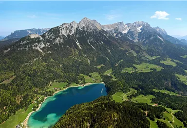
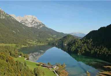
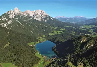
The best hiking routes from village centre Scheffau to Lake Hinterstein.
Medium
4,50 km
240 m
01:30 h


Route
4,50 km
240 m
90 m
01:30 h
910 m
Starting Point
Community Hall, Scheffau (740 m)
End Point
Hintersteiner See, Scheffau (890 m)
What to do in an emergency? Call emergency number
140 - Mountain Rescue (Bergrettung)
112 - European Emergency Number
133 - Police
144 - Ambulance
Many routes have rescue points at the hiking signs, which can be used as a clear location identification in an emergency.
The Alpine Club provides tips for optimal preparation for mountain hiking.
SOS-EU-Alp App
The SOS EU ALP app allows you to determine your location (x,y coordinates) via your smartphone. In an emergency, this location data can be sent directly to the responsible control center (Tyrol, South Tyrol or Bavaria).
Description
Option 1: Via Seebachgraben to Lake Hinterstein
(shown as blue route in this map / walking time: 1 h 30 min)
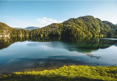
Starting from the center of Scheffau, follow the path no. 56 past the church and the community hall to Hintersteiner See. After a short walk downhill through the forest, turn right and follow the signs to Hintersteiner See via Seebachgraben (path no. 43) uphill through the forest until you reach the crystal-clear Lake Hinterstein.
Abbreviation: Before reaching the farm Grüblern there is the possibility to shorten left through the forest.
After a short...
Best Season
Jan
Feb
Mar
Apr
May
Jun
Jul
Aug
Sep
Oct
Nov
Dec
Skill Level
Endurance


Current Weather
Today
2026-03-28
Morning
-7 °C
Afternoon
-3 °C
Evening
-4 °C
Tomorrow
2026-03-29
Morning
-6 °C
Afternoon
-5 °C
Evening
-5 °C
Monday
2026-03-30
Morning
-5 °C
Afternoon
-4 °C
Evening
-4 °C
Tuesday
2026-03-31
Morning
-7 °C
Afternoon
-7 °C
Evening
-7 °C
Wednesday
2026-04-01
Morning
-7 °C
Afternoon
-5 °C
Evening
-5 °C
Thursday
2026-04-02
Morning
-5 °C
Afternoon
-1 °C
Evening
-2 °C
Friday
2026-04-03
Morning
-2 °C
Afternoon
Evening
-1 °C
Saturday
2026-04-04
Morning
-2 °C
Afternoon
1 °C
Evening
1 °C
Sunday
2026-04-05
Morning
Afternoon
3 °C
Evening
2 °C
Monday
2026-04-06
Morning
1 °C
Afternoon
4 °C
Evening
4 °C
Tuesday
2026-04-07
Morning
-1 °C
Afternoon
6 °C
Evening
4 °C
Wednesday
2026-04-08
Morning
Afternoon
8 °C
Evening
4 °C
Thursday
2026-04-09
Morning
1 °C
Afternoon
7 °C
Evening
4 °C
Friday
2026-04-10
Morning
1 °C
Afternoon
5 °C
Evening
2 °C
Last updated at 03/28/2026, 02:01 PM
Contact
Contact
You have questions? We are happy to assist you.


