

Hiking tour
Summit tour
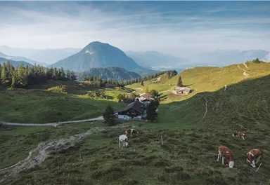
Crossing Scheffauer summit via Widauersteig trail
Varied and challenging loop over the Scheffauer summit.
Hard
13,00 km
1400 m
08:30 h


Hard
Route
13,00 km
1400 m
08:30 h
2111 m
Starting Point
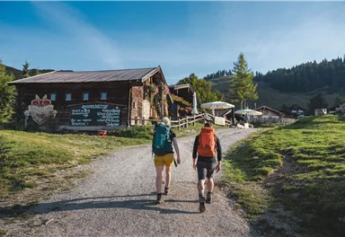
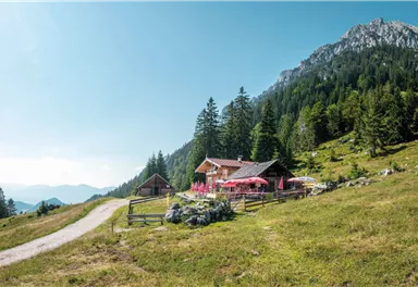
Kaindlhütte, Scheffau (1,293 m)
End Point
Scheffauer (2,111 m)
What to do in an emergency? Call emergency number
140 - Mountain Rescue (Bergrettung)
112 - European Emergency Number
133 - Police
144 - Ambulance
Many routes have rescue points at the hiking signs, which can be used as a clear location identification in an emergency.
The Alpine Club provides tips for optimal preparation for mountain hiking.
SOS-EU-Alp App
The SOS EU ALP app allows you to determine your location (x,y coordinates) via your smartphone. In an emergency, this location data can be sent directly to the responsible control center (Tyrol, South Tyrol or Bavaria).
Description
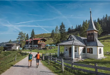
You start this tour at the Seestüberl at Hintersteiner See and hike in a northerly direction on the Steig 45a to the Walleralm. Here you have three places to stop for refreshments: the Kafma Alm, the Stöfflhütte and the Walleralm. Continue on the Steig 827 to the Hochegg and down to the romantic high plateau of the Steinbergalm to the cozy and family-run Kaindlhütte.
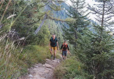
Shortly before the Kaindlhütte, turn south at a large boulder onto Widauersteig 814 and hike through shady forest and across alpine meadows...
Best Season
Jan
Feb
Mar
Apr
May
Jun
Jul
Aug
Sep
Oct
Nov
Dec
Skill Level
Endurance
Loop tour
Helmet (Danger of falling rocks!)
Recommandation: climbing harness and via ferrata set.


Current Weather
Today
2026-05-31
Morning
14 °C
Afternoon
17 °C
Evening
13 °C
Tomorrow
2026-06-01
Morning
8 °C
Afternoon
9 °C
Evening
10 °C
Tuesday
2026-06-02
Morning
12 °C
Afternoon
16 °C
Evening
13 °C
Wednesday
2026-06-03
Morning
6 °C
Afternoon
7 °C
Evening
7 °C
Thursday
2026-06-04
Morning
9 °C
Afternoon
12 °C
Evening
11 °C
Friday
2026-06-05
Morning
10 °C
Afternoon
12 °C
Evening
10 °C
Saturday
2026-06-06
Morning
10 °C
Afternoon
13 °C
Evening
12 °C
Sunday
2026-06-07
Morning
12 °C
Afternoon
15 °C
Evening
14 °C
Monday
2026-06-08
Morning
13 °C
Afternoon
16 °C
Evening
14 °C
Tuesday
2026-06-09
Morning
13 °C
Afternoon
15 °C
Evening
14 °C
Wednesday
2026-06-10
Morning
12 °C
Afternoon
14 °C
Evening
13 °C
Thursday
2026-06-11
Morning
12 °C
Afternoon
13 °C
Evening
12 °C
Friday
2026-06-12
Morning
11 °C
Afternoon
13 °C
Evening
12 °C
Saturday
2026-06-13
Morning
11 °C
Afternoon
13 °C
Evening
13 °C
Last updated at 05/31/2026, 02:00 AM
Contact
Contact
You have questions? We are happy to assist you.


