


Winter walking
Blaikner winter circuit
A gentle walk to ancient farmsteads with a refreshment stop in a welcoming inn.
3,80 km
70 m
01:30 h
Route
3,80 km
70 m
01:30 h
743 m
Starting Point
Hiking starting point Tourist Info, Scheffau (738 m)
End Point
Hiking starting point Tourist Info, Scheffau (738 m)
What to do in an emergency? Call emergency number
140 - Mountain Rescue (Bergrettung)
112 - European Emergency Number
133 - Police
144 - Ambulance
Many routes have rescue points at the hiking signs, which can be used as a clear location identification in an emergency.
The Alpine Club provides tips for optimal preparation for mountain hiking.

SOS-EU-Alp App
The SOS EU ALP app allows you to determine your location (x,y coordinates) via your smartphone. In an emergency, this location data can be sent directly to the responsible control center (Tyrol, South Tyrol or Bavaria).
Description
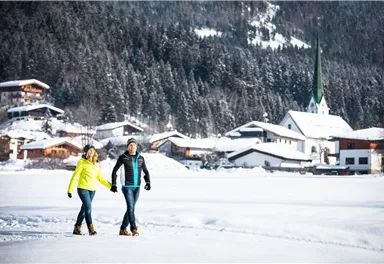
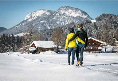
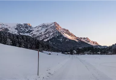
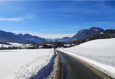
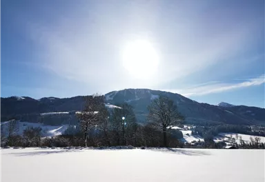
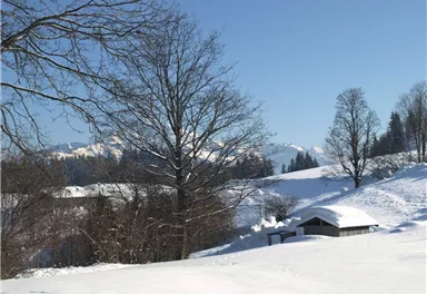
After visiting the Scheffau parish church, follow trail no. 56 towards Söll. Along the way, you can watch the youngest winter sports enthusiasts practising on the beginner ski slope, while the route passes several traditional farmhouses. After a short section along a forest track through the woods, the path leads downhill. Then turn left and continue via the Wurzach and Blaiken districts back towards Scheffau. At Pension Blaiken, turn left and follow a quiet side road past farmhouses and snow-covered meadows back to the village. Along the way, you can stop for refreshments at the rustic Gasthof...
Best Season
Jan
Feb
Mar
Apr
May
Jun
Jul
Aug
Sep
Oct
Nov
Dec
Skill Level
Endurance
Family-friendly
Loop tour
More information at: www.wilderkaiser.info/mobility
Public car park, Scheffau (740 m), north of the Community Hall - for free


Current Weather
Today
2026-10-10
Morning

7 °C
Afternoon

8 °C
Evening

5 °C
Tomorrow
2026-10-11
Morning
4 °C
Afternoon

6 °C
Evening
4 °C
Monday
2026-10-12
Morning
2 °C
Afternoon

6 °C
Evening

5 °C
Tuesday
2026-10-13
Morning
4 °C
Afternoon
9 °C
Evening
8 °C
Wednesday
2026-10-14
Morning
7 °C
Afternoon
10 °C
Evening
9 °C
Thursday
2026-10-15
Morning

8 °C
Afternoon
13 °C
Evening
11 °C
Friday
2026-10-16
Morning
9 °C
Afternoon
12 °C
Evening
10 °C
Saturday
2026-10-17
Morning
7 °C
Afternoon
8 °C
Evening
6 °C
Sunday
2026-10-18
Morning
5 °C
Afternoon
8 °C
Evening
6 °C
Monday
2026-10-19
Morning
4 °C
Afternoon
7 °C
Evening
6 °C
Tuesday
2026-10-20
Morning
3 °C
Afternoon
8 °C
Evening
6 °C
Wednesday
2026-10-21
Morning
4 °C
Afternoon
7 °C
Evening
6 °C
Thursday
2026-10-22
Morning
3 °C
Afternoon
9 °C
Evening
6 °C
Friday
2026-10-23
Morning
3 °C
Afternoon
9 °C
Evening
6 °C
Last updated at 10/10/2026, 02:00 PM
Contact
Contact
You have questions? We are happy to assist you.


