

Hiking tour
Schattseit trail route
Quietness, strength and with easy breathing steadily closer to the Wilder Kaiser.
You can return on foot or by bus.
Easy
5,50 km
100 m
01:45 h


Easy
Route
5,50 km
100 m
160 m
01:45 h
781 m
Starting Point
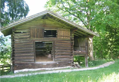
Hiking starting point Bergbahn, Söll (724 m)
End Point
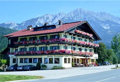
Gasthof Bocking, Söll (665 m)
What to do in an emergency? Call emergency number
140 - Mountain Rescue (Bergrettung)
112 - European Emergency Number
133 - Police
144 - Ambulance
Many routes have rescue points at the hiking signs, which can be used as a clear location identification in an emergency.
The Alpine Club provides tips for optimal preparation for mountain hiking.
SOS-EU-Alp App
The SOS EU ALP app allows you to determine your location (x,y coordinates) via your smartphone. In an emergency, this location data can be sent directly to the responsible control center (Tyrol, South Tyrol or Bavaria).
Description
Tip:
From the end point you can hike back on foot via Hauninger Dörfl or take the KaiserJet or Postbus (free of charge...
Best Season
Jan
Feb
Mar
Apr
May
Jun
Jul
Aug
Sep
Oct
Nov
Dec
Skill Level
Endurance
Family-friendly
More information at: www.wilderkaiser.info


Current Weather
Tuesday
2026-05-12
Morning
1 °C
Afternoon
-2 °C
Evening
-1 °C
Today
2026-05-13
Morning
Afternoon
5 °C
Evening
4 °C
Tomorrow
2026-05-14
Morning
1 °C
Afternoon
2 °C
Evening
Friday
2026-05-15
Morning
1 °C
Afternoon
4 °C
Evening
2 °C
Saturday
2026-05-16
Morning
1 °C
Afternoon
2 °C
Evening
1 °C
Sunday
2026-05-17
Morning
Afternoon
2 °C
Evening
3 °C
Monday
2026-05-18
Morning
3 °C
Afternoon
5 °C
Evening
4 °C
Tuesday
2026-05-19
Morning
4 °C
Afternoon
6 °C
Evening
6 °C
Wednesday
2026-05-20
Morning
6 °C
Afternoon
9 °C
Evening
7 °C
Thursday
2026-05-21
Morning
7 °C
Afternoon
10 °C
Evening
8 °C
Friday
2026-05-22
Morning
8 °C
Afternoon
10 °C
Evening
8 °C
Saturday
2026-05-23
Morning
8 °C
Afternoon
10 °C
Evening
9 °C
Sunday
2026-05-24
Morning
8 °C
Afternoon
11 °C
Evening
10 °C
Monday
2026-05-25
Morning
8 °C
Afternoon
12 °C
Evening
10 °C
Last updated at 05/12/2026, 02:00 PM
Contact
Contact
You have questions? We are happy to assist you.


