


 Deutsch
 Nederlands
Rehbach tour

Exciting round trip for adults and children through the Rehbach gorge.
Hiking starting point Tourist Info, Scheffau (738 m)
Hiking starting point Tourist Info, Scheffau (738 m)
Hiking
Intermediate
2:00 h
5,5 km
280 Elevation gain
We are sorry, your requested page is not available. You can start a new search on this page!
Exciting round trip for adults and children through the Rehbach gorge.
Hiking starting point Tourist Info, Scheffau (738 m)
Hiking starting point Tourist Info, Scheffau (738 m)
Hiking
Intermediate
2:00 h
5,5 km
280 Elevation gain

A circuit around the mountain that the locals love for its great view.
Hiking starting point Franzlhof, Söll (703 m)
Hiking starting point Franzlhof, Söll (703 m)
Hiking
Intermediate
6:00 h
17,8 km
670 Elevation gain

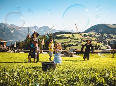
2 villages - you fancy quiete and a very rural athmosphere - Scheffau is the place to go, or, you opt for a great variety of gastronomy and restaurants - then Söll is good to go. No matter how, your decision is always superb. The ski hiking route is purely flat, which also means it's great for everybody.
restaurant Oberstegen, Söll
village, Scheffau
Cross-country skiing
Easy
1,4 km
15 Elevation gain

Picture-book cross-country skiing through the farm village with the mountain very close.
Hiking starting point Going Center (former Tourist informatin Going)
Hiking starting point Going Center (former Tourist informatin Going)
Cross-country skiing
Easy
3,9 km
60 Elevation gain

A wild and romantic walk through the Kaiserwald forest with its wildlife park and cosy, traditional Tirolean parlour.
Hiking starting point Tourist Info, Ellmau (800 m)
Hiking starting point Tourist Info, Ellmau (800 m)
Hiking
Intermediate
3:30 h
9,0 km
300 Elevation gain

Scenic and varied circular hike.
Hiking starting point Going center (former tourist information Going) (764 m)
Hiking starting point Going center (former tourist information Going) (764 m)
Hiking
Intermediate
4:00 h
11,0 km
500 Elevation gain
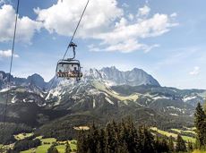
The highlight for everyone who loves hiking for pleasure - lush Alpine meadows, sparkling mountain lakes and delightful food in the Kitzbühel Alps. And the Bergbahnen Wilder Kaiser - Brixental summer cable cars make the ascent and descent easy.
Astberg, Going
Hochsöll
Hiking
Easy
6:45 h
20,0 km
720 Elevation gain

Gentle walking or running course in Ellmau
Hiking starting point Tourist Info, Ellmau (800 m)
Hiking starting point Tourist Info, Ellmau (800 m)
Jogging
Easy
0:20 h
3,0 km
54 Elevation gain

Onto the Hausberg mountain with panoramic views of the Wilder Kaiser and Hartkaiser mountains and back via the Ranhartalm.
Hiking starting point Tourist Info, Ellmau (800 m)
Hiking starting point Tourist Info, Ellmau (800 m)
Hiking
Easy
8:00 h
22,8 km
1020 Elevation gain

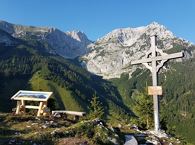
60-metre high rock dome – the Mecca for extreme climbers
Route number226
Access time1,25
Sport climbing

Hike across the Alpine pastures and shower in Kaiser water!
Hiking starting point Tourist Info, Scheffau (738 m)
Hiking starting point Tourist Info, Scheffau (738 m)
Hiking
Intermediate
5:30 h
11,8 km
910 Elevation gain
Alpine pasture circular hiking route with a breathtaking view over Scheffau!
Hiking starting point Tourist Info, Scheffau (738 m)
Hiking starting point Tourist Info, Scheffau (738 m)
Hiking
Intermediate
5:15 h
12,9 km
800 Elevation gain

Off the beaten track up to the Köpfing farmhouse. “Der Bergdoktor” (The Mountain Doctor) is a famous German-Austrian TV series, which is produced in the Wilder Kaiser region.
Bergdoktor parking lot, Söll
Bergdoktor parking lot, Söll
Hiking
Easy
3:00 h
8,4 km
370 Elevation gain
Hike to the Hexenwasser and get rewarded with a view.
Bergbahn valley station, Söll (724 m)
Bergbahn valley station, Söll (724 m)
Hiking
Easy
3:00 h
7,9 km
410 Elevation gain
Hikers exploring Tirol on foot will feel as free as a bird. The eagle walk is one of the 'Great Walks' of Tyrol chosen by a jury. They offer hikers the chance to get away from it all, discover the beauty of nature and experience a true adventure in the Alps.
St. Johann in Tirol
Arlbergpass
Hiking
Difficult
413,0 km
31000 Elevation gain

A walk that lets you experience the Brandstadl mountain and leads you to Jochstubnsee lake.
Brandstadlbahn valley station, Scheffau (681 m)
Brandstadlbahn valley station, Scheffau (681 m)
Hiking
Easy
4:45 h
12,7 km
1130 Elevation gain

Number of rope lengths4
Access time2,0
Alpine climbing route
Multi-rope length difficulty levels7-
Comfortable winter round with a magnificent view of the Hohe Salve.
Mountain station gondola Hexenwasser, Söll (1,150 m)
Mountain station gondola Hexenwasser, Söll (1,150 m)
Hiking
Easy
0:45 h
1,8 km
50 Elevation gain

Gentle cycle tour from Wörgl via Söll, Scheffau, Ellmau and Going to St. Johann or vice versa!
Wörgl (511 m)
St. Johann (660 m)
Cycling
Intermediate
38,2 km
450 Elevation gain

Beautiful, Alpine sport climbing with consistent difficulty.
Number of rope lengths11
Access time2,0
Alpine climbing route
Multi-rope length difficulty levels7-

Pure adrenaline is the motto of the Pölven trail on the third day of the Tour de Tirol
Hiking starting point Tourist Info, Söll (689 m)
Hiking starting point Tourist Info, Söll (689 m)
Jogging
Intermediate
22,8 km
1110 Elevation gain

A classic amongst the via ferratas on the Wilder Kaiser massif – ideal as a 2-day tour.
Access time3,5
Via ferrata
Difficulty levelD
Via ferrara length675,0 m
An ascent that is rewarded with refreshments. Back to the valley with the toboggan, the lift or on foot.
Village centre, Ellmau (800 m)
Astbergbahn, Going (804 m)
Hiking
Easy
2:45 h
5,8 km
460 Elevation gain

Short, crisp connection between the Blattlloipe and the Schwendterloipe.
Cross-country skiing
Intermediate
0,5 km
30 Elevation gain

Stripsenjochhaus – Stripsenkopf – Feldberg – Scheibenbichlalmen – Griesenau – Gasteig
Stripsenjochhaus, St. Johann in Tirol (1,577 m)
Gasteig (750 m)
Hiking
Intermediate
6:30 h
16,1 km
640 Elevation gain

Walk through the forest, along the river, back to the village.
Hiking starting point Tourist Info, Söll (689 m)
Hiking starting point Tourist Info, Söll (689 m)
Hiking
Easy
1:45 h
6,3 km
90 Elevation gain

mountain station Salvistabahn / Kleine Salve
Middle station Salvistabahn Itter
Hiking
Intermediate
2:45 h
7,4 km
360 Elevation gain

Varied round tour with many refreshments and wonderful views
Tourist Information Office, Scheffau (737 m)
Tourist Information Office, Scheffau (737 m)
Cycling
Intermediate
23,6 km
660 Elevation gain

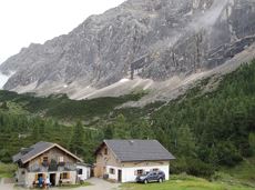
Hike to the Gaudeamushütte mountain hut by the Wilder Kaiser
Wochenbrunner Alm, Ellmau (1,085 m)
Gaudeamushütte, Going (1,263 m)
Hiking
Easy
0:35 h
1,3 km
200 Elevation gain

On the north side up to the Ellmauer Halt summit 2,344 m.
Access time4,5
Via ferrata
Difficulty levelB-C
Via ferrara length2000,0 m

Going, Hüttling - Schleierwasserfall - Obere Regalm - Baumgartenköpfl (Bergsteigergrab) - Gaudeamushütte - Ellmauer Tor - Hintere Goinger Halt - Jubiläumssteig - Gruttenhütte - Kaiser-Hochalm - Steiner-Hochalm - Hinterschießling Alm - Rehbachklamm - Scheffau, Dorf
Hiking starting point Hüttling, Going (820 m)
Scheffau village (738 m)
Hiking
Difficult
14:00 h
24,6 km
2060 Elevation gain

Peace and strength, slow down and take a deep breath.
Ahornsee car park, Söll (693 m)
Ahornsee car park, Söll (693 m)
Hiking
Intermediate
4:45 h
12,0 km
220 Elevation gain

Ideal tour for starters and high temperatures.
Hiking starting point Franzlhof, Söll (703 m)
Hiking starting point Franzlhof, Söll (703 m)
Hiking
Easy
0:45 h
2,4 km
50 Elevation gain

Wonderful winter hike on the sunny side of the valley and easy return to the starting point by bus.
Hiking starting point Tourist Information Office, Ellmau (800 m)
Hiking starting point Tourist Information Office, Scheffau (737 m)
Hiking
Easy
2:15 h
6,1 km
40 Elevation gain

Past inn, farm and chapel in the Kaiser countryside.
Hiking starting point Going Center (former Tourist informatin Going)
Hiking starting point Going Center (former Tourist informatin Going)
Cross-country skiing
Easy
1,2 km
10 Elevation gain

Bike to the Hexenwasser theme park and Hochsöll.
Village Center, Söll (689 m)
Hexenwasser theme park, Hochsöll (1,150 m)
Cycling
Intermediate
5,1 km
480 Elevation gain

Going, Hüttling – Graspoint-Niederalm – Obere Regalm – Brennender Palven – Gaudeamushütte – Klamml – Gruttenhütte
Hiking starting point Hüttling, Going (820 m)
Gaudeamushütte, Going (1,263 m) / Gruttenhütte, Ellmau (1,620 m)
Hiking
Intermediate
4:30 h
8,0 km
1120 Elevation gain

Short and easy circuit for beginners right next to the village of Söll.
Brunnhof field Söll
Brunnhof field Söll
Cross-country skiing
Easy
0,9 km

Easy snowshoe hike at the foot of the Wilder Kaiser.
Postbus stop Dorf/Bauhof, Ellmau
Postbus stop Dorf/Bauhof, Ellmau
Hiking
Easy
0:40 h
1,3 km
10 Elevation gain

A unique hike to the highest mountain hut in the Wilder Kaiser region featuring a panoramic view.
Hiking starting point Going center (former tourist information Going) (764 m)
Hiking starting point Going center (former tourist information Going) (764 m)
Hiking
Intermediate
6:00 h
14,0 km
890 Elevation gain