

Hiking tour
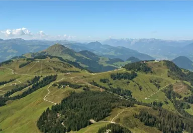
SkiWelt Panoramic Trail
Partially Open
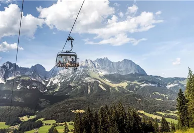
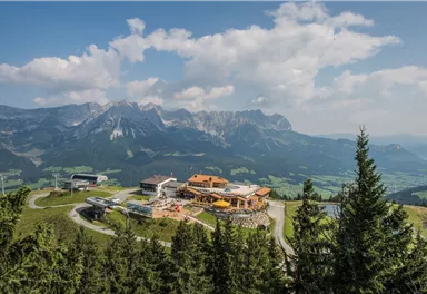
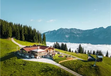
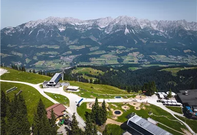
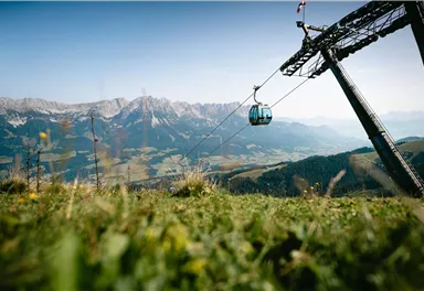
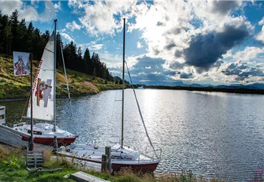
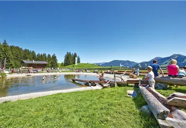
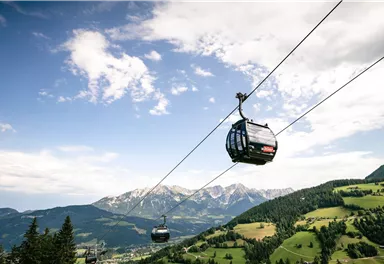
The highlight for everyone who loves hiking for pleasure - lush Alpine meadows, sparkling mountain lakes and delightful food in the Kitzbühel Alps. And the Bergbahnen Wilder Kaiser - Brixental summer cable cars make the ascent and descent easy.
Easy
20,00 km
720 m
06:45 h

Easy
Route
20,00 km
720 m
820 m
06:45 h
1654 m
Starting Point
Astberg, Going
End Point
Hochsöll
What to do in an emergency? Call emergency number
140 - Mountain Rescue (Bergrettung)
112 - European Emergency Number
133 - Police
144 - Ambulance
Many routes have rescue points at the hiking signs, which can be used as a clear location identification in an emergency.
The Alpine Club provides tips for optimal preparation for mountain hiking.
SOS-EU-Alp App
The SOS EU ALP app allows you to determine your location (x,y coordinates) via your smartphone. In an emergency, this location data can be sent directly to the responsible control center (Tyrol, South Tyrol or Bavaria).
Closure Information
Detour Information
Description
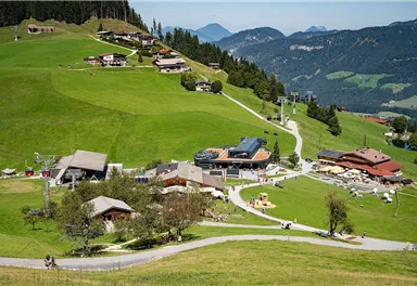
The SkiWelt Panoramic Trail can be hiked in many different ways. Access points and means of ascent and descent on the Bergbahnen Wilder Kaiser – Brixental summer cable cars are to be found in all four of the villages of the Kaiser region: Ellmau,...
Best Season
Jan
Feb
Mar
Apr
May
Jun
Jul
Aug
Sep
Oct
Nov
Dec
Skill Level
Endurance
Family-friendly
- Going Astbergbahn Talstation
- Ellmau Hartkaiserbahn /Ellmis Zauberwelt
- Scheffau Bergbahn
- Söll Gondelbahn Hexenwasser Hohe Salve
More information at: www.wilderkaiser.info/mobility
Videos


Current Weather
Today
2026-06-02
Morning
13 °C
Afternoon
16 °C
Evening
12 °C
Tomorrow
2026-06-03
Morning
5 °C
Afternoon
7 °C
Evening
8 °C
Thursday
2026-06-04
Morning
11 °C
Afternoon
15 °C
Evening
10 °C
Friday
2026-06-05
Morning
4 °C
Afternoon
6 °C
Evening
7 °C
Saturday
2026-06-06
Morning
10 °C
Afternoon
13 °C
Evening
11 °C
Sunday
2026-06-07
Morning
10 °C
Afternoon
13 °C
Evening
11 °C
Monday
2026-06-08
Morning
11 °C
Afternoon
13 °C
Evening
12 °C
Tuesday
2026-06-09
Morning
11 °C
Afternoon
14 °C
Evening
12 °C
Wednesday
2026-06-10
Morning
11 °C
Afternoon
14 °C
Evening
12 °C
Thursday
2026-06-11
Morning
11 °C
Afternoon
14 °C
Evening
12 °C
Friday
2026-06-12
Morning
13 °C
Afternoon
15 °C
Evening
13 °C
Saturday
2026-06-13
Morning
12 °C
Afternoon
14 °C
Evening
12 °C
Sunday
2026-06-14
Morning
12 °C
Afternoon
12 °C
Evening
11 °C
Monday
2026-06-15
Morning
11 °C
Afternoon
13 °C
Evening
11 °C
Last updated at 06/02/2026, 02:00 PM
Contact
Contact
You have questions? We are happy to assist you.


