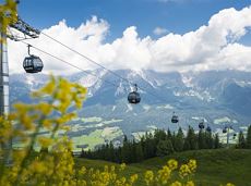
Winter hiking trails

Winter hiking trails

282 Routes and tours

Pölvenau circular route

Pölvenau circular route

Pleasant circular hiking trail through forests and meadows to the romantically situated moor lake.

Hiking starting point Franzlhof, Söll (703 m)

Hiking starting point Franzlhof, Söll (703 m)

Hiking

Intermediate

2:00 h

5,7 km

240 Elevation gain

Schwendt circuit

Schwendt circuit
Schwendt circuit
Schwendt circuit

Leisurely hike through forest and across meadows to the sunny plateau of Going and back

Hiking starting point Going center (former tourist information Going) (764 m)

Hiking starting point Going center (former tourist information Going) (764 m)

Hiking

Easy

1:15 h

4,1 km

70 Elevation gain

Gentle snowshoe hike in the valley in Going

Gentle snowshoe hike in the valley in Going

Savour the wonder of the winter landscape – experience the winter magic for yourself by crunching through the pristine snow with your snowshoes. Enjoy unique impressions and experiences as you explore the white winter splendour and take in the spectacular view over the surrounding mountain scenery.

Church square, Going (769 m)

Church square, Going (769 m)

Hiking

1:30 h

2,9 km

110 Elevation gain

Kaiseralm round hike

Kaiseralm round hike

Short hike from Jägerwirt to the Kaiseralm with great mountain views.

Hiking starting point Jägerwirt, Scheffau (883 m)

Hiking starting point Jägerwirt, Scheffau (883 m)

Hiking

Easy

1:45 h

5,0 km

250 Elevation gain

Hartkaiserweg trail Ellmau

Hartkaiserweg trail Ellmau

Ellmau village park - Hartkaiserbahn valley station - Bergschenke - Rübezahlalm - Jägerhütte - Hartkaiser summit station

Hiking starting point Tourist Info, Ellmau (800 m)

Hartkaiser summit station, Ellmau (1,555 m)

Jogging

Intermediate

8,2 km

720 Elevation gain

Schattseitloipe

Schattseitloipe
Schattseitloipe
Schattseitloipe

Enjoy winter silence and an imperial panorama in Söll.

parking area Ahornsee, Söll (693 m)

parking area Ahornsee, Söll (693 m)

Cross-country skiing

Intermediate

5,3 km

80 Elevation gain

Ellmau Stone Circle circuit

Ellmau Stone Circle circuit

Head through well-shaded forests of green to reach the Ellmau Stone Circle. This is a place with a special energy, making it an inviting option for taking some time to relax.

Hiking starting point Wochenbrunner Alm, Ellmau (1,085 m)

Hiking starting point Wochenbrunner Alm, Ellmau (1,085 m)

Hiking

Intermediate

1:00 h

2,4 km

120 Elevation gain

Salvenblick hiking round

Salvenblick hiking round

Comfortable round with a magnificent view of the Hohe Salve.

Mountain station gondola Hexenwasser, Söll (1,150 m)

Mountain station gondola Hexenwasser, Söll (1,150 m)

Hiking

Easy

0:35 h

1,8 km

50 Elevation gain

Asten circuit

Asten circuit
Asten circuit
Asten circuit

From Going to the Astberg with a short  high-altitude loop & impressive panoramic view.

Hiking starting point Going center (former tourist information Going) (764 m)

Hiking starting point Going center (former tourist information Going) (764 m)

Hiking

Easy

3:30 h

8,6 km

560 Elevation gain

Kaiser circular cycling route

Kaiser circular cycling route

Calling bike fans of all ability levels! The Kaiser circular cycling route is an 80-kilometre bike route through the spectacular scenery of the Kaisergebirge mountain range. An excellent network of well-signposted trails (a mix of asphalt and gravel paths) leads past idyllic nature, breathtaking panoramas and cultural sights. For relaxing moments in between stages, cool lakes and local restaurants invite you to linger and enjoy.

anywhere along the tour

anywhere along the tour

Cycling

Intermediate

6:45 h

85,6 km

700 Elevation gain

Kaiserkrone - stage 2

Kaiserkrone - stage 2

Gruttenhütte - Kaiser-Hochalm - Steiner-Hochalm - Jägersteig - Walleralm - Hochegg - Kaindlhütte

Gruttenhütte, Ellmau (1,620 m)

Hintersteiner See, Scheffau (889 m)

Hiking

Intermediate

5:30 h

13,5 km

560 Elevation gain

Rehbach gorge and Seilabodenkreuz

Rehbach gorge and Seilabodenkreuz
Rehbach gorge and SeilabodenkreuzPartially open
Rehbach gorge and Seilabodenkreuz

Family roundtrip through the Rebachklamm to the Seilabodenkreuz, via the Kaiseralm and the Jägerwirt back to the center of Scheffau.

Community Hall, Scheffau (740 m)

Community Hall, Scheffau (740 m)

Hiking

Intermediate

3:15 h

9,7 km

510 Elevation gain

Scheffau – Gruttenhütte

Scheffau – Gruttenhütte

Hike to the Gruttenhütte with great views to the Ellmauer Halt and the entire region.

Hiking starting point Tourist Info, Scheffau (738 m)

Gruttenhütte, Ellmau (1,620 m)

Hiking

Intermediate

6:30 h

16,4 km

990 Elevation gain

Schiessling circuit

Schiessling circuit
Schiessling circuit
Schiessling circuit

Short tour with varied paths and views

Hiking starting point Tourismus Info, Scheffau (737 m)

Hiking starting point Tourismus Info, Scheffau (737 m)

Hiking

Easy

2:00 h

5,8 km

230 Elevation gain

Prama circular hiking route

Prama circular hiking route

Easy, flat circular path through the sunny village part 'Prama' for walkers  families with pushchairs.

Hiking starting point Going center (former tourist information Going) (764 m)

Hiking starting point Going center (former tourist information Going) (764 m)

Hiking

Easy

1:00 h

3,9 km

30 Elevation gain

Hausberg trail (no. 8)

Hausberg trail (no. 8)

Hiking trail no. 8 to the Hausberg via the Marienkapelle (St Mary’s Chapel).

Hiking starting point Tourist Information Office, Ellmau (798 m)

Brenner Alm, Ellmau (1,236 m)

Hiking

Easy

3:00 h

7,5 km

440 Elevation gain