Südpfeiler route

350,00 m

Going_Klettern_Maukspitze-Suedpfeiler_Sportler_2021_ClimbersParadise_MichaelMeisl (3)_1920px.jpg
Going_Klettern_Maukspitze-Suedpfeiler_Sportler_2021_ClimbersParadise_MichaelMeisl (1)_1920px.jpg
Going_Klettern_Maukspitze-Suedpfeiler_Sportler_2021_ClimbersParadise_MichaelMeisl (4)_1920px.jpg
Going_Klettern_Maukspitze-Suedpfeiler_Sportler_2021_ClimbersParadise_MichaelMeisl (9).jpg
Going_Klettern_Maukspitze-Suedpfeiler_Sportler_2021_ClimbersParadise_MichaelMeisl (5)_1920px.jpg
Going_Klettern_Maukspitze-Suedpfeiler_Sportler_2021_ClimbersParadise_MichaelMeisl (2)_1920px.jpg
Wilder_Kaiser_Infrastruktur_Ackerlhütte_Sommer2021_Manuel_Bialucha (4)_72dpi.jpg
Mauk_Suedpfeiler.jpg

Route

350,00 m

What to do in an emergency? Call emergency number

140 - Mountain Rescue (Bergrettung)
112 - European Emergency Number
133 - Police
144 - Ambulance

Many routes have rescue points at the hiking signs, which can be used as a clear location identification in an emergency.

The Alpine Club provides tips for optimal preparation for mountain hiking.

SOS EU ALP

SOS-EU-Alp App

The SOS EU ALP app allows you to determine your location (x,y coordinates) via your smartphone. In an emergency, this location data can be sent directly to the responsible control center (Tyrol, South Tyrol or Bavaria).

Description

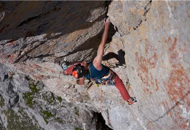
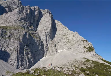
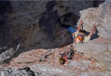
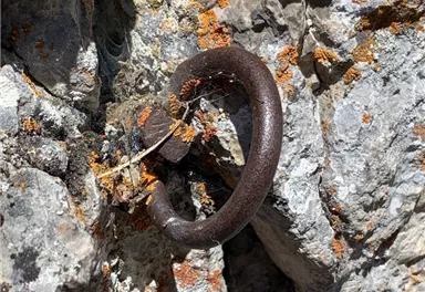
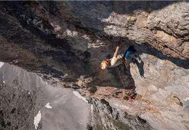
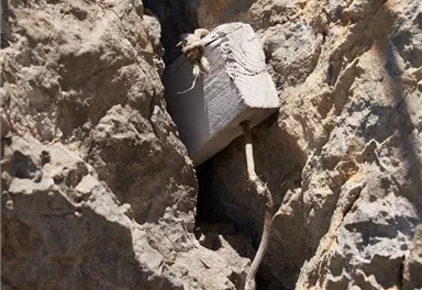
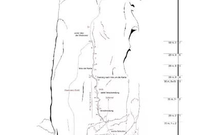
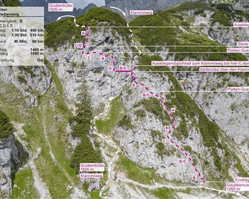
This route was first technically climbed by Seppi Spöck and Jürgen Vogt in 1963 and rated 5b/A1. After being restored by Reini Percht, HP Widmann, Christian Hechenberger and Simon Berger, Simon and Christian were able to free climb the route in 2019. The two lower pitches are challenging. The steep, overhanging dihedral is well secured with bolts and normal hooks. By and large, the rock surface is good except for a few brittle passages. Some friends are recommended as additional safety equipment. The route first extends through the yellow dihedral to the right of the prominent pillar edge, then traverses...

Developed by

S. Spöck, J. Vogt; 1963 - Freie Begehung: C. Hechenberger, S. Berger; 2019

Elevation of starting point

1850

Climbing time (guideline)

7,0

Wall height

320,0

Elevation of starting point

820

Exposure S

Walk time to entry point (guideline)

2,0

Number of rope lengths

13

Elevation of exit point

2150

Refreshments & infrastructure

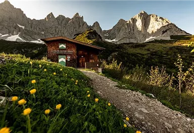
A rustic cabin surrounded by green meadows and mountains. The sky is cloudy and the landscape appears calm and idyllic.

Pasture / hut / mountain lodge

Going

A person stands in a wooden room and holds a lamp over a basket. It is dark, but the light from the lamp illuminates the room.

Pasture / hut / mountain lodge

Going

Closed - opens on 05/18, 10:00 AM

Current Weather

Today

2025-11-13

Morning

13 °C

Afternoon

16 °C

Evening

14 °C

Tomorrow

2025-11-14

Morning

13 °C

Afternoon

16 °C

Evening

14 °C

Saturday

2025-11-15

Morning

9 °C

Afternoon

9 °C

Evening

7 °C

Sunday

2025-11-16

Morning

6 °C

Afternoon

8 °C

Evening

6 °C

Monday

2025-11-17

Morning

2 °C

Afternoon

Evening

-3 °C

Tuesday

2025-11-18

Morning

-4 °C

Afternoon

-1 °C

Evening

-2 °C

Wednesday

2025-11-19

Morning

-4 °C

Afternoon

-3 °C

Evening

-4 °C

Thursday

2025-11-20

Morning

-5 °C

Afternoon

-4 °C

Evening

-5 °C

Friday

2025-11-21

Morning

-5 °C

Afternoon

-4 °C

Evening

-4 °C

Saturday

2025-11-22

Morning

-4 °C

Afternoon

-3 °C

Evening

-3 °C

Sunday

2025-11-23

Morning

-2 °C

Afternoon

-3 °C

Evening

-1 °C

Monday

2025-11-24

Morning

-3 °C

Afternoon

-2 °C

Evening

-2 °C

Tuesday

2025-11-25

Morning

-1 °C

Afternoon

Evening

Wednesday

2025-11-26

Morning

Afternoon

Evening

1 °C

Contact

Contact

You have questions? We are happy to assist you.

+43 50509Mail
Wilder Kaiser Logo