Kaiserkrone - alternative route Stripsenjochhaus-descent via Kaiserbachtal valley

Kaiserkrone - alternative route Stripsenjochhaus-descent via Kaiserbachtal valley

Kaiserkrone - alternative route Stripsenjochhaus-descent via Kaiserbachtal valley

Description

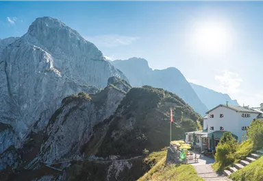
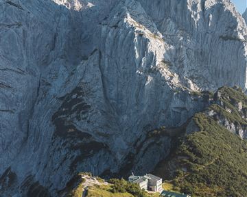
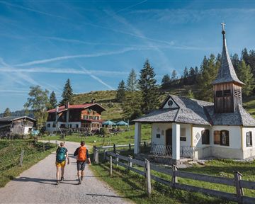
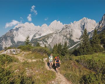
From the Stripsenjochhaus mountain hut you hike on the trail 801/E4 in serpentines through mountain pines downhill and enjoy magnificent views of Fleischbank, the Steinerne Rinne and Predigtstuhl summit. After a section through the forest you reach the gravel path to the Griesner Alm mountain hut. At the turnoff to the alpine pasture, hike straight out of the valley past the mountain pine distillery, the Fischbachalm mountain hut and the toll booth. At the end of the Kaiserbachtal valley it is only a short distance on the asphalt road to Griesenau.

Read more

Information

  • The composition of the trail varies between trails, forest roads and a short section on asphalt.

  • Rucksack, sturdy hiking/mountaineering boots with anti-slip treaded soles, weather-appropriate hiking gear (breathable), a change of clothes, sun protection (sunglasses, sun cream, lip protection, headgear), waterproofs (rain jacket/poncho, pocket umbrella, rucksack protector), cold protection (hat, gloves), sufficient food and drink, hiking poles (height adjustable) if required, first aid kit incl. rescue blanket and bivouac sack, mobile phone with fully charged battery, headlamp, plastic bag for waste, hiking map, route description and information materials (GPX track), ID, insurance card, cash

    Additions for overnight stay at mountain hut:
    Mountain hut sleeping bag, indoor shoes, toiletries and towel, personal medication, headlamp, Alpine Club ID Card, cash, charger for mobile phone

    The hiking routes between the huts are often rather long, we recommend taking plenty of food and drink and booking your overnight stays well in advance.

Read more

Refreshment stops & infrastructure

More tours

Kaiserkrone - stage 1

Kaiserkrone - stage 1

Hiking starting point Hüttling, Going (820 m)

Gaudeamushütte, Going (1,263 m) / Gruttenhütte, Ellmau (1,620 m)

8,0 km

Going, Hüttling – Graspoint-Niederalm – Obere Regalm – Brennender Palven – Gaudeamushütte – Klamml – Gruttenhütte

Hiking

Intermediate

5:00 h

1250 Elevation gain

3-day mountain hut walk - stage 1

3-day mountain hut walk - stage 1

Hiking starting point Hüttling, Going (820 m)

Gaudeamushütte, Going (1,263 m) / Gruttenhütte, Ellmau (1,620 m)

8,0 km

Going, Hüttling – Graspoint-Niederalm – Obere Regalm – Bergsteigergrab – Adlerweg – Gaudeamushütte – Klamml – Gruttenhütte

Hiking

Intermediate

5:00 h

1250 Elevation gain

Natura Trail

Natura Trail
Natura Trail
Natura Trail

Hiking starting point Hüttling, Going (820 m)

Hiking starting point Hüttling, Going (820 m)

7,7 km

At the heart of the conservation and moorland area, experience the joy of well-being!

Hiking

Intermediate

2:45 h

330 Elevation gain

Ellmauer Tor

Ellmauer Tor
Ellmauer Tor
Ellmauer Tor

Hiking starting point Wochenbrunner Alm, Ellmau (1,085 m)

Ellmauer Tor, Ellmau (2,001 m)

7,7 km

Challenging adventure hike to the Ellmauer Tor

Hiking

Intermediate

5:00 h

900 Elevation gain

Kleine Salve & Hohe Salve summit tour

Kleine Salve & Hohe Salve summit tour

mountain station Salvistabahn / Kleine Salve

Middle station Salvistabahn Itter

7,4 km

Amazing views along the entire tour make this summit crossing of the Hohe Salve a memorable experience. And the best thing about it: this tour can be managed by almost everyone with some basic

Hiking

Intermediate

2:45 h

360 Elevation gain

Contact

If you have any questions,we are happy to help.

+43 50509
or