

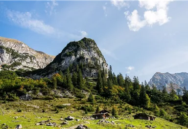
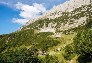
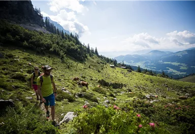
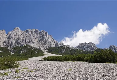
Kaiserkrone long-distance hike
Kaiserkrone - alternative route at the foot of the Sonnenstein
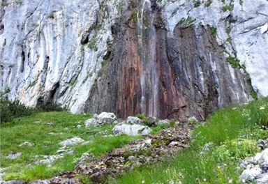
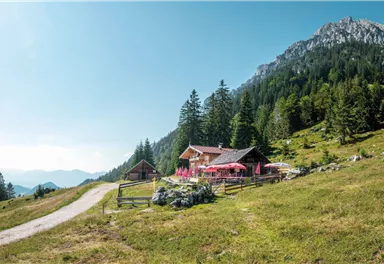
Fork 823/826 – via waterfall – Veitskirche – Steiner-Hochalm
Medium
3,80 km
360 m
02:30 h


Medium
Route
3,80 km
360 m
490 m
02:30 h
1606 m
Starting Point
Fork on the Wilder-Kaiser-Steig 823/826 (1,405 m)
End Point
Steiner-Hochalm, Scheffau (1,257 m)
What to do in an emergency? Call emergency number
140 - Mountain Rescue (Bergrettung)
112 - European Emergency Number
133 - Police
144 - Ambulance
Many routes have rescue points at the hiking signs, which can be used as a clear location identification in an emergency.
The Alpine Club provides tips for optimal preparation for mountain hiking.
SOS-EU-Alp App
The SOS EU ALP app allows you to determine your location (x,y coordinates) via your smartphone. In an emergency, this location data can be sent directly to the responsible control center (Tyrol, South Tyrol or Bavaria).
Description
Best Season
Jan
Feb
Mar
Apr
May
Jun
Jul
Aug
Sep
Oct
Nov
Dec
Skill Level
Endurance
Multiday hike
Multi-Day Tour Feature
Variante
Additions for overnight stay at mountain hut:
Mountain hut sleeping bag, indoor shoes, toiletries and towel, personal medication, headlamp, Alpine Club ID Card, cash, charger for mobile phone The hiking routes between the huts are often rather long, we recommend taking plenty of food and drink and booking your overnight stays well in advance.

Current Weather
Today
2026-05-18
Morning
5 °C
Afternoon
8 °C
Evening
6 °C
Tomorrow
2026-05-19
Morning
3 °C
Afternoon
7 °C
Evening
6 °C
Wednesday
2026-05-20
Morning
6 °C
Afternoon
8 °C
Evening
7 °C
Thursday
2026-05-21
Morning
7 °C
Afternoon
10 °C
Evening
8 °C
Friday
2026-05-22
Morning
8 °C
Afternoon
12 °C
Evening
11 °C
Saturday
2026-05-23
Morning
10 °C
Afternoon
14 °C
Evening
11 °C
Sunday
2026-05-24
Morning
11 °C
Afternoon
15 °C
Evening
13 °C
Monday
2026-05-25
Morning
10 °C
Afternoon
12 °C
Evening
10 °C
Tuesday
2026-05-26
Morning
11 °C
Afternoon
16 °C
Evening
13 °C
Wednesday
2026-05-27
Morning
12 °C
Afternoon
17 °C
Evening
12 °C
Thursday
2026-05-28
Morning
11 °C
Afternoon
14 °C
Evening
11 °C
Friday
2026-05-29
Morning
11 °C
Afternoon
14 °C
Evening
11 °C
Saturday
2026-05-30
Morning
10 °C
Afternoon
13 °C
Evening
11 °C
Sunday
2026-05-31
Morning
10 °C
Afternoon
12 °C
Evening
11 °C
Last updated at 05/18/2026, 02:00 AM
Contact
Contact
You have questions? We are happy to assist you.


