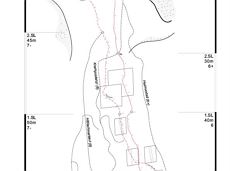
Hiking and mountain tours

The Wilder Kaiser and the Kitzbühel Alps offer visitors a wide range of hiking and mountain tours of varying degrees of difficulty. Select your perfect hiking or mountain tour in the region from easy, moderate, difficult or even extreme!
The tour recommendations listed here are based on the current weather conditions.
However, we would like to point out that the weather and therefore the conditions can change quickly and that every tour is undertaken at your own risk.

282 Routes and tours

Kaiser circular cycling route

Kaiser circular cycling route

Calling bike fans of all ability levels! The Kaiser circular cycling route is an 80-kilometre bike route through the spectacular scenery of the Kaisergebirge mountain range. An excellent network of well-signposted trails (a mix of asphalt and gravel paths) leads past idyllic nature, breathtaking panoramas and cultural sights. For relaxing moments in between stages, cool lakes and local restaurants invite you to linger and enjoy.

anywhere along the tour

anywhere along the tour

Cycling

Intermediate

6:45 h

85,6 km

700 Elevation gain

Bergdoktor wintertour of Ellmau & Going

Bergdoktor wintertour of Ellmau & Going

A tour of the main filming locations of the TV series “Der Bergdoktor” (The Mountain Doctor) in Ellmau and Going, with a refreshment stop at the inn used during filming

Hiking starting point Tourist Info, Ellmau (800 m)

Hiking starting point Tourist Info, Ellmau (800 m)

Hiking

4:15 h

11,4 km

180 Elevation gain

Circuit around Going

Circuit around Going

The circuit around Going is a lengthy and demanding tour with a great variety of different sections.

Tourist Information Office, Going (766 m)

Tourist Information Office, Going (766 m)

Jogging

Intermediate

1:25 h

11,2 km

280 Elevation gain

Scheffau – Gruttenhütte

Scheffau – Gruttenhütte

Hike to the Gruttenhütte with great views to the Ellmauer Halt and the entire region.

Hiking starting point Tourist Info, Scheffau (738 m)

Gruttenhütte, Ellmau (1,620 m)

Hiking

Intermediate

6:30 h

16,4 km

990 Elevation gain

Eagle Walk Stage 03: Kaindlhütte - Kufstein

Eagle Walk Stage 03: Kaindlhütte - Kufstein

This stage takes hikers to the small town of Kufstein located on the banks of the Inn river – a town which has been celebrated in song and is steeped in history and character. Walkers make their way through the lush and verdant beauty of a pasture paradise with cosy huts and mountain restaurants before stopping for a rest at the Brentenjochhütte hut (delicious “Kiachl” are served every Saturday). With so many sights to marvel at, don't forget to keep an eye out for the nearly one thousand species of flowering plants native to the Kaiser Mountains. 

Hintersteiner See

Kufstein

Hiking

Intermediate

4:00 h

12,5 km

160 Elevation gain

Kaiserkrone - stage 2

Kaiserkrone - stage 2

Gruttenhütte - Kaiser-Hochalm - Steiner-Hochalm - Jägersteig - Walleralm - Hochegg - Kaindlhütte

Gruttenhütte, Ellmau (1,620 m)

Hintersteiner See, Scheffau (889 m)

Hiking

Intermediate

5:30 h

13,5 km

560 Elevation gain

Schattseitloipe

Schattseitloipe
Schattseitloipe
Schattseitloipe

Enjoy winter silence and an imperial panorama in Söll.

parking area Ahornsee, Söll (693 m)

parking area Ahornsee, Söll (693 m)

Cross-country skiing

Intermediate

5,3 km

80 Elevation gain

Bichlloipe

Bichlloipe
Bichlloipe
Bichlloipe

Cross-country skiing on an isolated plateau, surrounded by forest and winter meadows.

Cross-country skiing

Easy

1,3 km

30 Elevation gain

Jubiläumssteig trail

Jubiläumssteig trail

Experience impressive low and panoramic views in the unique rocky scenery of the legendary "Wild Castle", as this area is known according to legend thanks to its many turrets, peaks, hollows and balconies.

Wochenbrunner Alm, Ellmau (1.085 m)

Wochenbrunner Alm, Ellmau (1.085 m)

Hiking

Difficult

3:45 h

6,3 km

630 Elevation gain

Hintere Goinger Halt summit tour

Hintere Goinger Halt summit tour

The Hintere Goinger Halt (2,193 m) is considered to be the easiest summit to reach in the Wilder Kaiser.

Hiking starting point Wochenbrunner Alm, Ellmau (1,085 m)

Hiking starting point Wochenbrunner Alm, Ellmau (1,085 m)

Hiking

Difficult

6:30 h

8,9 km

1090 Elevation gain

Schiessling circuit

Schiessling circuit
Schiessling circuit
Schiessling circuit

Short tour with varied paths and views

Hiking starting point Tourismus Info, Scheffau (737 m)

Hiking starting point Tourismus Info, Scheffau (737 m)

Hiking

Easy

2:00 h

5,8 km

230 Elevation gain

Bergdoktor circular route Söll

Bergdoktor circular route Söll

Off the beaten track up to the Köpfing farmhouse. “Der Bergdoktor” (The Mountain Doctor) is a famous German-Austrian TV series, which is produced in the Wilder Kaiser region.

Bergdoktor parking lot, Söll

Bergdoktor parking lot, Söll

Hiking

Easy

3:00 h

8,4 km

370 Elevation gain

Going – Gruttenhütte circular walk

Going – Gruttenhütte circular walk

A unique hike to the highest mountain hut in the Wilder Kaiser region featuring a panoramic view.

Hiking starting point Going center (former tourist information Going) (764 m)

Hiking starting point Going center (former tourist information Going) (764 m)

Hiking

Intermediate

5:45 h

14,2 km

860 Elevation gain

Hiking and mountain tours

282 Routes and tours

Kaiser circular cycling route

Kaiser circular cycling route

Calling bike fans of all ability levels! The Kaiser circular cycling route is an 80-kilometre bike route through the spectacular scenery of the Kaisergebirge mountain range. An excellent network of well-signposted trails (a mix of asphalt and gravel paths) leads past idyllic nature, breathtaking panoramas and cultural sights. For relaxing moments in between stages, cool lakes and local restaurants invite you to linger and enjoy.

anywhere along the tour

anywhere along the tour

Cycling

Intermediate

6:45 h

85,6 km

700 Elevation gain

Bergdoktor wintertour of Ellmau & Going

Bergdoktor wintertour of Ellmau & Going

A tour of the main filming locations of the TV series “Der Bergdoktor” (The Mountain Doctor) in Ellmau and Going, with a refreshment stop at the inn used during filming

Hiking starting point Tourist Info, Ellmau (800 m)

Hiking starting point Tourist Info, Ellmau (800 m)

Hiking

4:15 h

11,4 km

180 Elevation gain

Circuit around Going

Circuit around Going

The circuit around Going is a lengthy and demanding tour with a great variety of different sections.

Tourist Information Office, Going (766 m)

Tourist Information Office, Going (766 m)

Jogging

Intermediate

1:25 h

11,2 km

280 Elevation gain

Scheffau – Gruttenhütte

Scheffau – Gruttenhütte

Hike to the Gruttenhütte with great views to the Ellmauer Halt and the entire region.

Hiking starting point Tourist Info, Scheffau (738 m)

Gruttenhütte, Ellmau (1,620 m)

Hiking

Intermediate

6:30 h

16,4 km

990 Elevation gain

Eagle Walk Stage 03: Kaindlhütte - Kufstein

Eagle Walk Stage 03: Kaindlhütte - Kufstein

This stage takes hikers to the small town of Kufstein located on the banks of the Inn river – a town which has been celebrated in song and is steeped in history and character. Walkers make their way through the lush and verdant beauty of a pasture paradise with cosy huts and mountain restaurants before stopping for a rest at the Brentenjochhütte hut (delicious “Kiachl” are served every Saturday). With so many sights to marvel at, don't forget to keep an eye out for the nearly one thousand species of flowering plants native to the Kaiser Mountains. 

Hintersteiner See

Kufstein

Hiking

Intermediate

4:00 h

12,5 km

160 Elevation gain

Kaiserkrone - stage 2

Kaiserkrone - stage 2

Gruttenhütte - Kaiser-Hochalm - Steiner-Hochalm - Jägersteig - Walleralm - Hochegg - Kaindlhütte

Gruttenhütte, Ellmau (1,620 m)

Hintersteiner See, Scheffau (889 m)

Hiking

Intermediate

5:30 h

13,5 km

560 Elevation gain

Schattseitloipe

Schattseitloipe
Schattseitloipe
Schattseitloipe

Enjoy winter silence and an imperial panorama in Söll.

parking area Ahornsee, Söll (693 m)

parking area Ahornsee, Söll (693 m)

Cross-country skiing

Intermediate

5,3 km

80 Elevation gain

Bichlloipe

Bichlloipe
Bichlloipe
Bichlloipe

Cross-country skiing on an isolated plateau, surrounded by forest and winter meadows.

Cross-country skiing

Easy

1,3 km

30 Elevation gain

Jubiläumssteig trail

Jubiläumssteig trail

Experience impressive low and panoramic views in the unique rocky scenery of the legendary "Wild Castle", as this area is known according to legend thanks to its many turrets, peaks, hollows and balconies.

Wochenbrunner Alm, Ellmau (1.085 m)

Wochenbrunner Alm, Ellmau (1.085 m)

Hiking

Difficult

3:45 h

6,3 km

630 Elevation gain

Hintere Goinger Halt summit tour

Hintere Goinger Halt summit tour

The Hintere Goinger Halt (2,193 m) is considered to be the easiest summit to reach in the Wilder Kaiser.

Hiking starting point Wochenbrunner Alm, Ellmau (1,085 m)

Hiking starting point Wochenbrunner Alm, Ellmau (1,085 m)

Hiking

Difficult

6:30 h

8,9 km

1090 Elevation gain

Schiessling circuit

Schiessling circuit
Schiessling circuit
Schiessling circuit

Short tour with varied paths and views

Hiking starting point Tourismus Info, Scheffau (737 m)

Hiking starting point Tourismus Info, Scheffau (737 m)

Hiking

Easy

2:00 h

5,8 km

230 Elevation gain

Bergdoktor circular route Söll

Bergdoktor circular route Söll

Off the beaten track up to the Köpfing farmhouse. “Der Bergdoktor” (The Mountain Doctor) is a famous German-Austrian TV series, which is produced in the Wilder Kaiser region.

Bergdoktor parking lot, Söll

Bergdoktor parking lot, Söll

Hiking

Easy

3:00 h

8,4 km

370 Elevation gain

Going – Gruttenhütte circular walk

Going – Gruttenhütte circular walk

A unique hike to the highest mountain hut in the Wilder Kaiser region featuring a panoramic view.

Hiking starting point Going center (former tourist information Going) (764 m)

Hiking starting point Going center (former tourist information Going) (764 m)

Hiking

Intermediate

5:45 h

14,2 km

860 Elevation gain

Protected by