

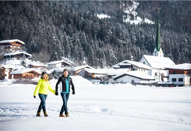
Winter walking
Connection Scheffau-Söll hiking route
This hike connects the towns of Scheffau and Söll.
7,10 km
70 m
02:40 h
Route
7,10 km
70 m
110 m
02:40 h
743 m
Starting Point
Hiking starting point Tourist Info, Scheffau (737 m)
End Point
Hiking starting point Tourist Info, Söll (689 m)
What to do in an emergency? Call emergency number
140 - Mountain Rescue (Bergrettung)
112 - European Emergency Number
133 - Police
144 - Ambulance
Many routes have rescue points at the hiking signs, which can be used as a clear location identification in an emergency.
The Alpine Club provides tips for optimal preparation for mountain hiking.
SOS-EU-Alp App
The SOS EU ALP app allows you to determine your location (x,y coordinates) via your smartphone. In an emergency, this location data can be sent directly to the responsible control center (Tyrol, South Tyrol or Bavaria).
Description
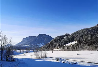
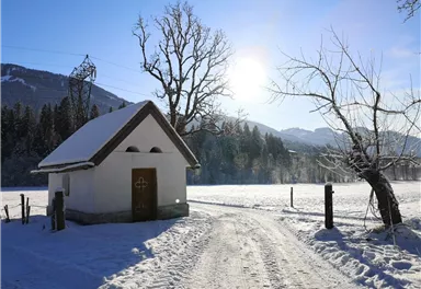
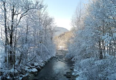
Start in the centre of Scheffau and follow the groomed ski run behind Hotel Kaiserlodge downhill towards the district of Blaiken. From there, follow the signs to Söll and continue along the paved path through the districts of Blaiken and Seebach. After passing a small chapel, the route remains mostly flat until you reach the Stockach district of Söll. From Stockach, the trail climbs gently via Unterhauning and Gänsleit to Lake Ahornsee. Continue along the road to the roundabout, from where you reach the centre of Söll. The return journey is easy by public bus. Of course, the tour...
Best Season
Jan
Feb
Mar
Apr
May
Jun
Jul
Aug
Sep
Oct
Nov
Dec
Skill Level
Endurance
More information at www.wilderkaiser.info/mobility


Current Weather
Today
2026-05-11
Morning
9 °C
Afternoon
8 °C
Evening
4 °C
Tomorrow
2026-05-12
Morning
-2 °C
Afternoon
-3 °C
Evening
-2 °C
Wednesday
2026-05-13
Morning
1 °C
Afternoon
5 °C
Evening
5 °C
Thursday
2026-05-14
Morning
3 °C
Afternoon
3 °C
Evening
1 °C
Friday
2026-05-15
Morning
Afternoon
Evening
Saturday
2026-05-16
Morning
Afternoon
1 °C
Evening
1 °C
Sunday
2026-05-17
Morning
1 °C
Afternoon
4 °C
Evening
4 °C
Monday
2026-05-18
Morning
4 °C
Afternoon
7 °C
Evening
6 °C
Tuesday
2026-05-19
Morning
7 °C
Afternoon
9 °C
Evening
8 °C
Wednesday
2026-05-20
Morning
7 °C
Afternoon
10 °C
Evening
7 °C
Thursday
2026-05-21
Morning
7 °C
Afternoon
9 °C
Evening
9 °C
Friday
2026-05-22
Morning
8 °C
Afternoon
11 °C
Evening
9 °C
Saturday
2026-05-23
Morning
9 °C
Afternoon
12 °C
Evening
9 °C
Sunday
2026-05-24
Morning
9 °C
Afternoon
11 °C
Evening
10 °C
Last updated at 05/11/2026, 02:00 AM
Contact
Contact
You have questions? We are happy to assist you.


