


Long-distance hike (from 4 days)
Eagle Walk Stage 03: Kaindlhütte - Kufstein
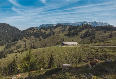
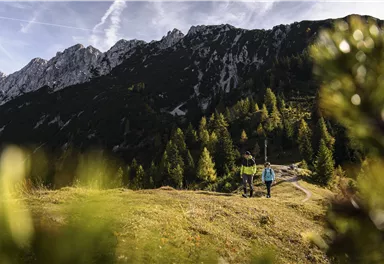
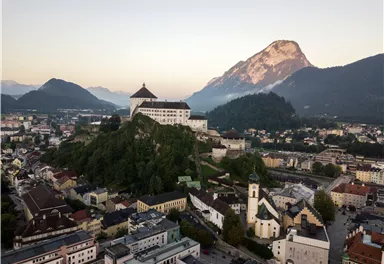
This stage takes hikers to the small town of Kufstein located on the banks of the Inn river – a town which has been celebrated in song and is steeped in history and character. Walkers make their way through the lush and verdant beauty of a pasture paradise with cosy huts and mountain restaurants before stopping for a rest at the Brentenjochhütte hut (delicious “Kiachl” are served every Saturday). With so many sights to marvel at, don't forget to keep an eye out for the nearly one thousand species of flowering plants native to the Kaiser Mountains.
Medium
12,50 km
160 m
04:00 h
Medium
Route
12,50 km
160 m
968 m
04:00 h
1445 m
Starting Point
Hintersteiner See
End Point
Kufstein
What to do in an emergency? Call emergency number
140 - Mountain Rescue (Bergrettung)
112 - European Emergency Number
133 - Police
144 - Ambulance
Many routes have rescue points at the hiking signs, which can be used as a clear location identification in an emergency.
The Alpine Club provides tips for optimal preparation for mountain hiking.

SOS-EU-Alp App
The SOS EU ALP app allows you to determine your location (x,y coordinates) via your smartphone. In an emergency, this location data can be sent directly to the responsible control center (Tyrol, South Tyrol or Bavaria).
Description
Starting point: Kaindlhütte hut
Follow the Bettlersteig trail (marked as trail number 827) from the Kaindlhütte hut heading east, passing the Steinbergalm hut. The trail leads over a saddle to the right of the Brandkogel mountain. Take the left trail towards Gamskogel mountain. Beneath the Brandkogel and Taxköpfl mountains, the trail leads to the peak of the Gamskogel at 1,449 metres. Continue heading west and downhill until you reach the Brentenjochalm hut (at 1,208 metres) after about two kilometres. Now take the panoramic Jochboden trail leading downhill through a forest. When you reach the Schneerosenweg fork, head right and turn...
Best Season
Jan
Feb
Mar
Apr
May
Jun
Jul
Aug
Sep
Oct
Nov
Dec
Skill Level
Endurance
Multi-Day Tour Feature
Etappe
Current Weather
Today
2026-10-09
Morning

5 °C
Afternoon

7 °C
Evening

7 °C
Tomorrow
2026-10-10
Morning

7 °C
Afternoon
8 °C
Evening
6 °C
Sunday
2026-10-11
Morning

3 °C
Afternoon
6 °C
Evening
4 °C
Monday
2026-10-12
Morning
3 °C
Afternoon
7 °C
Evening
5 °C
Tuesday
2026-10-13
Morning

4 °C
Afternoon
10 °C
Evening
8 °C
Wednesday
2026-10-14
Morning
7 °C
Afternoon
11 °C
Evening
10 °C
Thursday
2026-10-15
Morning
9 °C
Afternoon
13 °C
Evening
11 °C
Friday
2026-10-16
Morning
9 °C
Afternoon
11 °C
Evening

9 °C
Saturday
2026-10-17
Morning
7 °C
Afternoon
10 °C
Evening
8 °C
Sunday
2026-10-18
Morning
7 °C
Afternoon
10 °C
Evening
8 °C
Monday
2026-10-19
Morning
6 °C
Afternoon
9 °C
Evening
7 °C
Tuesday
2026-10-20
Morning
5 °C
Afternoon
10 °C
Evening
7 °C
Wednesday
2026-10-21
Morning
5 °C
Afternoon
10 °C
Evening
7 °C
Thursday
2026-10-22
Morning
4 °C
Afternoon
8 °C
Evening
6 °C
Last updated at 10/09/2026, 02:00 PM
Contact
Contact
You have questions? We are happy to assist you.


