

Hiking tour
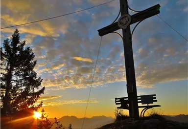
Kleiner Pölven summit from Alpenschlössl
The viewpoint mountain of the locals, steep and fascinating.
Medium
10,40 km
790 m
05:00 h

Route
10,40 km
790 m
05:00 h
1562 m
Starting Point
Hiking starting point Alpenschlössl, Söll (762 m)
End Point
Hiking starting point Alpenschlössl, Söll (762 m)
What to do in an emergency? Call emergency number
140 - Mountain Rescue (Bergrettung)
112 - European Emergency Number
133 - Police
144 - Ambulance
Many routes have rescue points at the hiking signs, which can be used as a clear location identification in an emergency.
The Alpine Club provides tips for optimal preparation for mountain hiking.
SOS-EU-Alp App
The SOS EU ALP app allows you to determine your location (x,y coordinates) via your smartphone. In an emergency, this location data can be sent directly to the responsible control center (Tyrol, South Tyrol or Bavaria).
Description
Continue along the forest road and then on a winding path until you reach a turnstile at the upper end of the alpine pasture. From here you head back into the forest, over wooden steps and a steep climb to the first rope insurance.
The path leads across to the...
Best Season
Jan
Feb
Mar
Apr
May
Jun
Jul
Aug
Sep
Oct
Nov
Dec
Skill Level
Endurance
Coming from St. Johann/Kufstein on the B178 main road, take the exit on the right, after the Söll business park, into the neighborhood of Ried. Follow the signs to "Alpenschlössl", after a 90° bend to the left past the houses, turn right at the next junction. After approx. 400 m you will reach the Alpenschlössl hiking starting point on the right-hand side.
Current Weather
Today
2026-02-21
Morning
-2 °C
Afternoon
-2 °C
Evening
-2 °C
Tomorrow
2026-02-22
Morning
1 °C
Afternoon
3 °C
Evening
4 °C
Monday
2026-02-23
Morning
1 °C
Afternoon
2 °C
Evening
3 °C
Tuesday
2026-02-24
Morning
3 °C
Afternoon
5 °C
Evening
5 °C
Wednesday
2026-02-25
Morning
6 °C
Afternoon
9 °C
Evening
8 °C
Thursday
2026-02-26
Morning
7 °C
Afternoon
9 °C
Evening
7 °C
Friday
2026-02-27
Morning
5 °C
Afternoon
7 °C
Evening
6 °C
Saturday
2026-02-28
Morning
2 °C
Afternoon
4 °C
Evening
3 °C
Sunday
2026-03-01
Morning
1 °C
Afternoon
3 °C
Evening
2 °C
Monday
2026-03-02
Morning
1 °C
Afternoon
3 °C
Evening
3 °C
Tuesday
2026-03-03
Morning
-1 °C
Afternoon
5 °C
Evening
4 °C
Wednesday
2026-03-04
Morning
2 °C
Afternoon
4 °C
Evening
3 °C
Thursday
2026-03-05
Morning
2 °C
Afternoon
2 °C
Evening
2 °C
Friday
2026-03-06
Morning
1 °C
Afternoon
2 °C
Evening
2 °C
Contact
Contact
You have questions? We are happy to assist you.


