

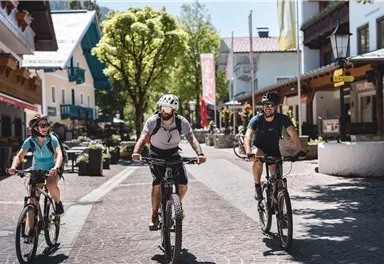
Mountainbike tour
MTB Tour Söll - Hintersteiner See Lake
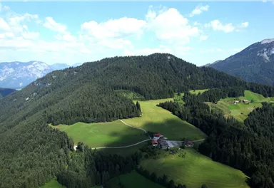
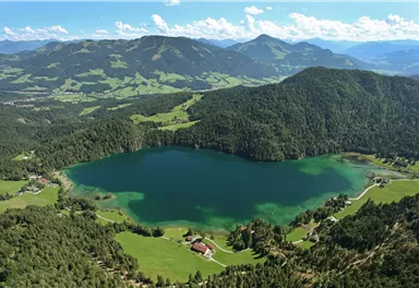
Picture-postcard panoramic scenery to Hintersteiner See lake, a natural gem.
Medium
9,40 km
430 m
Medium
Route
9,40 km
430 m
230 m
1007 m
Starting Point
Villag Center, Söll (689 m)
End Point
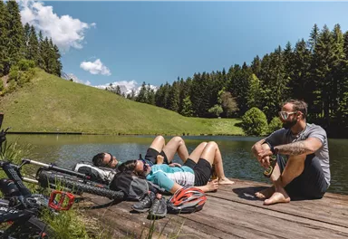
Hintersteiner See Lake, Scheffau (889 m)
What to do in an emergency? Call emergency number
140 - Mountain Rescue (Bergrettung)
112 - European Emergency Number
133 - Police
144 - Ambulance
Many routes have rescue points at the hiking signs, which can be used as a clear location identification in an emergency.
The Alpine Club provides tips for optimal preparation for mountain hiking.
SOS-EU-Alp App
The SOS EU ALP app allows you to determine your location (x,y coordinates) via your smartphone. In an emergency, this location data can be sent directly to the responsible control center (Tyrol, South Tyrol or Bavaria).
Description
inn. Shortly before that, take the underpass and go left and then right again over the bridge towards Achleitberg mountain. The sharply bending route takes you through the forest to the former Gasthof Achleiten inn. Cycle through the Scheffau district of Greidern until you come to Hintersteiner See lake. The lido tempts you to take a refreshing dive into the cool waters or treat yourself to something tasty at the Seestüberl restaurant.
Best Season
Jan
Feb
Mar
Apr
May
Jun
Jul
Aug
Sep
Oct
Nov
Dec
Skill Level
Endurance
More information at: www.wilderkaiser.info/mobility
West Pölven public car park is located to the east of the supermarket car park. The Tourist Information Office is in the pedestrianised zone.


Current Weather
Today
2026-05-22
Morning
9 °C
Afternoon
14 °C
Evening
13 °C
Tomorrow
2026-05-23
Morning
13 °C
Afternoon
16 °C
Evening
15 °C
Sunday
2026-05-24
Morning
14 °C
Afternoon
17 °C
Evening
16 °C
Monday
2026-05-25
Morning
15 °C
Afternoon
18 °C
Evening
17 °C
Tuesday
2026-05-26
Morning
16 °C
Afternoon
18 °C
Evening
17 °C
Wednesday
2026-05-27
Morning
14 °C
Afternoon
16 °C
Evening
13 °C
Thursday
2026-05-28
Morning
10 °C
Afternoon
13 °C
Evening
11 °C
Friday
2026-05-29
Morning
10 °C
Afternoon
13 °C
Evening
12 °C
Saturday
2026-05-30
Morning
11 °C
Afternoon
14 °C
Evening
12 °C
Sunday
2026-05-31
Morning
11 °C
Afternoon
14 °C
Evening
12 °C
Monday
2026-06-01
Morning
12 °C
Afternoon
13 °C
Evening
11 °C
Tuesday
2026-06-02
Morning
11 °C
Afternoon
14 °C
Evening
12 °C
Wednesday
2026-06-03
Morning
12 °C
Afternoon
12 °C
Evening
11 °C
Thursday
2026-06-04
Morning
11 °C
Afternoon
12 °C
Evening
11 °C
Last updated at 05/22/2026, 02:00 PM
Contact
Contact
You have questions? We are happy to assist you.


