


 Deutsch
 Nederlands
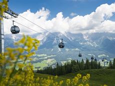
Toboggan run Astberg Direction Going

A mountain with lots of tobogganing options and good refreshment stops.
Astbergbahn Talstation, Going (805 m)
Astbergbahn Talstation, Going (805 m)
Tobogganing
Intermediate
3,2 km
The tour recommendations listed here are based on the current weather conditions.
However, we would like to point out that the weather and therefore the conditions can change quickly and that every tour is undertaken at your own risk.
A mountain with lots of tobogganing options and good refreshment stops.
Astbergbahn Talstation, Going (805 m)
Astbergbahn Talstation, Going (805 m)
Tobogganing
Intermediate
3,2 km

Varied hike with cosy refreshment stops and a wonderful mountain panorama.
mountain station Salvistabahn / Kleine Salve
Middle station Salvistabahn Itter
Hiking
Intermediate
2:45 h
7,4 km
360 Elevation gain

Mountain tour to the extreme climbers’ training rock and spectacle of nature with refreshment stop at the Graspoint-Niederalm.
Hiking starting point Hüttling, Going (820 m)
Hiking starting point Hüttling, Going (820 m)
Hiking
Intermediate
3:30 h
5,5 km
520 Elevation gain

The heart of the tour is the deep, wonderful-to-climb chimney, which lends the tour an Alpine character.
Number of rope lengths9
Access time1,5
Alpine climbing route
Multi-rope length difficulty levels6

Number of rope lengths12
Access time2,0
Alpine climbing route
Multi-rope length difficulty levels6+ (6-/A0)

Explore the popular path past the TV backdrop on snowshoes.
Cable car valley station, Söll (725 m)
Cable car valley station, Söll (725 m)
Hiking
4:45 h
7,0 km
350 Elevation gain

Nice circular hike through Going with visits to numerous chapels.
Hiking starting point Going center (former tourist information Going) (764 m)
Hiking starting point Going center (former tourist information Going) (764 m)
Hiking
Easy
2:45 h
9,3 km
210 Elevation gain

Gasteig – Wilder-Kaiser-Steig – Ursulablick – Gscheuerkopf – Graspoint-Hochalm – Graspoint-Niederalm – Going, Hüttling
Gasteig (750 m)
Hiking starting point Hüttling, Going (820 m)
Hiking
Intermediate
5:15 h
10,8 km
840 Elevation gain

Winter hike with picturesque views of the Wilder Kaiser to the 'Wolfsegg' plateau
Hiking starting point Going center (former tourist information Going) (764 m)
Hiking starting point Going center (former tourist information Going) (764 m)
Hiking
1:30 h
4,0 km
65 Elevation gain

Gentle walking or running course in Ellmau
Hiking starting point Tourist Info, Ellmau (800 m)
Hiking starting point Tourist Info, Ellmau (800 m)
Jogging
Easy
0:20 h
3,0 km
54 Elevation gain

An adventure hike from Ellmau village centre to the Wochenbrunner Alm mountain hut from where you can enjoy stunning views and the Ellmau Stone Circle.
Hiking starting point Tourist Info, Ellmau (800 m)
Hiking starting point Tourist Info, Ellmau (800 m)
Hiking
Easy
4:30 h
13,5 km
530 Elevation gain

Cozy winter walk through the snowy "Hexenwasser" and amazing views of the Hohe Salve.
Mountain station gondola Hexenwasser, Söll (1,150 m)
Mountain station gondola Hexenwasser, Söll (1,150 m)
Hiking
0:50 h
2,0 km
70 Elevation gain

Gaudeamushütte – Gamswegl – path 825 – Gruttenhütte
Gaudeamushütte, Going (1,263 m)
Gruttenhütte, Ellmau (1,620 m)
Hiking
Intermediate
1:45 h
3,2 km
480 Elevation gain

Embark on a sunny cross-country safari in the snowfields around the Sölllandl.
Spar super market Söll
Spar super market Söll
Cross-country skiing
Intermediate
5,9 km
70 Elevation gain

A circular route full of experiences that leads from the Seebachgraben gorge to the Wilder-Kaiser-Steig trail - discover one of the most beautiful parts of Scheffau!
Hiking starting point Tourist Info, Scheffau (738 m)
Hiking starting point Tourist Info, Scheffau (738 m)
Hiking
Intermediate
7:00 h
19,6 km
1140 Elevation gain

Ancient path of the romans - a better stroll.
Hiking starting point Tourist Info, Söll (689 m)
Hiking starting point Tourist Info, Söll (689 m)
Hiking
Easy
1:00 h
3,0 km
55 Elevation gain

A beautiful tour around the Kalkstein mountain and Pillersee lake.
Tourist Info, Going (764 m)
Tourist Info, Going (764 m)
Cycling
Intermediate
66,9 km
550 Elevation gain
 Open
OpenThe short via ferrata is ideal for beginners.
Access time0,9166666666666666
Via ferrata
Difficulty levelB-C
Via ferrara length50,0 m

A tour of the main filming locations of the TV series “Der Bergdoktor” (The Mountain Doctor) in Ellmau and Going, with a refreshment stop at the inn used during filming
Hiking info point, Tourist Info Ellmau (800 m)
Hiking info point, Tourist Info Ellmau (800 m)
Hiking
Easy
3:15 h
11,4 km
180 Elevation gain

Hike to the Hexenwasser and get rewarded with a view.
Bergbahn valley station, Söll (724 m)
Bergbahn valley station, Söll (724 m)
Hiking
Easy
3:00 h
7,9 km
410 Elevation gain

An extensive exploration of the “Moor & more”. Exciting puzzle tour with Rocky through the Kaiserwald forest is sure to be lots of fun, even for older children.
Hiking starting point Hüttling, Going (820 m)
Hiking starting point Hüttling, Going (820 m)
Hiking
Easy
3:00 h
8,0 km
380 Elevation gain

Ellmau hiking info point - Wimm - Riesen - Biedringer Alm - Biedringer Bauernhöfe - Ellmauer Kaiserbad - Ellmau hiking info point
Hiking starting point Tourist Info, Ellmau (800 m)
Hiking starting point Tourist Info, Ellmau (800 m)
Jogging
Easy
9,8 km
400 Elevation gain

Walking tour for refreshment and relaxation close to the village.
Hiking starting point Tourist Info, Scheffau (738 m)
Hiking starting point Tourist Info, Scheffau (738 m)
Hiking
Easy
0:45 h
2,3 km
70 Elevation gain

Gruttenhütte - Kaiser-Hochalm - Steiner-Hochalm - Jägersteig - Walleralm - Hochegg - Kaindlhütte
Gruttenhütte, Ellmau (1,620 m)
Hintersteiner See, Scheffau (889 m)
Hiking
Intermediate
5:30 h
13,5 km
560 Elevation gain

"Enjoyable" winter hike with a cozy stop and a fantastic panorama.
Hiking starting point Tourist Info, Ellmau (800 m)
Hiking starting point Tourist Info, Ellmau (800 m)
Hiking
4:30 h
10,5 km
370 Elevation gain
 Partially open
The highlight for everyone who loves hiking for pleasure - lush Alpine meadows, sparkling mountain lakes and delightful food in the Kitzbühel Alps. And the Bergbahnen Wilder Kaiser - Brixental summer cable cars make the ascent and descent easy.
Astberg, Going
Hochsöll
Hiking
Easy
6:45 h
20,0 km
720 Elevation gain

More than 190 sport climbing routes, difficulty levels 3 to 9a+
Route number191
Access time0,6666666666666666
Sport climbing

Shady hike with idyllic resting places and views from the Zillertaler Alpen to the Inn valley.
Hiking starting point Alpenschlössl, Söll (762 m)
Hiking starting point Alpenschlössl, Söll (762 m)
Hiking
Easy
3:30 h
9,5 km
480 Elevation gain

Walk through the forest, along the river, back to the village.
Hiking starting point Tourist Info, Söll (689 m)
Hiking starting point Tourist Info, Söll (689 m)
Hiking
Easy
2:15 h
6,3 km
90 Elevation gain

Moderate tour to the Schleier Waterfall, a great outdoor experience.
Tourist Info, Going (764 m)
Tourist Info, Going (764 m)
Cycling
Intermediate
6,6 km
410 Elevation gain

Stripsenjochhaus - Griesner Alm - Griesenau
Stripsenjochhaus (1,577 m)
Griesenau, Kirchdorf (719 m)
Hiking
Intermediate
3:00 h
7,9 km

On the north side up to the Ellmauer Halt summit 2,344 m.
Access time4,5
Via ferrata
Difficulty levelB-C
Via ferrara length2000,0 m
 Partially open
Hartkaiserbahn summit station - Ellmis Zauberwald - Tanzbodensee lake - Hartkaiserbahn summit station
Hartkaiser summit station, Ellmau (1,555 m)
Hartkaiser summit station, Ellmau (1,555 m)
Jogging
Easy
3,4 km
120 Elevation gain

Short circular walk at the snow-white Brandstadl mountain with panorama view.
Brandstadlbahn summit station, Scheffau (1,643 m)
Brandstadlbahn summit station, Scheffau (1,643 m)
Hiking
0:30 h
1,3 km
40 Elevation gain

Number of rope lengths5
Access time2,0
Alpine climbing route
Multi-rope length difficulty levels7+

Over hill and dale through idyllic nature up to the Rauhen Kopf.
Astberg Bergstation
Astberg Bergstation
Hiking
Intermediate
4:45 h
13,1 km
620 Elevation gain

Off the beaten track up to the Köpfing farmhouse. “Der Bergdoktor” (The Mountain Doctor) is a famous German-Austrian TV series, which is produced in the Wilder Kaiser region.
Bergdoktor parking lot, Söll
Bergdoktor parking lot, Söll
Hiking
Easy
3:00 h
8,4 km
370 Elevation gain

Scenic and varied circular hike.
Hiking starting point Going center (former tourist information Going) (764 m)
Hiking starting point Going center (former tourist information Going) (764 m)
Hiking
Intermediate
4:00 h
11,0 km
500 Elevation gain

A beautiful easy hike at the foot of the Wilder Kaiser
Hiking starting point Tourist Info, Ellmau (800 m)
Hiking starting point Tourist Info, Ellmau (800 m)
Hiking
Easy
1:45 h
5,9 km
60 Elevation gain

Panoramic circular walk in the Wilder Kaiser leading to the highest mountain hut in the region.
Hiking starting point Tourist Info, Ellmau (800 m)
Hiking starting point Tourist Info, Ellmau (800 m)
Hiking
Intermediate
6:00 h
15,7 km
870 Elevation gain
The tour recommendations listed here are based on the current weather conditions.
However, we would like to point out that the weather and therefore the conditions can change quickly and that every tour is undertaken at your own risk.
A mountain with lots of tobogganing options and good refreshment stops.
Astbergbahn Talstation, Going (805 m)
Astbergbahn Talstation, Going (805 m)
Tobogganing
Intermediate
3,2 km
Varied hike with cosy refreshment stops and a wonderful mountain panorama.
mountain station Salvistabahn / Kleine Salve
Middle station Salvistabahn Itter
Hiking
Intermediate
2:45 h
7,4 km
360 Elevation gain
Mountain tour to the extreme climbers’ training rock and spectacle of nature with refreshment stop at the Graspoint-Niederalm.
Hiking starting point Hüttling, Going (820 m)
Hiking starting point Hüttling, Going (820 m)
Hiking
Intermediate
3:30 h
5,5 km
520 Elevation gain
The heart of the tour is the deep, wonderful-to-climb chimney, which lends the tour an Alpine character.
Number of rope lengths9
Access time1,5
Alpine climbing route
Multi-rope length difficulty levels6
Number of rope lengths12
Access time2,0
Alpine climbing route
Multi-rope length difficulty levels6+ (6-/A0)
Explore the popular path past the TV backdrop on snowshoes.
Cable car valley station, Söll (725 m)
Cable car valley station, Söll (725 m)
Hiking
4:45 h
7,0 km
350 Elevation gain
Nice circular hike through Going with visits to numerous chapels.
Hiking starting point Going center (former tourist information Going) (764 m)
Hiking starting point Going center (former tourist information Going) (764 m)
Hiking
Easy
2:45 h
9,3 km
210 Elevation gain
Gasteig – Wilder-Kaiser-Steig – Ursulablick – Gscheuerkopf – Graspoint-Hochalm – Graspoint-Niederalm – Going, Hüttling
Gasteig (750 m)
Hiking starting point Hüttling, Going (820 m)
Hiking
Intermediate
5:15 h
10,8 km
840 Elevation gain
Winter hike with picturesque views of the Wilder Kaiser to the 'Wolfsegg' plateau
Hiking starting point Going center (former tourist information Going) (764 m)
Hiking starting point Going center (former tourist information Going) (764 m)
Hiking
1:30 h
4,0 km
65 Elevation gain
Gentle walking or running course in Ellmau
Hiking starting point Tourist Info, Ellmau (800 m)
Hiking starting point Tourist Info, Ellmau (800 m)
Jogging
Easy
0:20 h
3,0 km
54 Elevation gain
An adventure hike from Ellmau village centre to the Wochenbrunner Alm mountain hut from where you can enjoy stunning views and the Ellmau Stone Circle.
Hiking starting point Tourist Info, Ellmau (800 m)
Hiking starting point Tourist Info, Ellmau (800 m)
Hiking
Easy
4:30 h
13,5 km
530 Elevation gain
Cozy winter walk through the snowy "Hexenwasser" and amazing views of the Hohe Salve.
Mountain station gondola Hexenwasser, Söll (1,150 m)
Mountain station gondola Hexenwasser, Söll (1,150 m)
Hiking
0:50 h
2,0 km
70 Elevation gain
Gaudeamushütte – Gamswegl – path 825 – Gruttenhütte
Gaudeamushütte, Going (1,263 m)
Gruttenhütte, Ellmau (1,620 m)
Hiking
Intermediate
1:45 h
3,2 km
480 Elevation gain
Embark on a sunny cross-country safari in the snowfields around the Sölllandl.
Spar super market Söll
Spar super market Söll
Cross-country skiing
Intermediate
5,9 km
70 Elevation gain
A circular route full of experiences that leads from the Seebachgraben gorge to the Wilder-Kaiser-Steig trail - discover one of the most beautiful parts of Scheffau!
Hiking starting point Tourist Info, Scheffau (738 m)
Hiking starting point Tourist Info, Scheffau (738 m)
Hiking
Intermediate
7:00 h
19,6 km
1140 Elevation gain
Ancient path of the romans - a better stroll.
Hiking starting point Tourist Info, Söll (689 m)
Hiking starting point Tourist Info, Söll (689 m)
Hiking
Easy
1:00 h
3,0 km
55 Elevation gain
A beautiful tour around the Kalkstein mountain and Pillersee lake.
Tourist Info, Going (764 m)
Tourist Info, Going (764 m)
Cycling
Intermediate
66,9 km
550 Elevation gain
OpenThe short via ferrata is ideal for beginners.
Access time0,9166666666666666
Via ferrata
Difficulty levelB-C
Via ferrara length50,0 m
A tour of the main filming locations of the TV series “Der Bergdoktor” (The Mountain Doctor) in Ellmau and Going, with a refreshment stop at the inn used during filming
Hiking info point, Tourist Info Ellmau (800 m)
Hiking info point, Tourist Info Ellmau (800 m)
Hiking
Easy
3:15 h
11,4 km
180 Elevation gain
Hike to the Hexenwasser and get rewarded with a view.
Bergbahn valley station, Söll (724 m)
Bergbahn valley station, Söll (724 m)
Hiking
Easy
3:00 h
7,9 km
410 Elevation gain
An extensive exploration of the “Moor & more”. Exciting puzzle tour with Rocky through the Kaiserwald forest is sure to be lots of fun, even for older children.
Hiking starting point Hüttling, Going (820 m)
Hiking starting point Hüttling, Going (820 m)
Hiking
Easy
3:00 h
8,0 km
380 Elevation gain
Ellmau hiking info point - Wimm - Riesen - Biedringer Alm - Biedringer Bauernhöfe - Ellmauer Kaiserbad - Ellmau hiking info point
Hiking starting point Tourist Info, Ellmau (800 m)
Hiking starting point Tourist Info, Ellmau (800 m)
Jogging
Easy
9,8 km
400 Elevation gain
Walking tour for refreshment and relaxation close to the village.
Hiking starting point Tourist Info, Scheffau (738 m)
Hiking starting point Tourist Info, Scheffau (738 m)
Hiking
Easy
0:45 h
2,3 km
70 Elevation gain
Gruttenhütte - Kaiser-Hochalm - Steiner-Hochalm - Jägersteig - Walleralm - Hochegg - Kaindlhütte
Gruttenhütte, Ellmau (1,620 m)
Hintersteiner See, Scheffau (889 m)
Hiking
Intermediate
5:30 h
13,5 km
560 Elevation gain
"Enjoyable" winter hike with a cozy stop and a fantastic panorama.
Hiking starting point Tourist Info, Ellmau (800 m)
Hiking starting point Tourist Info, Ellmau (800 m)
Hiking
4:30 h
10,5 km
370 Elevation gain
Partially openThe highlight for everyone who loves hiking for pleasure - lush Alpine meadows, sparkling mountain lakes and delightful food in the Kitzbühel Alps. And the Bergbahnen Wilder Kaiser - Brixental summer cable cars make the ascent and descent easy.
Astberg, Going
Hochsöll
Hiking
Easy
6:45 h
20,0 km
720 Elevation gain
More than 190 sport climbing routes, difficulty levels 3 to 9a+
Route number191
Access time0,6666666666666666
Sport climbing
Shady hike with idyllic resting places and views from the Zillertaler Alpen to the Inn valley.
Hiking starting point Alpenschlössl, Söll (762 m)
Hiking starting point Alpenschlössl, Söll (762 m)
Hiking
Easy
3:30 h
9,5 km
480 Elevation gain
Walk through the forest, along the river, back to the village.
Hiking starting point Tourist Info, Söll (689 m)
Hiking starting point Tourist Info, Söll (689 m)
Hiking
Easy
2:15 h
6,3 km
90 Elevation gain
Moderate tour to the Schleier Waterfall, a great outdoor experience.
Tourist Info, Going (764 m)
Tourist Info, Going (764 m)
Cycling
Intermediate
6,6 km
410 Elevation gain
Stripsenjochhaus - Griesner Alm - Griesenau
Stripsenjochhaus (1,577 m)
Griesenau, Kirchdorf (719 m)
Hiking
Intermediate
3:00 h
7,9 km
On the north side up to the Ellmauer Halt summit 2,344 m.
Access time4,5
Via ferrata
Difficulty levelB-C
Via ferrara length2000,0 m
Partially openHartkaiserbahn summit station - Ellmis Zauberwald - Tanzbodensee lake - Hartkaiserbahn summit station
Hartkaiser summit station, Ellmau (1,555 m)
Hartkaiser summit station, Ellmau (1,555 m)
Jogging
Easy
3,4 km
120 Elevation gain
Short circular walk at the snow-white Brandstadl mountain with panorama view.
Brandstadlbahn summit station, Scheffau (1,643 m)
Brandstadlbahn summit station, Scheffau (1,643 m)
Hiking
0:30 h
1,3 km
40 Elevation gain
Number of rope lengths5
Access time2,0
Alpine climbing route
Multi-rope length difficulty levels7+
Over hill and dale through idyllic nature up to the Rauhen Kopf.
Astberg Bergstation
Astberg Bergstation
Hiking
Intermediate
4:45 h
13,1 km
620 Elevation gain
Off the beaten track up to the Köpfing farmhouse. “Der Bergdoktor” (The Mountain Doctor) is a famous German-Austrian TV series, which is produced in the Wilder Kaiser region.
Bergdoktor parking lot, Söll
Bergdoktor parking lot, Söll
Hiking
Easy
3:00 h
8,4 km
370 Elevation gain
Scenic and varied circular hike.
Hiking starting point Going center (former tourist information Going) (764 m)
Hiking starting point Going center (former tourist information Going) (764 m)
Hiking
Intermediate
4:00 h
11,0 km
500 Elevation gain
A beautiful easy hike at the foot of the Wilder Kaiser
Hiking starting point Tourist Info, Ellmau (800 m)
Hiking starting point Tourist Info, Ellmau (800 m)
Hiking
Easy
1:45 h
5,9 km
60 Elevation gain
Panoramic circular walk in the Wilder Kaiser leading to the highest mountain hut in the region.
Hiking starting point Tourist Info, Ellmau (800 m)
Hiking starting point Tourist Info, Ellmau (800 m)
Hiking
Intermediate
6:00 h
15,7 km
870 Elevation gain