

Hiking tour
Circumnavigation Juffinger Jöchl
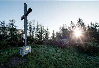
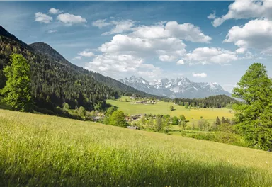
Shady hike with idyllic resting places and views from the Zillertaler Alpen to the Inn valley.
Easy
9,50 km
480 m
03:30 h
Easy
Route
9,50 km
480 m
03:30 h
1177 m
Starting Point
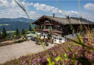
Hiking starting point Alpenschlössl, Söll (762 m)
End Point
Hiking starting point Alpenschlössl, Söll (762 m)
What to do in an emergency? Call emergency number
140 - Mountain Rescue (Bergrettung)
112 - European Emergency Number
133 - Police
144 - Ambulance
Many routes have rescue points at the hiking signs, which can be used as a clear location identification in an emergency.
The Alpine Club provides tips for optimal preparation for mountain hiking.
SOS-EU-Alp App
The SOS EU ALP app allows you to determine your location (x,y coordinates) via your smartphone. In an emergency, this location data can be sent directly to the responsible control center (Tyrol, South Tyrol or Bavaria).
Description
Best Season
Jan
Feb
Mar
Apr
May
Jun
Jul
Aug
Sep
Oct
Nov
Dec
Skill Level
Endurance
Loop tour
Coming from St. Johann/Kufstein on the B178 main road, take the exit on the right, after the Söll business park, into the neighborhood of Ried. Follow the signs to "Alpenschlössl", after a 90° bend to the left past the houses, turn right at the next junction. After approx. 400 m you will reach the Alpenschlössl hiking starting point on the right-hand side.

Current Weather
Today
2026-05-31
Morning
14 °C
Afternoon
17 °C
Evening
13 °C
Tomorrow
2026-06-01
Morning
8 °C
Afternoon
9 °C
Evening
10 °C
Tuesday
2026-06-02
Morning
12 °C
Afternoon
16 °C
Evening
13 °C
Wednesday
2026-06-03
Morning
6 °C
Afternoon
7 °C
Evening
7 °C
Thursday
2026-06-04
Morning
9 °C
Afternoon
12 °C
Evening
11 °C
Friday
2026-06-05
Morning
10 °C
Afternoon
12 °C
Evening
10 °C
Saturday
2026-06-06
Morning
10 °C
Afternoon
13 °C
Evening
12 °C
Sunday
2026-06-07
Morning
12 °C
Afternoon
15 °C
Evening
14 °C
Monday
2026-06-08
Morning
13 °C
Afternoon
16 °C
Evening
14 °C
Tuesday
2026-06-09
Morning
13 °C
Afternoon
15 °C
Evening
14 °C
Wednesday
2026-06-10
Morning
12 °C
Afternoon
14 °C
Evening
13 °C
Thursday
2026-06-11
Morning
12 °C
Afternoon
13 °C
Evening
12 °C
Friday
2026-06-12
Morning
11 °C
Afternoon
13 °C
Evening
12 °C
Saturday
2026-06-13
Morning
11 °C
Afternoon
13 °C
Evening
13 °C
Last updated at 05/31/2026, 02:00 AM
Contact
Contact
You have questions? We are happy to assist you.


