


 Deutsch
 Nederlands
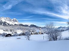
Panoramatrail

Sports ground, Söll (687 m)
Sports ground, Söll (687 m)
Jogging
Easy
8,4 km
130 Elevation gain
Sports ground, Söll (687 m)
Sports ground, Söll (687 m)
Jogging
Easy
8,4 km
130 Elevation gain

Comfortable round with a magnificent view of the Hohe Salve.
Mountain station gondola Hexenwasser, Söll (1,150 m)
Mountain station gondola Hexenwasser, Söll (1,150 m)
Hiking
Easy
0:35 h
1,8 km
50 Elevation gain

Exciting adventure stations for family tobogganing on the Hohe Salve.
Cable car valley station, Söll (725 m)
Cable car valley station, Söll (725 m)
Tobogganing
Easy
4,0 km

Gaudeamushütte – Gamswegl – path 825 – Gruttenhütte
Gaudeamushütte, Going (1,263 m)
Gruttenhütte, Ellmau (1,620 m)
Hiking
Intermediate
1:45 h
3,2 km
480 Elevation gain

Walking tour for refreshment and relaxation close to the village.
Hiking starting point Tourist Info, Scheffau (738 m)
Hiking starting point Tourist Info, Scheffau (738 m)
Hiking
Easy
0:45 h
2,3 km
70 Elevation gain

Short circular walk at the snow-white Brandstadl mountain with panorama view.
Brandstadlbahn summit station, Scheffau (1,643 m)
Brandstadlbahn summit station, Scheffau (1,643 m)
Hiking
0:30 h
1,3 km
40 Elevation gain

A picturesque mountain hike that leads from the turquoise waters of the most beautiful mountain lake in Tirol up to the rustic Alpine village.
Hiking starting point Seestüberl, Scheffau (890 m)
Hiking starting point Seestüberl, Scheffau (890 m)
Hiking
Intermediate
3:15 h
9,3 km
360 Elevation gain

Atmospheric forest walk along the snow-white creek.
Hiking starting point Tourist Info, Scheffau (738 m)
Hiking starting point Tourist Info, Scheffau (738 m)
Hiking
2:00 h
4,2 km
160 Elevation gain

Nice circular hike through Going with visits to numerous chapels.
Hiking starting point Going center (former tourist information Going) (764 m)
Hiking starting point Going center (former tourist information Going) (764 m)
Hiking
Easy
2:45 h
9,3 km
210 Elevation gain

Ellmau hiking info point - Wimm - Riesen - Biedringer Alm - Biedringer Bauernhöfe - Ellmauer Kaiserbad - Ellmau hiking info point
Hiking starting point Tourist Info, Ellmau (800 m)
Hiking starting point Tourist Info, Ellmau (800 m)
Jogging
Easy
9,8 km
400 Elevation gain

The panoramic spot of the locals, steep and fascinating.
Hiking starting point Franzlhof, Söll (703 m)
Hiking starting point Franzlhof, Söll (703 m)
Hiking
Intermediate
5:00 h
8,5 km
880 Elevation gain

Off the beaten track up to the Köpfing farmhouse. “Der Bergdoktor” (The Mountain Doctor) is a famous German-Austrian TV series, which is produced in the Wilder Kaiser region.
Bergdoktor parking lot, Söll
Bergdoktor parking lot, Söll
Hiking
Easy
3:00 h
8,4 km
370 Elevation gain
 Partially open
Pure adrenaline is the motto of the Pölven trail on the third day of the Tour de Tirol
Hiking starting point Tourist Info, Söll (689 m)
Hiking starting point Tourist Info, Söll (689 m)
Jogging
Intermediate
22,8 km
1110 Elevation gain

This pleasant circular walk takes you to Söll’s war memorial in a beautiful section of forest.
Hiking starting point Tourist Info, Söll (689 m)
Hiking starting point Tourist Info, Söll (689 m)
Hiking
Easy
0:30 h
2,1 km
10 Elevation gain

Quietness, strength and with easy breathing steadily closer to the Wilder Kaiser. You can return on foot or by bus.
Hiking starting point Bergbahn, Söll (724 m)
Gasthof Bocking, Söll (665 m)
Hiking
Easy
1:45 h
5,5 km
100 Elevation gain

Peace and strength, slow down and take a deep breath.
Ahornsee car park, Söll (693 m)
Ahornsee car park, Söll (693 m)
Hiking
4:45 h
12,0 km
220 Elevation gain

Stripsenjochhaus – Eggersteig – Steinerne Rinne – Ellmauer Tor – Jubiläumssteig – Gruttenhütte
Stripsenjochhaus, St. Johann in Tirol (1,577 m)
Gaudeamushütte, Going (1,263 m)
Hiking
Difficult
5:00 h
6,3 km
590 Elevation gain

The Kaiserkrone Trail is a trail running event with several competitions that lead around the Wilder Kaiser mountain massif. More about the event at: www.kaiserkrone.run
Start & Finish - village center of Scheffau (732 m), address: Dorf 45, 6351 Scheffau
Start & Finish - village center of Scheffau (732 m), address: Dorf 45, 6351 Scheffau
Jogging
Easy

Turnoff to Granderalm – Schleier Waterfall – Going, Hüttling
First turnoff after the Granderalm
Hiking starting point Hüttling, Going (820 m)
Hiking
Intermediate
2:00 h
3,1 km
40 Elevation gain

Cross-country skiing on an isolated plateau, surrounded by forest and winter meadows.
Cross-country skiing
Easy
1,3 km
30 Elevation gain
Skiing or hiking on the cross-country trail isn’t possible when there’s been too little snow on the sunny side. In this case there’s a perfectly prepared trail available on the shaded side - the Dorfloipe Going.
Infobüro Going,
Wanderstartplatz Infobüro, Going (764 m)
Cross-country skiing
Easy
1,4 km
120 Elevation gain

A relaxing hike towards the village center.
Hiking starting point Alpenschlössl, Söll (762 m)
Hiking starting point Alpenschlössl Söll (762 m)
Hiking
Easy
0:55 h
3,2 km
20 Elevation gain

Postkarten circuit Ellmau Ellmau hiking info point – Kapellenpark – Marienkapelle – Ellmau Parish Church
Hiking starting point Tourist Info, Ellmau (800 m)
Hiking starting point Tourist Info, Ellmau (800 m)
Hiking
Easy
0:25 h
1,3 km
40 Elevation gain

Going, Hüttling – Graspoint-Niederalm – Obere Regalm – Brennender Palven – Gaudeamushütte – Klamml – Gruttenhütte
Hiking starting point Hüttling, Going (820 m)
Gaudeamushütte, Going (1,263 m) / Gruttenhütte, Ellmau (1,620 m)
Hiking
Intermediate
4:30 h
8,0 km
1120 Elevation gain

Varied beginner trail round between the Kaiser towns of Ellmau and Going.
Wanderstartplatz Tourismus Info, Ellmau
Wanderstartplatz Tourismus Info, Ellmau
Jogging
Easy
9,7 km
500 Elevation gain

Varied round tour with many refreshments and wonderful views
Tourist Information Office, Scheffau (737 m)
Tourist Information Office, Scheffau (737 m)
Cycling
Intermediate
23,6 km
660 Elevation gain

A challenging circular mountainbike tour with plenty of welcoming refreshment stops.
Village Center, Söll (703 m)
Village Center, Söll (703 m)
Cycling
Intermediate
28,5 km
950 Elevation gain

Family hike on Austria’s longest sculpture trail
Hartkaiser summit station, Ellmau (1,555 m)
Rübezahl-Alm, Ellmau (1,174 m)
Hiking
Intermediate
1:00 h
2,5 km
50 Elevation gain

The viewpoint mountain of the locals, steep and fascinating.
Hiking starting point Alpenschlössl, Söll (762 m)
Hiking starting point Alpenschlössl, Söll (762 m)
Hiking
Intermediate
5:00 h
10,4 km
790 Elevation gain

Short, crisp connection between the Blattlloipe and the Schwendterloipe.
Cross-country skiing
Intermediate
0,5 km
30 Elevation gain

Hikers, young and old alike, will find in this wild romantic gorge natural playgrounds such as bridges and balancing beams by streams and ponds.
Hiking starting point Tourist Info, Scheffau (738 m)
Hiking starting point Tourist Info, Scheffau (738 m)
Hiking
Easy
1:15 h
3,5 km
130 Elevation gain

This short and easy valley circuit takes you around the village of Going am Wilden Kaiser and past the bathing lake, a delightful spot to cool off in fine weather.
Hiking starting point Going center (former tourist information Going) (764 m)
Hiking starting point Going center (former tourist information Going) (764 m)
Hiking
Easy
1:00 h
6,4 km
110 Elevation gain

Round tour through Scheffau with panoramic views, refreshment by the stream and slowing down in the forest.
Hiking starting point Tourist Info, Scheffau (738 m)
Hiking starting point Tourist Info, Scheffau (738 m)
Hiking
Easy
1:15 h
4,3 km
90 Elevation gain

Overview of all competition routes of the Trailrunning Event "Kaiserkrone Trail". More about the event at: www.kaiserkrone.run
Event area - village center of Scheffau (732 m), address: Dorf 45, 6351 Scheffau
Event area - village center of Scheffau (732 m), address: Dorf 45, 6351 Scheffau
Jogging

A beautiful tour up to the Astberg lake via the Hollenauer Kreuz with fantastic views
Astbergbahn valley station, Going (805 m)
Astbergsee, Going (1.251m)
Hiking
Easy
3,0 km
465 Elevation gain

The Kaiserkrone Trail is a trail running event with several competitions that lead around the Wilder Kaiser mountain massif. More about the event at: www.kaiserkrone.run
Start & Finish - village center of Scheffau (732 m), address: Dorf 45, 6351 Scheffau
Start & Finish - village center of Scheffau (732 m), address: Dorf 45, 6351 Scheffau
Jogging
Difficult
56,0 km
3640 Elevation gain

Stripsenjochhaus – Stripsenkopf – Feldberg – Scheibenbichlalmen – Griesenau – Gasteig
Stripsenjochhaus, St. Johann in Tirol (1,577 m)
Gasteig (750 m)
Hiking
Intermediate
6:30 h
16,1 km
640 Elevation gain
 Open
OpenAccess time0:05 h
Via ferrata
Difficulty levelA/B
Via ferrara length180,0 m

Wild and free - 5 days of hiking on old paths around the Wilder Kaiser The five-day hike from hut to hut is one of the most beautiful multi-day circular tours in Tirol. It takes mountain walkers along a route of around 58 kilometres, featuring ascents and descents with a difference in altitude of approximately 4,000 metres as they circle around the imposing Wilder Kaiser massif.
Hiking starting point Hüttling, Going (820 m)
Hiking starting point Hüttling, Going (820 m)
Hiking
Intermediate
27 h
57,7 km
4000 Elevation gain

Cozy winter tour in Hochsöll with lift support, refreshments and view to the Hohe Salve.
Mountain station gondola Hexenwasser, Söll (1,150 m)
Mountain station gondola Hexenwasser, Söll (1,150 m)
Hiking
1:30 h
3,2 km
100 Elevation gain
Sports ground, Söll (687 m)
Sports ground, Söll (687 m)
Jogging
Easy
8,4 km
130 Elevation gain
Comfortable round with a magnificent view of the Hohe Salve.
Mountain station gondola Hexenwasser, Söll (1,150 m)
Mountain station gondola Hexenwasser, Söll (1,150 m)
Hiking
Easy
0:35 h
1,8 km
50 Elevation gain
Exciting adventure stations for family tobogganing on the Hohe Salve.
Cable car valley station, Söll (725 m)
Cable car valley station, Söll (725 m)
Tobogganing
Easy
4,0 km
Gaudeamushütte – Gamswegl – path 825 – Gruttenhütte
Gaudeamushütte, Going (1,263 m)
Gruttenhütte, Ellmau (1,620 m)
Hiking
Intermediate
1:45 h
3,2 km
480 Elevation gain
Walking tour for refreshment and relaxation close to the village.
Hiking starting point Tourist Info, Scheffau (738 m)
Hiking starting point Tourist Info, Scheffau (738 m)
Hiking
Easy
0:45 h
2,3 km
70 Elevation gain
Short circular walk at the snow-white Brandstadl mountain with panorama view.
Brandstadlbahn summit station, Scheffau (1,643 m)
Brandstadlbahn summit station, Scheffau (1,643 m)
Hiking
0:30 h
1,3 km
40 Elevation gain
A picturesque mountain hike that leads from the turquoise waters of the most beautiful mountain lake in Tirol up to the rustic Alpine village.
Hiking starting point Seestüberl, Scheffau (890 m)
Hiking starting point Seestüberl, Scheffau (890 m)
Hiking
Intermediate
3:15 h
9,3 km
360 Elevation gain
Atmospheric forest walk along the snow-white creek.
Hiking starting point Tourist Info, Scheffau (738 m)
Hiking starting point Tourist Info, Scheffau (738 m)
Hiking
2:00 h
4,2 km
160 Elevation gain
Nice circular hike through Going with visits to numerous chapels.
Hiking starting point Going center (former tourist information Going) (764 m)
Hiking starting point Going center (former tourist information Going) (764 m)
Hiking
Easy
2:45 h
9,3 km
210 Elevation gain
Ellmau hiking info point - Wimm - Riesen - Biedringer Alm - Biedringer Bauernhöfe - Ellmauer Kaiserbad - Ellmau hiking info point
Hiking starting point Tourist Info, Ellmau (800 m)
Hiking starting point Tourist Info, Ellmau (800 m)
Jogging
Easy
9,8 km
400 Elevation gain
The panoramic spot of the locals, steep and fascinating.
Hiking starting point Franzlhof, Söll (703 m)
Hiking starting point Franzlhof, Söll (703 m)
Hiking
Intermediate
5:00 h
8,5 km
880 Elevation gain
Off the beaten track up to the Köpfing farmhouse. “Der Bergdoktor” (The Mountain Doctor) is a famous German-Austrian TV series, which is produced in the Wilder Kaiser region.
Bergdoktor parking lot, Söll
Bergdoktor parking lot, Söll
Hiking
Easy
3:00 h
8,4 km
370 Elevation gain
Partially openPure adrenaline is the motto of the Pölven trail on the third day of the Tour de Tirol
Hiking starting point Tourist Info, Söll (689 m)
Hiking starting point Tourist Info, Söll (689 m)
Jogging
Intermediate
22,8 km
1110 Elevation gain
This pleasant circular walk takes you to Söll’s war memorial in a beautiful section of forest.
Hiking starting point Tourist Info, Söll (689 m)
Hiking starting point Tourist Info, Söll (689 m)
Hiking
Easy
0:30 h
2,1 km
10 Elevation gain
Quietness, strength and with easy breathing steadily closer to the Wilder Kaiser. You can return on foot or by bus.
Hiking starting point Bergbahn, Söll (724 m)
Gasthof Bocking, Söll (665 m)
Hiking
Easy
1:45 h
5,5 km
100 Elevation gain
Peace and strength, slow down and take a deep breath.
Ahornsee car park, Söll (693 m)
Ahornsee car park, Söll (693 m)
Hiking
4:45 h
12,0 km
220 Elevation gain
Stripsenjochhaus – Eggersteig – Steinerne Rinne – Ellmauer Tor – Jubiläumssteig – Gruttenhütte
Stripsenjochhaus, St. Johann in Tirol (1,577 m)
Gaudeamushütte, Going (1,263 m)
Hiking
Difficult
5:00 h
6,3 km
590 Elevation gain
The Kaiserkrone Trail is a trail running event with several competitions that lead around the Wilder Kaiser mountain massif. More about the event at: www.kaiserkrone.run
Start & Finish - village center of Scheffau (732 m), address: Dorf 45, 6351 Scheffau
Start & Finish - village center of Scheffau (732 m), address: Dorf 45, 6351 Scheffau
Jogging
Easy
Turnoff to Granderalm – Schleier Waterfall – Going, Hüttling
First turnoff after the Granderalm
Hiking starting point Hüttling, Going (820 m)
Hiking
Intermediate
2:00 h
3,1 km
40 Elevation gain
Cross-country skiing on an isolated plateau, surrounded by forest and winter meadows.
Cross-country skiing
Easy
1,3 km
30 Elevation gain
Skiing or hiking on the cross-country trail isn’t possible when there’s been too little snow on the sunny side. In this case there’s a perfectly prepared trail available on the shaded side - the Dorfloipe Going.
Infobüro Going,
Wanderstartplatz Infobüro, Going (764 m)
Cross-country skiing
Easy
1,4 km
120 Elevation gain
A relaxing hike towards the village center.
Hiking starting point Alpenschlössl, Söll (762 m)
Hiking starting point Alpenschlössl Söll (762 m)
Hiking
Easy
0:55 h
3,2 km
20 Elevation gain
Postkarten circuit Ellmau Ellmau hiking info point – Kapellenpark – Marienkapelle – Ellmau Parish Church
Hiking starting point Tourist Info, Ellmau (800 m)
Hiking starting point Tourist Info, Ellmau (800 m)
Hiking
Easy
0:25 h
1,3 km
40 Elevation gain
Going, Hüttling – Graspoint-Niederalm – Obere Regalm – Brennender Palven – Gaudeamushütte – Klamml – Gruttenhütte
Hiking starting point Hüttling, Going (820 m)
Gaudeamushütte, Going (1,263 m) / Gruttenhütte, Ellmau (1,620 m)
Hiking
Intermediate
4:30 h
8,0 km
1120 Elevation gain
Varied beginner trail round between the Kaiser towns of Ellmau and Going.
Wanderstartplatz Tourismus Info, Ellmau
Wanderstartplatz Tourismus Info, Ellmau
Jogging
Easy
9,7 km
500 Elevation gain
Varied round tour with many refreshments and wonderful views
Tourist Information Office, Scheffau (737 m)
Tourist Information Office, Scheffau (737 m)
Cycling
Intermediate
23,6 km
660 Elevation gain
A challenging circular mountainbike tour with plenty of welcoming refreshment stops.
Village Center, Söll (703 m)
Village Center, Söll (703 m)
Cycling
Intermediate
28,5 km
950 Elevation gain
Family hike on Austria’s longest sculpture trail
Hartkaiser summit station, Ellmau (1,555 m)
Rübezahl-Alm, Ellmau (1,174 m)
Hiking
Intermediate
1:00 h
2,5 km
50 Elevation gain
The viewpoint mountain of the locals, steep and fascinating.
Hiking starting point Alpenschlössl, Söll (762 m)
Hiking starting point Alpenschlössl, Söll (762 m)
Hiking
Intermediate
5:00 h
10,4 km
790 Elevation gain
Short, crisp connection between the Blattlloipe and the Schwendterloipe.
Cross-country skiing
Intermediate
0,5 km
30 Elevation gain
Hikers, young and old alike, will find in this wild romantic gorge natural playgrounds such as bridges and balancing beams by streams and ponds.
Hiking starting point Tourist Info, Scheffau (738 m)
Hiking starting point Tourist Info, Scheffau (738 m)
Hiking
Easy
1:15 h
3,5 km
130 Elevation gain
This short and easy valley circuit takes you around the village of Going am Wilden Kaiser and past the bathing lake, a delightful spot to cool off in fine weather.
Hiking starting point Going center (former tourist information Going) (764 m)
Hiking starting point Going center (former tourist information Going) (764 m)
Hiking
Easy
1:00 h
6,4 km
110 Elevation gain
Round tour through Scheffau with panoramic views, refreshment by the stream and slowing down in the forest.
Hiking starting point Tourist Info, Scheffau (738 m)
Hiking starting point Tourist Info, Scheffau (738 m)
Hiking
Easy
1:15 h
4,3 km
90 Elevation gain
Overview of all competition routes of the Trailrunning Event "Kaiserkrone Trail". More about the event at: www.kaiserkrone.run
Event area - village center of Scheffau (732 m), address: Dorf 45, 6351 Scheffau
Event area - village center of Scheffau (732 m), address: Dorf 45, 6351 Scheffau
Jogging
A beautiful tour up to the Astberg lake via the Hollenauer Kreuz with fantastic views
Astbergbahn valley station, Going (805 m)
Astbergsee, Going (1.251m)
Hiking
Easy
3,0 km
465 Elevation gain
The Kaiserkrone Trail is a trail running event with several competitions that lead around the Wilder Kaiser mountain massif. More about the event at: www.kaiserkrone.run
Start & Finish - village center of Scheffau (732 m), address: Dorf 45, 6351 Scheffau
Start & Finish - village center of Scheffau (732 m), address: Dorf 45, 6351 Scheffau
Jogging
Difficult
56,0 km
3640 Elevation gain
Stripsenjochhaus – Stripsenkopf – Feldberg – Scheibenbichlalmen – Griesenau – Gasteig
Stripsenjochhaus, St. Johann in Tirol (1,577 m)
Gasteig (750 m)
Hiking
Intermediate
6:30 h
16,1 km
640 Elevation gain
OpenAccess time0:05 h
Via ferrata
Difficulty levelA/B
Via ferrara length180,0 m
Wild and free - 5 days of hiking on old paths around the Wilder Kaiser The five-day hike from hut to hut is one of the most beautiful multi-day circular tours in Tirol. It takes mountain walkers along a route of around 58 kilometres, featuring ascents and descents with a difference in altitude of approximately 4,000 metres as they circle around the imposing Wilder Kaiser massif.
Hiking starting point Hüttling, Going (820 m)
Hiking starting point Hüttling, Going (820 m)
Hiking
Intermediate
27 h
57,7 km
4000 Elevation gain
Cozy winter tour in Hochsöll with lift support, refreshments and view to the Hohe Salve.
Mountain station gondola Hexenwasser, Söll (1,150 m)
Mountain station gondola Hexenwasser, Söll (1,150 m)
Hiking
1:30 h
3,2 km
100 Elevation gain