

Trailrunning
Trailrunning
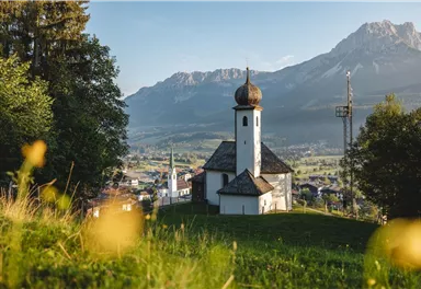
Astberg Trail
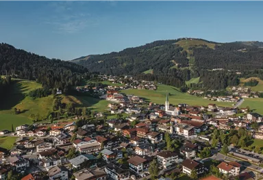
Varied beginner trail round between the Kaiser towns of Ellmau and Going.
Easy
9,70 km
500 m


Easy
Route
9,70 km
500 m
1256 m
Starting Point
Wanderstartplatz Tourismus Info, Ellmau
End Point
Wanderstartplatz Tourismus Info, Ellmau
What to do in an emergency? Call emergency number
140 - Mountain Rescue (Bergrettung)
112 - European Emergency Number
133 - Police
144 - Ambulance
Many routes have rescue points at the hiking signs, which can be used as a clear location identification in an emergency.
The Alpine Club provides tips for optimal preparation for mountain hiking.
SOS-EU-Alp App
The SOS EU ALP app allows you to determine your location (x,y coordinates) via your smartphone. In an emergency, this location data can be sent directly to the responsible control center (Tyrol, South Tyrol or Bavaria).
Description
Best Season
Jan
Feb
Mar
Apr
May
Jun
Jul
Aug
Sep
Oct
Nov
Dec
Skill Level
Endurance
More information at: www.wilderkaiser.info/mobility
Heading from St. Johann on the B178 road, take the first exit to Ellmau and drive straight on through the town until you see the Tourist Info on the right-hand side (short-stay parking zone). The hiking starting point is located opposite this on the left-hand side.


Current Weather
Today
2026-05-01
Morning
5 °C
Afternoon
9 °C
Evening
8 °C
Tomorrow
2026-05-02
Morning
10 °C
Afternoon
14 °C
Evening
13 °C
Sunday
2026-05-03
Morning
13 °C
Afternoon
17 °C
Evening
15 °C
Monday
2026-05-04
Morning
11 °C
Afternoon
14 °C
Evening
11 °C
Tuesday
2026-05-05
Morning
8 °C
Afternoon
10 °C
Evening
8 °C
Wednesday
2026-05-06
Morning
6 °C
Afternoon
7 °C
Evening
5 °C
Thursday
2026-05-07
Morning
3 °C
Afternoon
6 °C
Evening
5 °C
Friday
2026-05-08
Morning
5 °C
Afternoon
8 °C
Evening
6 °C
Saturday
2026-05-09
Morning
6 °C
Afternoon
9 °C
Evening
8 °C
Sunday
2026-05-10
Morning
7 °C
Afternoon
10 °C
Evening
8 °C
Monday
2026-05-11
Morning
9 °C
Afternoon
10 °C
Evening
9 °C
Tuesday
2026-05-12
Morning
9 °C
Afternoon
8 °C
Evening
7 °C
Wednesday
2026-05-13
Morning
8 °C
Afternoon
7 °C
Evening
8 °C
Thursday
2026-05-14
Morning
8 °C
Afternoon
8 °C
Evening
8 °C
Last updated at 05/01/2026, 02:00 PM
Contact
Contact
You have questions? We are happy to assist you.


