

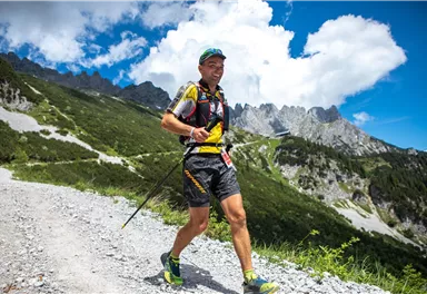
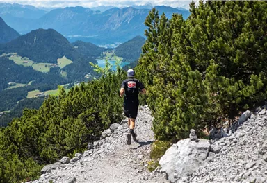
Running
Trailrunning
Laufen
Trailrunning
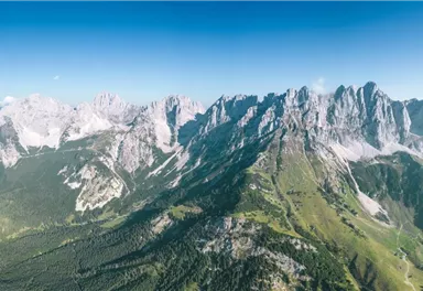
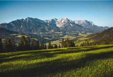
Kaiserkrone Trail - ULTRA - official competition route
Details about the Kaiserkrone Trail - Trailrunning Event at: www.kaiserkrone.run
Hard
56,00 km
3640 m

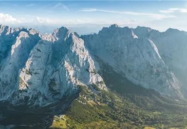
Hard
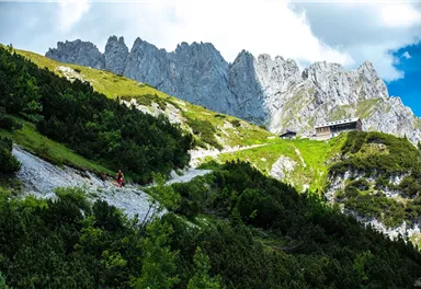
Route
56,00 km
3640 m
1704 m
Starting Point
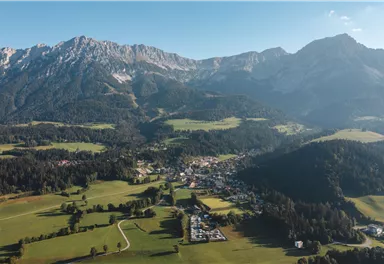
Start & Finish - village center of Scheffau (732 m), address: Dorf 45, 6351 Scheffau
End Point
Start & Finish - village center of Scheffau (732 m), address: Dorf 45, 6351 Scheffau
What to do in an emergency? Call emergency number
140 - Mountain Rescue (Bergrettung)
112 - European Emergency Number
133 - Police
144 - Ambulance
Many routes have rescue points at the hiking signs, which can be used as a clear location identification in an emergency.
The Alpine Club provides tips for optimal preparation for mountain hiking.
SOS-EU-Alp App
The SOS EU ALP app allows you to determine your location (x,y coordinates) via your smartphone. In an emergency, this location data can be sent directly to the responsible control center (Tyrol, South Tyrol or Bavaria).
Description
Official route of the competition Kaiserkrone ULTRA.
• The GPX file can be downloaded on this page by clicking on the "download" link symbol.
• Important participant information, regulations, mandatory equipment, etc. are listed in the respective competition announcement information.
REGISTRATION + INFORMATION for the competition: www.kaiserkrone.run
Best Season
Jan
Feb
Mar
Apr
May
Jun
Jul
Aug
Sep
Oct
Nov
Dec
KaiserJet hiking bus 4061 or postbus line 4060 - the bus stop "Scheffau Dorf" is located directly at the event start/finish area.
Timetables at www.wilderkaiser.info/mobil
Heading from Wörgl, Kufstein or St. Johann on the B178 road, take the exit to Scheffau.
- Park & Ride car park next to the ENI petrol station (pay & display - card payment only), address: Loferer Str. 1, 6351 Scheffau
Free bus connection to the event to ‘Scheffau Dorf’ approx. every 30 minutes with the KaiserJet 4061 hiking bus or Hintersteiner See hiking bus - timetables www.wilderkaiser.info/mobil - Widschwendter car park, address: Blaiken 38, 6351 Scheffau
- Bergbahn Scheffau (gondola lift) car park, address: Schwarzach 1, 6351 Scheffau
downloaded on this page by clicking on the
"download" link symbol.
• Important participant information, regulations, mandatory
equipment, etc. are listed in the respective competition announcement
information.
REGISTRATION + INFORMATION for the competition: www.kaiserkrone.run

Current Weather
Today
2026-05-17
Morning
1 °C
Afternoon
5 °C
Evening
4 °C
Tomorrow
2026-05-18
Morning
6 °C
Afternoon
8 °C
Evening
5 °C
Tuesday
2026-05-19
Morning
2 °C
Afternoon
5 °C
Evening
6 °C
Wednesday
2026-05-20
Morning
5 °C
Afternoon
8 °C
Evening
7 °C
Thursday
2026-05-21
Morning
7 °C
Afternoon
10 °C
Evening
9 °C
Friday
2026-05-22
Morning
9 °C
Afternoon
12 °C
Evening
11 °C
Saturday
2026-05-23
Morning
11 °C
Afternoon
14 °C
Evening
12 °C
Sunday
2026-05-24
Morning
11 °C
Afternoon
13 °C
Evening
12 °C
Monday
2026-05-25
Morning
11 °C
Afternoon
14 °C
Evening
13 °C
Tuesday
2026-05-26
Morning
12 °C
Afternoon
15 °C
Evening
12 °C
Wednesday
2026-05-27
Morning
10 °C
Afternoon
13 °C
Evening
12 °C
Thursday
2026-05-28
Morning
11 °C
Afternoon
15 °C
Evening
13 °C
Friday
2026-05-29
Morning
11 °C
Afternoon
13 °C
Evening
12 °C
Saturday
2026-05-30
Morning
11 °C
Afternoon
13 °C
Evening
12 °C
Last updated at 05/17/2026, 02:00 AM
Contact
Contact
You have questions? We are happy to assist you.


