Hoppala, route niet gevonden

De door u opgevraagde pagina is niet beschikbaar. U bent welkom om een nieuwe zoekopdracht op deze pagina te starten.

0 Routes & tochten

Hike to Wochenbrunner Alm

Hike to Wochenbrunner Alm

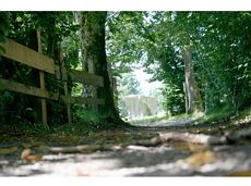
Hike from the centre of Ellmau, along trail no. 14, through the "Spatlahner gorge" up to the Wochenbrunner Alm.

Hiking starting point Tourist Information Office, Ellmau (800 m)

Hiking starting point Tourist Information Office, Ellmau (800 m)

Wandelen

Gemakkelijk

1:30 u

4,4 km

285 Hoogtemeters

Going – Gruttenhütte circular walk

Going – Gruttenhütte circular walk

A unique hike to the highest mountain hut in the Wilder Kaiser region featuring a panoramic view.

Hiking starting point Going center (former tourist information Going) (764 m)

Hiking starting point Going center (former tourist information Going) (764 m)

Wandelen

Normaal

6:00 u

14,0 km

890 Hoogtemeters

Kaiseralm round hike

Kaiseralm round hike

Short hike from Jägerwirt to the Kaiseralm with great mountain views.

Hiking starting point Jägerwirt, Scheffau (883 m)

Hiking starting point Jägerwirt, Scheffau (883 m)

Wandelen

Gemakkelijk

1:45 u

5,0 km

250 Hoogtemeters

Schattseittrail

Schattseittrail
Schattseittrail
Schattseittrail

The Schattseit trail, mystical and refreshing in equal measure, is a section of the infamous Kaisermarathon, probably the toughest mountain marathon in the Alps.

Tourismus Info, Söll

Tourismus Info, Söll

Hardlopen

Gemakkelijk

12,8 km

330 Hoogtemeters

Pölven Bike Tour

Pölven Bike Tour
Pölven Bike Tour
Pölven Bike Tour

A beautiful bike tour with moderate and short climbs araound the striking Pölven mountain.

anywhere along the tour

anywhere along the tour

Fietsen

Gemakkelijk

29,6 km

420 Hoogtemeters

Panoramic circuit Brandstadl–Hartkaiser

Panoramic circuit Brandstadl–Hartkaiser

This familyfriendly hike leads you along the panoramic trail from the Brandstadl mountain in Scheffau to the Hartkaiser mountain in Ellmau.

Brandstadlbahn mountain station, Scheffau (1,650 m) or Hartkaiserbahn mountain station, Ellmau (1.550 m)

Brandstadlbahn mountain station, Scheffau (1,650 m) or Hartkaiserbahn mountain station, Ellmau (1.550 m)

Wandelen

Gemakkelijk

1:50 u

6,0 km

170 Hoogtemeters

Ellmau Stone Circle circuit

Ellmau Stone Circle circuit

Head through well-shaded forests of green to reach the Ellmau Stone Circle. This is a place with a special energy, making it an inviting option for taking some time to relax.

Hiking starting point Wochenbrunner Alm, Ellmau (1,085 m)

Hiking starting point Wochenbrunner Alm, Ellmau (1,085 m)

Wandelen

Normaal

1:00 u

2,4 km

120 Hoogtemeters

Hochalm hike

Hochalm hike
Hochalm hike
Hochalm hike

A circular route full of experiences that leads from the Seebachgraben gorge to the Wilder-Kaiser-Steig trail - discover one of the most beautiful parts of Scheffau!

Hiking starting point Tourist Info, Scheffau (738 m)

Hiking starting point Tourist Info, Scheffau (738 m)

Wandelen

Normaal

7:00 u

19,6 km

1140 Hoogtemeters

War memorial circular route

War memorial circular route

This pleasant circular walk takes you to Söll’s war memorial in a beautiful section of forest.

Hiking starting point Tourist Info, Söll (689 m)

Hiking starting point Tourist Info, Söll (689 m)

Wandelen

Gemakkelijk

0:30 u

2,1 km

10 Hoogtemeters

11er-Kaiserblick circuit

11er-Kaiserblick circuit

Onto the Hausberg mountain with panoramic views of the Wilder Kaiser and Hartkaiser mountains and back via the Ranhartalm.

Hiking starting point Tourist Info, Ellmau (800 m)

Hiking starting point Tourist Info, Ellmau (800 m)

Wandelen

Gemakkelijk

8:00 u

22,8 km

1020 Hoogtemeters

Gentle snowshoe hike in the valley in Going

Gentle snowshoe hike in the valley in Going

Savour the wonder of the winter landscape – experience the winter magic for yourself by crunching through the pristine snow with your snowshoes. Enjoy unique impressions and experiences as you explore the white winter splendour and take in the spectacular view over the surrounding mountain scenery.

Church square, Going (769 m)

Church square, Going (769 m)

Wandelen

Gemakkelijk

1:30 u

2,9 km

110 Hoogtemeters

3-day mountain hut tour - overall itinerary

3-day mountain hut tour - overall itinerary

Going, Hüttling - Schleierwasserfall - Obere Regalm - Baumgartenköpfl (Bergsteigergrab) - Gaudeamushütte - Ellmauer Tor - Hintere Goinger Halt - Jubiläumssteig - Gruttenhütte - Kaiser-Hochalm - Steiner-Hochalm - Hinterschießling Alm - Rehbachklamm - Scheffau, Dorf

Hiking starting point Hüttling, Going (820 m)

Scheffau village (738 m)

Wandelen

Moeilijk

14:00 u

24,6 km

2060 Hoogtemeters

“Moor & more” Rocky Way

“Moor & more” Rocky Way

An extensive exploration of “Moor & more”. The puzzle tour in the Wilder Kaiser forest is sure to be lots of fun, even for older children.

Hiking starting point Hüttling, Going (820 m)

Hiking starting point Hüttling, Going (820 m)

Wandelen

Gemakkelijk

3:00 u

8,0 km

380 Hoogtemeters

Schwendt circuit

Schwendt circuit
Schwendt circuit
Schwendt circuit

Pleasant hike through forests and across meadows to the sunny plateau of Going and back

Hiking starting point Going center (former tourist information Going) (764 m)

Hiking starting point Going center (former tourist information Going) (764 m)

Wandelen

Gemakkelijk

1:15 u

4,1 km

70 Hoogtemeters

Hartkaiser circuit (no. 1 & 3)

Hartkaiser circuit (no. 1 & 3)

From the Bergdoktorhaus to the Rübezahl-Alm mountain hut and the Carved Figures path to Ellmi’s Zauberwelt.

Hiking starting point Tourist Info, Ellmau (800 m)

Hiking starting point Tourist Info, Ellmau (800 m)

Wandelen

Gemakkelijk

5:30 u

15,8 km

730 Hoogtemeters

Kaiser crag

Kaiser crag
Kaiser crag
Kaiser crag

Along with the Murmeltierfelsen and Gamsfelsen, there are a total of 17 climbing routes of difficulty levels 3 to 6b+ near the Gaudeamushütte mountain hut.

Sportklimmen