

Hiking tour
Schwendt circuit
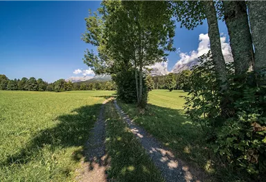
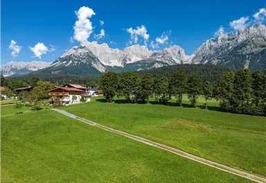
Leisurely hike through forest and across meadows to the sunny plateau of Going and back
Easy
4,10 km
70 m
01:15 h
Easy
Route
4,10 km
70 m
01:15 h
836 m
Starting Point
Hiking starting point Going center (former tourist information Going) (764 m)
End Point
Hiking starting point Going center (former tourist information Going) (764 m)
What to do in an emergency? Call emergency number
140 - Mountain Rescue (Bergrettung)
112 - European Emergency Number
133 - Police
144 - Ambulance
Many routes have rescue points at the hiking signs, which can be used as a clear location identification in an emergency.
The Alpine Club provides tips for optimal preparation for mountain hiking.
SOS-EU-Alp App
The SOS EU ALP app allows you to determine your location (x,y coordinates) via your smartphone. In an emergency, this location data can be sent directly to the responsible control center (Tyrol, South Tyrol or Bavaria).
Description
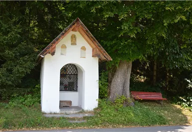
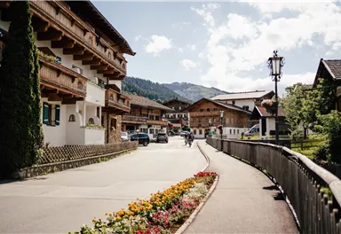
From the hiking starting point ‘Going Center' (former Tourist information Going; 764 m) follow the village road (Dorfstraße) along the Going creek to the Raffeisenbank. After the underpass turn right and continue hiking and follow the Pramaweg to the next junction. Here you turn left onto the Thurnbichlweg and follow the path further uphill, with the Wilder Kaiser always in view.
Arrived in district 'Thurnbichl‘, it is time to pause for a moment and admire the beautiful flowers and plants between modern houses and traditional farms....
Best Season
Jan
Feb
Mar
Apr
May
Jun
Jul
Aug
Sep
Oct
Nov
Dec
Skill Level
Endurance
Family-friendly
Loop tour
More information at: www.wilderkaiser.info


Current Weather
Today
2026-06-01
Morning
10 °C
Afternoon
10 °C
Evening
10 °C
Tomorrow
2026-06-02
Morning
13 °C
Afternoon
16 °C
Evening
11 °C
Wednesday
2026-06-03
Morning
5 °C
Afternoon
6 °C
Evening
7 °C
Thursday
2026-06-04
Morning
10 °C
Afternoon
14 °C
Evening
11 °C
Friday
2026-06-05
Morning
7 °C
Afternoon
7 °C
Evening
7 °C
Saturday
2026-06-06
Morning
7 °C
Afternoon
10 °C
Evening
9 °C
Sunday
2026-06-07
Morning
10 °C
Afternoon
13 °C
Evening
11 °C
Monday
2026-06-08
Morning
11 °C
Afternoon
14 °C
Evening
12 °C
Tuesday
2026-06-09
Morning
11 °C
Afternoon
14 °C
Evening
12 °C
Wednesday
2026-06-10
Morning
11 °C
Afternoon
14 °C
Evening
12 °C
Thursday
2026-06-11
Morning
10 °C
Afternoon
14 °C
Evening
12 °C
Friday
2026-06-12
Morning
11 °C
Afternoon
13 °C
Evening
12 °C
Saturday
2026-06-13
Morning
11 °C
Afternoon
14 °C
Evening
12 °C
Sunday
2026-06-14
Morning
11 °C
Afternoon
14 °C
Evening
12 °C
Last updated at 06/01/2026, 02:00 PM
Contact
Contact
You have questions? We are happy to assist you.


