Hoppala, route niet gevonden

De door u opgevraagde pagina is niet beschikbaar. U bent welkom om een nieuwe zoekopdracht op deze pagina te starten.

0 Routes & tochten

MTB-Tour around Juffinger Jöchl

MTB-Tour around Juffinger Jöchl

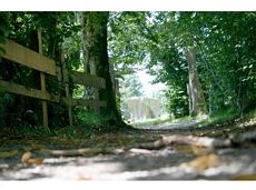
A crisp, varied tour from Söll via the Lengau to Bad Häring and over the Werlberg, past the Juffinger Jöchl back to Söll. Between the individual forest sections, you are rewarded again and again with magnificent views of large parts of the Inntal valley.

Village centre, Söll (689 m)

Village centre, Söll (689 m)

Fietsen

Moeilijk

24,0 km

900 Hoogtemeters

Ellmauer Halt summit tour

Ellmauer Halt summit tour

A demanding mountain tour with some ferrata passages up to the highest summit in the Wilder Kaiser (2,344 m).

Hiking starting point Wochenbrunner Alm, Ellmau (1,085 m)

Hiking starting point Wochenbrunner Alm, Ellmau (1,085 m)

Wandelen

Moeilijk

7:30 u

9,3 km

1250 Hoogtemeters

Tannbichl Kapellen Runde

Tannbichl Kapellen Runde

Nice circular hike through Going with visits to numerous chapels.

Hiking starting point Going center (former tourist information Going) (764 m)

Hiking starting point Going center (former tourist information Going) (764 m)

Wandelen

Gemakkelijk

2:45 u

9,3 km

210 Hoogtemeters

Bergdoktor e-bike tour “From the village square via the doctor’s practice to the Gruberhof”

Bergdoktor e-bike tour “From the village square via the doctor’s practice to the Gruberhof”

Going church square - Bergdoktor practice Ellmau and Gruberhof Söll. This e-bike tour gives you a chance to enjoy the magnificent mountain panorama at the foot of the Wilder Kaiser and takes you past the three main filming locations of the “Der Bergdoktor” (The Mountain Doctor) TV series.

Going church square

Going church square

Fietsen

Normaal

51,0 km

990 Hoogtemeters

Eagle Walk Stage 02: Gaudeamushütte - Kaindlhütte

Eagle Walk Stage 02: Gaudeamushütte - Kaindlhütte

Is it about the journey or the destination? Well, one of the destinations of this stage is definitely the Hintersteiner See lake and its views. Surrounded by stunning mountain vistas, dwarf pine scrubland and beech forests, the lake is one of the cleanest and most beautiful mountain lakes in Tirol. The private pristine gem covers 56 hectares and measures 36 metres at its deepest point. With this picture-perfect backdrop, hikers will complete the remaining distance to the Kaindlhütte hut in no time.

Gaudeamushütte

Hintersteiner See

Wandelen

Normaal

6:30 u

15,1 km

888 Hoogtemeters

Astberg Trail

Astberg Trail
Astberg Trail
Astberg Trail

Varied beginner trail round between the Kaiser towns of Ellmau and Going.

Wanderstartplatz Tourismus Info, Ellmau

Wanderstartplatz Tourismus Info, Ellmau

Hardlopen

Gemakkelijk

10,2 km

520 Hoogtemeters

Scheffauer summit tour

Scheffauer summit tour

The panoramic Scheffauer is the last high peak in the west at 2,111 m above sea level.

Hiking starting point Bärnstatt, Scheffau (920 m)

Hiking starting point Bärnstatt, Scheffau (920 m)

Wandelen

Moeilijk

7:00 u

7,9 km

1180 Hoogtemeters

Wochenbrunnweg

Wochenbrunnweg
Wochenbrunnweg
Wochenbrunnweg

A wild and romantic walk through the Kaiserwald forest with its wildlife park and cosy, traditional Tirolean parlour.

Hiking starting point Tourist Info, Ellmau (800 m)

Hiking starting point Tourist Info, Ellmau (800 m)

Wandelen

Normaal

3:30 u

9,0 km

300 Hoogtemeters

Sonnseit circuit (no. 14)

Sonnseit circuit (no. 14)

An adventure hike from Ellmau village centre to the Wochenbrunner Alm mountain hut from where you can enjoy stunning views and the Ellmau Stone Circle.

Hiking starting point Tourist Info, Ellmau (800 m)

Hiking starting point Tourist Info, Ellmau (800 m)

Wandelen

Gemakkelijk

4:30 u

13,5 km

530 Hoogtemeters

Bergdoktor wintertour of Ellmau & Going

Bergdoktor wintertour of Ellmau & Going

A tour of the main filming locations of the TV series “Der Bergdoktor” (The Mountain Doctor) in Ellmau and Going, with a refreshment stop at the inn used during filming

Hiking starting point Tourist Info, Ellmau (800 m)

Hiking starting point Tourist Info, Ellmau (800 m)

Wandelen

Gemakkelijk

4:15 u

11,4 km

180 Hoogtemeters

3-day mountain hut tour - overall itinerary

3-day mountain hut tour - overall itinerary

Going, Hüttling - Schleierwasserfall - Obere Regalm - Baumgartenköpfl (Bergsteigergrab) - Gaudeamushütte - Ellmauer Tor - Hintere Goinger Halt - Jubiläumssteig - Gruttenhütte - Kaiser-Hochalm - Steiner-Hochalm - Hinterschießling Alm - Rehbachklamm - Scheffau, Dorf

Hiking starting point Hüttling, Going (820 m)

Scheffau village (738 m)

Wandelen

Moeilijk

14:00 u

24,6 km

2060 Hoogtemeters

Kaiser crag

Kaiser crag
Kaiser crag
Kaiser crag

Along with the Murmeltierfelsen and Gamsfelsen, there are a total of 17 climbing routes of difficulty levels 3 to 6b+ near the Gaudeamushütte mountain hut.

Sportklimmen

Via ferrata s'Schuastagangl Steinplatte

Via ferrata s'Schuastagangl Steinplatte
GeslotenVia ferrata s'Schuastagangl Steinplatte
Via ferrata s'Schuastagangl Steinplatte

The classic on the Steinplatte Waidring was rehabilitated in June 2023 and is a treat for via ferrata fans! The via ferrata "s'Schuastagangl" (C/D) offers wonderful panoramic views, crisp ascents and unforgettable mountain moments. The varied tour leads through steep rock faces and slippery passages up to the summit of the Waidringer Steinplatte (1,848m). Strength for steeper ascents and courage for ladder passages and the "Knieschloderer" variant with airy steps and a rope bridge are required!

Via ferrata

Salvenblick hiking round

Salvenblick hiking round

Comfortable round with a magnificent view of the Hohe Salve.

Mountain station gondola Hexenwasser, Söll (1,150 m)

Mountain station gondola Hexenwasser, Söll (1,150 m)

Wandelen

Gemakkelijk

0:35 u

1,8 km

50 Hoogtemeters

Pölven Bike Tour

Pölven Bike Tour
Pölven Bike Tour
Pölven Bike Tour

A beautiful bike tour with moderate and short climbs araound the striking Pölven mountain.

anywhere along the tour

anywhere along the tour

Fietsen

Gemakkelijk

29,6 km

420 Hoogtemeters

Hollenauer Kreuz winter hiking route

Hollenauer Kreuz winter hiking route

Climb to the best viewpoint in the mountains, where the Wilder Kaiser is within touching distance.

Hiking starting point Going center (former tourist information Going) (764 m)

Hiking starting point Going center (former tourist information Going) (764 m)

Wandelen

Normaal

4:30 u

10,7 km

360 Hoogtemeters

Jubiläumssteig trail

Jubiläumssteig trail
GeslotenJubiläumssteig trail
Jubiläumssteig trail

Experience impressive low and panoramic views in the unique rocky scenery of the legendary "Wild Castle", as this area is known according to legend thanks to its many turrets, peaks, hollows and balconies.

Wochenbrunner Alm, Ellmau (1.085 m)

Wochenbrunner Alm, Ellmau (1.085 m)

Wandelen

Moeilijk

3:45 u

6,3 km

630 Hoogtemeters

Bergdoktor tour of Ellmau & Going

Bergdoktor tour of Ellmau & Going

A tour of the main filming locations of the TV series “Der Bergdoktor” (The Mountain Doctor) in Ellmau and Going, with a refreshment stop at the inn used during filming

Hiking info point, Tourist Info Ellmau (800 m)

Hiking info point, Tourist Info Ellmau (800 m)

Wandelen

Gemakkelijk

3:15 u

11,4 km

180 Hoogtemeters