

Hiking tour
Summit tour
Scheffauer summit tour
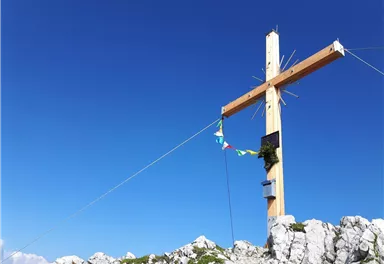
The panoramic Scheffauer is the last high peak in the west at 2,111 m above sea level.
Hard
7,90 km
1180 m
07:00 h


Hard
Route
7,90 km
1180 m
07:00 h
2111 m
Starting Point
Hiking starting point Bärnstatt, Scheffau (920 m)
End Point
Hiking starting point Bärnstatt, Scheffau (920 m)
What to do in an emergency? Call emergency number
140 - Mountain Rescue (Bergrettung)
112 - European Emergency Number
133 - Police
144 - Ambulance
Many routes have rescue points at the hiking signs, which can be used as a clear location identification in an emergency.
The Alpine Club provides tips for optimal preparation for mountain hiking.
SOS-EU-Alp App
The SOS EU ALP app allows you to determine your location (x,y coordinates) via your smartphone. In an emergency, this location data can be sent directly to the responsible control center (Tyrol, South Tyrol or Bavaria).
Description
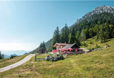
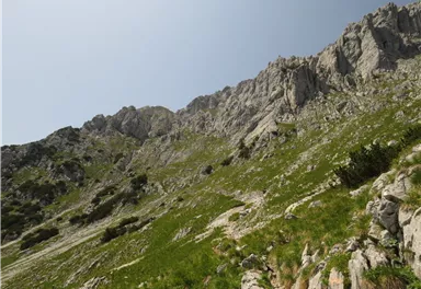
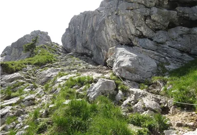
Depart from the hiking starting point by taking the forest road (barriers), always following the signs for “Scheffauer”. After about an hour of hiking, you will come to the Steiner-Hochalm mountain hut (1,257 m). You should then head uphill on the narrow trail 814a, passing through open meadows and then the thin deciduous forest before crossing the large field of scree until you reach the “Scheffauer” turnoff.
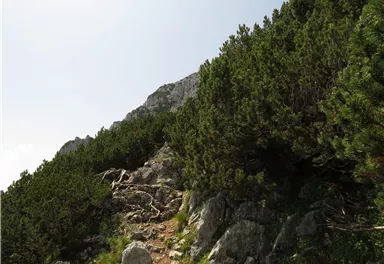
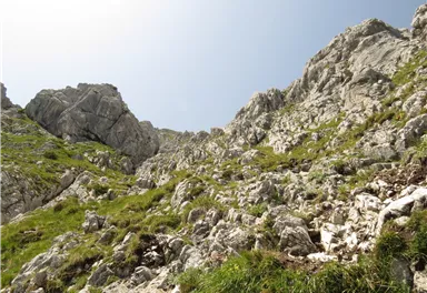
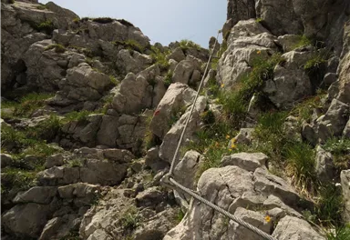
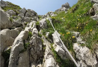
The terrain becomes more demanding as of this point, leading up through steep fields of mountain pine and steep rocky sections until you come to the ridge (the key part known...
Best Season
Jan
Feb
Mar
Apr
May
Jun
Jul
Aug
Sep
Oct
Nov
Dec
Skill Level
Endurance
Helmet (Danger of falling rocks!)
More information at: www.wilderkaiser.info


Current Weather
Today
2026-06-01
Morning
10 °C
Afternoon
10 °C
Evening
10 °C
Tomorrow
2026-06-02
Morning
13 °C
Afternoon
16 °C
Evening
11 °C
Wednesday
2026-06-03
Morning
5 °C
Afternoon
6 °C
Evening
7 °C
Thursday
2026-06-04
Morning
10 °C
Afternoon
14 °C
Evening
11 °C
Friday
2026-06-05
Morning
7 °C
Afternoon
7 °C
Evening
7 °C
Saturday
2026-06-06
Morning
7 °C
Afternoon
10 °C
Evening
9 °C
Sunday
2026-06-07
Morning
10 °C
Afternoon
13 °C
Evening
11 °C
Monday
2026-06-08
Morning
11 °C
Afternoon
14 °C
Evening
12 °C
Tuesday
2026-06-09
Morning
11 °C
Afternoon
14 °C
Evening
12 °C
Wednesday
2026-06-10
Morning
11 °C
Afternoon
14 °C
Evening
12 °C
Thursday
2026-06-11
Morning
10 °C
Afternoon
14 °C
Evening
12 °C
Friday
2026-06-12
Morning
11 °C
Afternoon
13 °C
Evening
12 °C
Saturday
2026-06-13
Morning
11 °C
Afternoon
14 °C
Evening
12 °C
Sunday
2026-06-14
Morning
11 °C
Afternoon
14 °C
Evening
12 °C
Last updated at 06/01/2026, 02:00 PM
Contact
Contact
You have questions? We are happy to assist you.


