

Hiking tour
Summit tour
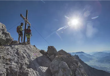
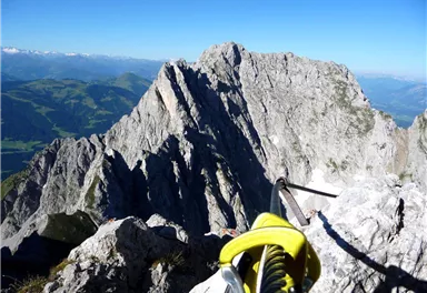
Ellmauer Halt summit tour
A demanding mountain tour with some ferrata passages up to the highest summit in the Wilder Kaiser (2,344 m).
Hard
9,30 km
1250 m
07:30 h


Hard
Route
9,30 km
1250 m
07:30 h
2344 m
Starting Point
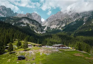
Hiking starting point Wochenbrunner Alm, Ellmau (1,085 m)
End Point
Hiking starting point Wochenbrunner Alm, Ellmau (1,085 m)
More Links
What to do in an emergency? Call emergency number
140 - Mountain Rescue (Bergrettung)
112 - European Emergency Number
133 - Police
144 - Ambulance
Many routes have rescue points at the hiking signs, which can be used as a clear location identification in an emergency.
The Alpine Club provides tips for optimal preparation for mountain hiking.
SOS-EU-Alp App
The SOS EU ALP app allows you to determine your location (x,y coordinates) via your smartphone. In an emergency, this location data can be sent directly to the responsible control center (Tyrol, South Tyrol or Bavaria).
Description
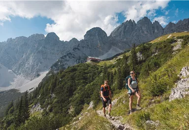
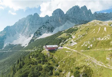
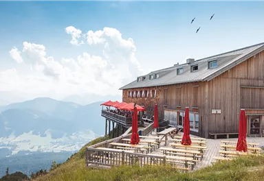
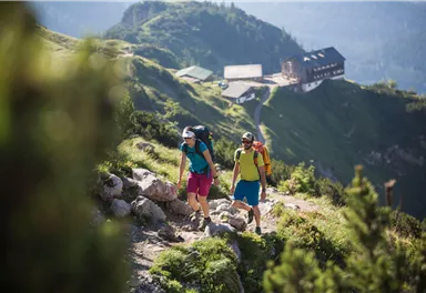
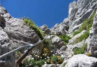
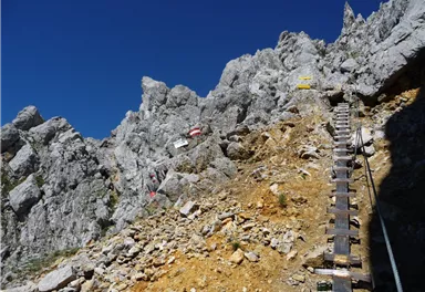
The normal route to the highest peak of the Kaisergebirge begins at the starting point of the hike at the Wochenbrunner Alm. Here you first follow trail 825 to the Gruttenhütte. After a short break, you will ascend to the large gravel cirque "Hochgrubach". On the following ascent via the Gamsängersteig there is great danger from falling rocks due to mountaineers ahead. In the first section of the climb, you will cross steep, rocky and grass-interspersed, fragile terrain (scree terrain - only partially secured with steel ropes) until you reach the Jägerwand steps with over 70 treads a little below...
Best Season
Jan
Feb
Mar
Apr
May
Jun
Jul
Aug
Sep
Oct
Nov
Dec
Skill Level
Endurance
Prerequisite: Helmet (Danger of falling rocks!)
Recommandation: climbing harness and via ferrata set.
More information at: www.wilderkaiser.info
Heading from St. Johann on the B178 road, take the first exit to Ellmau and then drive straight on until you reach the junction (green signs – leading towards KaiserBad/Kaisergebirge/Wochenbrunn). Turn right here, then turn right again immediately after passing the bus stop. Follow the (toll) road until you reach the Wochenbrunner Alm car park.


Current Weather
Today
2026-05-18
Morning
5 °C
Afternoon
8 °C
Evening
6 °C
Tomorrow
2026-05-19
Morning
3 °C
Afternoon
7 °C
Evening
6 °C
Wednesday
2026-05-20
Morning
6 °C
Afternoon
8 °C
Evening
7 °C
Thursday
2026-05-21
Morning
7 °C
Afternoon
10 °C
Evening
8 °C
Friday
2026-05-22
Morning
8 °C
Afternoon
12 °C
Evening
11 °C
Saturday
2026-05-23
Morning
10 °C
Afternoon
14 °C
Evening
11 °C
Sunday
2026-05-24
Morning
11 °C
Afternoon
15 °C
Evening
13 °C
Monday
2026-05-25
Morning
10 °C
Afternoon
12 °C
Evening
10 °C
Tuesday
2026-05-26
Morning
11 °C
Afternoon
16 °C
Evening
13 °C
Wednesday
2026-05-27
Morning
12 °C
Afternoon
17 °C
Evening
12 °C
Thursday
2026-05-28
Morning
11 °C
Afternoon
14 °C
Evening
11 °C
Friday
2026-05-29
Morning
11 °C
Afternoon
14 °C
Evening
11 °C
Saturday
2026-05-30
Morning
10 °C
Afternoon
13 °C
Evening
11 °C
Sunday
2026-05-31
Morning
10 °C
Afternoon
12 °C
Evening
11 °C
Last updated at 05/18/2026, 02:00 AM
Contact
Contact
You have questions? We are happy to assist you.


