Deutsch
 English
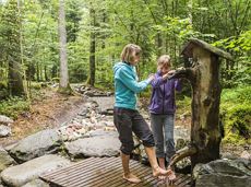
“Moor & more” Törfchen circular hiking route

Moorland hike suitable for children. The elf will help you discover the special inhabitants of the moor.
Römerhof, St. Johann (769 m)
Römerhof, St. Johann (769 m)
Wandelen
Gemakkelijk
1:30 u
4,3 km
100 Hoogtemeters