


 Deutsch
 English
MTB Tour Kathen Circuit

A moderately challenging panoramic circuit around the Astberg mountain.
Tourist Info, Going (764 m)
Tourist Info, Going (764 m)
Fietsen
Normaal
15,3 km
480 Hoogtemeters
A moderately challenging panoramic circuit around the Astberg mountain.
Tourist Info, Going (764 m)
Tourist Info, Going (764 m)
Fietsen
Normaal
15,3 km
480 Hoogtemeters

Gaudeamushütte – Gamswegl – path 825 – Gruttenhütte
Gaudeamushütte, Going (1,263 m)
Gruttenhütte, Ellmau (1,620 m)
Wandelen
Normaal
1:45 u
3,2 km
480 Hoogtemeters

Through the winter forest to the wildlife park at the Wochenbrunner Alm.
Hiking starting point Tourist Info, Ellmau (800 m)
Hiking starting point Tourist Info, Ellmau (800 m)
Wandelen
3:30 u
9,0 km
300 Hoogtemeters

The heart of the tour is the deep, wonderful-to-climb chimney, which lends the tour an Alpine character.
Alpine klimroutes

Comfortable round with a magnificent view of the Hohe Salve.
Mountain station gondola Hexenwasser, Söll (1,150 m)
Mountain station gondola Hexenwasser, Söll (1,150 m)
Wandelen
Gemakkelijk
0:35 u
1,8 km
50 Hoogtemeters

Explore the sunny foot of the Pölven mountain.
Langlaufen
Gemakkelijk
0,9 km

The panoramic Scheffauer is the last high peak in the west at 2,111 m above sea level.
Hiking starting point Bärnstatt, Scheffau (920 m)
Hiking starting point Bärnstatt, Scheffau (920 m)
Wandelen
Moeilijk
7:00 u
7,9 km
1180 Hoogtemeters

A must for hikers in Söll - local history and culinary delights on the sunny side.
Hiking starting point Franzlhof, Söll (703 m)
Hiking starting point Franzlhof, Söll (703 m)
Wandelen
Normaal
3:45 u
11,0 km
420 Hoogtemeters

Varied beginner trail round between the Kaiser towns of Ellmau and Going.
Wanderstartplatz Tourismus Info, Ellmau
Wanderstartplatz Tourismus Info, Ellmau
Hardlopen
Gemakkelijk
9,7 km
500 Hoogtemeters

Stripsenjochhaus - Griesner Alm - Griesenau
Stripsenjochhaus (1,577 m)
Griesenau, Kirchdorf (719 m)
Wandelen
Normaal
3:00 u
7,9 km

Going church square - Bergdoktor practice Ellmau and Gruberhof Söll. This e-bike tour gives you a chance to enjoy the magnificent mountain panorama at the foot of the Wilder Kaiser and takes you past the three main filming locations of the “Der Bergdoktor” (The Mountain Doctor) TV series.
Going church square
Going church square
Fietsen
Normaal
51,0 km
990 Hoogtemeters

Ellmau Tourist Information Office - golf course - Wochenbrunner Alm
Tourist Information Office, Ellmau (800 m)
Wochenbrunner Alm, Ellmau (1,085 m)
Fietsen
Normaal
4,8 km
260 Hoogtemeters

A relaxing hike towards the village center.
Hiking starting point Alpenschlössl, Söll (762 m)
Hiking starting point Alpenschlössl Söll (762 m)
Wandelen
Gemakkelijk
0:55 u
3,2 km
20 Hoogtemeters

The Wilder Kaiser always in view.
Ahornsee car park, Söll (693 m)
Hiking starting point Bocking, Söll (670 m)
Wandelen
3:30 u
6,0 km
130 Hoogtemeters

Postkarten circuit Ellmau Ellmau hiking info point – Kapellenpark – Marienkapelle – Ellmau Parish Church
Hiking starting point Tourist Info, Ellmau (800 m)
Hiking starting point Tourist Info, Ellmau (800 m)
Wandelen
Gemakkelijk
0:25 u
1,3 km
40 Hoogtemeters
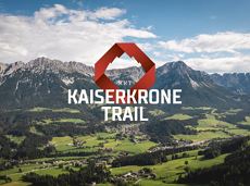
Details about the Kaiserkrone Trail - Trailrunning Event at: www.kaiserkrone.run
Start & Finish - village center of Scheffau (732 m), address: Dorf 45, 6351 Scheffau
Start & Finish - village center of Scheffau (732 m), address: Dorf 45, 6351 Scheffau
Hardlopen
Moeilijk
24,7 km
2690 Hoogtemeters

This familyfriendly hike leads you along the panoramic trail from the Brandstadl mountain in Scheffau to the Hartkaiser mountain in Ellmau.
Brandstadlbahn mountain station, Scheffau (1,650 m) or Hartkaiserbahn mountain station, Ellmau (1.550 m)
Brandstadlbahn mountain station, Scheffau (1,650 m) or Hartkaiserbahn mountain station, Ellmau (1.550 m)
Wandelen
Gemakkelijk
1:50 u
6,0 km
170 Hoogtemeters

Snowshoe hike via the Kaiseralmen with starting and finishing at the Gasthof Jägerwirt.
Gasthof Jägerwirt, Scheffau (883 m)
Gasthof Jägerwirt, Scheffau (883 m)
Wandelen
3:15 u
4,8 km
250 Hoogtemeters

There are 3 steep rises which are moderable with e-bikes.
Cable car valley station, Söll (725 m)
Au Hoch-Alm, Söll (1.600 m)
Fietsen
Normaal
8,9 km
860 Hoogtemeters
 Open
OpenVia ferrata

Crystal-clear mountain lake and magnificent views of the Wilder Kaiser’s western summits
Hintersteiner See, Scheffau (890 m)
Hintersteiner See, Scheffau (890 m)
Wandelen
Gemakkelijk
1:30 u
5,2 km
130 Hoogtemeters

The largest bouldering hall in the Tirolean Unterland region.
Kletterhalle

The ski hiking route is purely flat, which also means it's great for everybody.
restaurant Oberstegen, Söll
village, Scheffau
Langlaufen
Gemakkelijk
1,4 km
15 Hoogtemeters

Short circular walk at the snow-white Brandstadl mountain with panorama view.
Brandstadlbahn summit station, Scheffau (1,643 m)
Brandstadlbahn summit station, Scheffau (1,643 m)
Wandelen
0:30 u
1,3 km
40 Hoogtemeters

Varied round tour with many refreshments and wonderful views
Tourist Information Office, Scheffau (737 m)
Tourist Information Office, Scheffau (737 m)
Fietsen
Normaal
23,6 km
660 Hoogtemeters

Mystical winter tour through the Schnapflwald forest
Hiking starting point Tourist Info, Söll (689 m)
Hiking starting point Tourist Info, Söll (689 m)
Wandelen
1:00 u
3,0 km
40 Hoogtemeters

Looping the village of Söll, the sight seeing hike!
Hiking starting point Tourist Info, Söll (689 m)
Hiking starting point Tourist Info, Söll (689 m)
Wandelen
Gemakkelijk
1:00 u
3,7 km
50 Hoogtemeters

Baumgartenköpfl (Bergsteigergrab) – Wilder-Kaiser-Steig – Jubiläumssteig – Gruttenhütte
Brennender Palven (1,572 m)
Gruttenhütte, Ellmau (1,620 m)
Wandelen
Moeilijk
2:30 u
3,3 km
410 Hoogtemeters

Easy, flat circular path through the sunny village part 'Prama' for walkers families with pushchairs.
Hiking starting point Going center (former tourist information Going) (764 m)
Hiking starting point Going center (former tourist information Going) (764 m)
Wandelen
Gemakkelijk
1:00 u
3,9 km
30 Hoogtemeters

Going, Hüttling – Graspoint-Niederalm – Obere Regalm – Brennender Palven – Gaudeamushütte – Klamml – Gruttenhütte
Hiking starting point Hüttling, Going (820 m)
Gaudeamushütte, Going (1,263 m) / Gruttenhütte, Ellmau (1,620 m)
Wandelen
Normaal
4:30 u
8,0 km
1120 Hoogtemeters

Walking tour for refreshment and relaxation close to the village.
Hiking starting point Tourist Info, Scheffau (738 m)
Hiking starting point Tourist Info, Scheffau (738 m)
Wandelen
Gemakkelijk
0:45 u
2,3 km
70 Hoogtemeters

Gentle cycle tour from Wörgl via Söll, Scheffau, Ellmau and Going to St. Johann or vice versa!
Wörgl (511 m)
St. Johann (660 m)
Fietsen
Normaal
38,3 km
520 Hoogtemeters

Ellmau Tourist Information Office - football pitch - Ellmauer Hof - KaiserBad - Hausbach farms - Ellmau Tourist Information Office
Tourist Information Office, Ellmau (820 m)
Tourist Information Office, Ellmau (820 m)
Fietsen
Gemakkelijk
8,2 km
110 Hoogtemeters

On the north side up to the Ellmauer Halt summit 2,344 m.
Via ferrata

A short MTB tour to the Walleralm mountain inn, easily combined with other routes.
Parkplatz Pension Maier, Scheffau (925 m)
Parkplatz Walleralm, Söll (685 m)
Fietsen
Normaal
3,3 km
260 Hoogtemeters

A tour of the main filming locations of the TV series “Der Bergdoktor” (The Mountain Doctor) in Ellmau and Going, with a refreshment stop at the inn used during filming
Hiking info point, Tourist Info Ellmau (800 m)
Hiking info point, Tourist Info Ellmau (800 m)
Wandelen
Gemakkelijk
3:15 u
11,4 km
180 Hoogtemeters

Enjoy unspoilt views of the Sölllandl region from snow-covered fields.
Hiking starting point Franzlhof, Söll (703 m)
Hiking starting point Franzlhof, Söll (703 m)
Wandelen
2:15 u
5,8 km
100 Hoogtemeters

Two very demanding, fantastic lookout peaks on the Wilder Kaiser, which are not to be underestimated.
Hiking starting point Wegscheid, Scheffau (883 m)
Hiking starting point Wegscheid, Scheffau (883 m)
Wandelen
Moeilijk
9:00 u
11,0 km
1440 Hoogtemeters

Hike across the Alpine pastures and shower in Kaiser water!
Hiking starting point Tourist Info, Scheffau (738 m)
Hiking starting point Tourist Info, Scheffau (738 m)
Wandelen
Normaal
5:30 u
11,8 km
910 Hoogtemeters

Alpine klimroutes