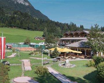
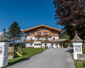
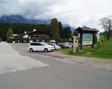
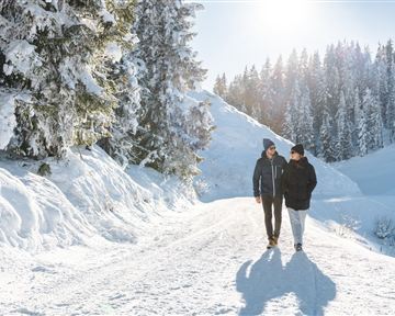
Hausberg circular hiking route
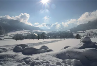
Leisurely high-altitude hike on the mountain and by the Astbergsee lake - the Kaiser's mirror!
Blattlalm, Going (1,246 m)
Hiking
Easy
0:40 h
1,7 km
80 Elevation gain
We are sorry, your requested page is not available. You can start a new search on this page!
Leisurely high-altitude hike on the mountain and by the Astbergsee lake - the Kaiser's mirror!
Blattlalm, Going (1,246 m)
Hiking
Easy
0:40 h
1,7 km
80 Elevation gain
A circular route full of experiences that leads from the Seebachgraben gorge to the Wilder-Kaiser-Steig trail - discover one of the most beautiful parts of Scheffau!
Hiking starting point Tourist Info, Scheffau (738 m)
Hiking
Intermediate
7:00 h
19,6 km
1140 Elevation gain
Short, crisp connection between the Blattlloipe and the Schwendterloipe.
Cross-country skiing
Intermediate
0,5 km
30 Elevation gain
Alpine pasture circular hiking route with a breathtaking view over Scheffau!
Hiking starting point Tourist Info, Scheffau (738 m)
Hiking
Intermediate
5:15 h
12,9 km
800 Elevation gain
Short tour with varied paths and views
Hiking starting point Tourismus Info, Scheffau (737 m)
Hiking
Easy
2:00 h
5,8 km
230 Elevation gain
Hiking starting point Tourist Info, Scheffau (737 m)
Hiking
Easy
3:45 h
11,2 km
410 Elevation gain
A walk that lets you experience the Brandstadl mountain and leads you to Jochstubnsee lake.
Brandstadlbahn valley station, Scheffau (681 m)
Hiking
Easy
4:45 h
12,7 km
1130 Elevation gain
Access time0,16666666666666666
Via ferrata
Difficulty levelB-C
Via ferrara length200,0 m
Postkarten circuit Ellmau Ellmau hiking info point – Kapellenpark – Marienkapelle – Ellmau Parish Church
Hiking starting point Tourist Info, Ellmau (800 m)
Hiking
Easy
0:25 h
1,3 km
40 Elevation gain
Hike along the sunny side along field paths and settlements from Scheffau to Ellmau..
Hiking starting point, Tourismus Info, Scheffau (737 m)
Bus stop Ellmau Bauhof/Dorf, Ellmau (800 m)
Hiking
Easy
1:30 h
5,7 km
100 Elevation gain
The best seat in the house for a view of the Wilder Kaiser!
Hiking starting point Going center (former tourist information Going) (764 m)
Hiking
Easy
2:15 h
5,8 km
290 Elevation gain
The Anna Grotto is hidden in the middle of a forest at the very foot of the Wilder Kaiser.
Wochenbrunner Alm, Ellmau (1,085 m)
Hiking
Easy
0:20 h
0,7 km
50 Elevation gain
Imperial glide during the day and at night - on the only night trail.
Cross-country skiing
Easy
1,2 km
30 Elevation gain
With the Söller Zehner (1st competition in the Tour de Tirol) the circuit is run three times!
Hiking starting point Tourist Info, Söll (689 m)
Jogging
Easy
3,3 km
80 Elevation gain
This well-secured sport climbing route features interesting lines in prime rock.
Number of rope lengths9
Access time2,0
Alpine climbing route
Multi-rope length difficulty levels8+
A beautiful bike tour with moderate and short climbs araound the striking Pölven mountain.
anywhere along the tour
Cycling
Easy
29,6 km
420 Elevation gain
Number of rope lengths3
Access time2,0
Alpine climbing route
Multi-rope length difficulty levels7-
The best hiking routes from village centre Scheffau to Lake Hinterstein.
Community Hall, Scheffau (740 m)
Hintersteiner See, Scheffau (890 m)
Hiking
Intermediate
1:30 h
4,5 km
240 Elevation gain
Number of rope lengths11
Access time1,5
Alpine climbing route
Multi-rope length difficulty levels8
This familyfriendly hike leads you along the panoramic trail from the Brandstadl mountain in Scheffau to the Hartkaiser mountain in Ellmau.
Brandstadlbahn mountain station, Scheffau (1,650 m) or Hartkaiserbahn mountain station, Ellmau (1.550 m)
Hiking
Easy
1:50 h
6,0 km
170 Elevation gain
Mountain tour to the extreme climbers’ training rock and spectacle of nature with refreshment stop at the Graspoint-Niederalm.
Hiking starting point Hüttling, Going (820 m)
Hiking
Intermediate
3:30 h
5,5 km
520 Elevation gain
Grey skies and rain are no excuse: keen climbers have plenty of opportunities to push their boundaries even indoors.
Climbing room
The short via ferrata is ideal for beginners.
Access time0,9166666666666666
Via ferrata
Difficulty levelB-C
Via ferrara length50,0 m
The Kitzbüheler Horn Via Ferrata offers a Magnificent Climbing Adventure for Less Experienced Climbers. Enjoy Spectacular Views and Adrenaline Rushes while being Safe and Secure throughout Your Journey.
Via ferrata
Short circular walk at the snow-white Brandstadl mountain with panorama view.
Brandstadlbahn summit station, Scheffau (1,643 m)
Hiking
0:30 h
1,3 km
40 Elevation gain
A gentle walk to ancient farmsteads with a refreshment stop in a welcoming inn.
Hiking starting point Tourist Info, Scheffau (738 m)
Hiking
1:30 h
3,8 km
80 Elevation gain
Number of rope lengths8
Access time2,0
Alpine climbing route
Multi-rope length difficulty levels8-
Gentle cycle tour from Wörgl via Söll, Scheffau, Ellmau and Going to St. Johann or vice versa!
Wörgl (511 m)
St. Johann (660 m)
Cycling
Intermediate
38,3 km
520 Elevation gain
More than 190 sport climbing routes, difficulty levels 3 to 9a+
Route number191
Access time0,6666666666666666
Sport climbing
A moderately challenging panoramic circuit around the Astberg mountain.
Tourist Info, Going (764 m)
Cycling
Intermediate
15,3 km
480 Elevation gain
Ellmau hiking info point - Gasthof Au - Ellmauer Hof - Haflingertränke - Auwald - Ellmau hiking info point
Hiking starting point Tourist Info, Ellmau (800 m)
Jogging
Easy
1:30 h
9,8 km
300 Elevation gain
Going, Hüttling – Graspoint-Niederalm – Obere Regalm – Brennender Palven – Gaudeamushütte – Klamml – Gruttenhütte
Hiking starting point Hüttling, Going (820 m)
Gaudeamushütte, Going (1,263 m) / Gruttenhütte, Ellmau (1,620 m)
Hiking
Intermediate
4:30 h
8,0 km
1120 Elevation gain
Kaindlhütte - Bettlersteig - Anton-Karg-Haus - Hans-Berger-Haus - Stripsenjochhaus
Hintersteiner See, Scheffau (889 m)
Stripsenjochhaus, St. Johann in Tirol (1,577 m)
Hiking
Intermediate
5:00 h
9,3 km
840 Elevation gain
The Pramarunde circuit - a scenically beautiful circuit at all times of the year
Tourist Information Office, Going (766 m)
Jogging
Easy
0:30 h
4,4 km
70 Elevation gain
Access time0,08333333333333333
Via ferrata
Difficulty levelA/B
Via ferrara length180,0 m
Explore the village Scheffau on a circuit run
Starting point Scheffau Tourist Information Office (752 m)
Jogging
Easy
5,6 km
120 Elevation gain
Off the beaten track up to the Köpfing farmhouse. “Der Bergdoktor” (The Mountain Doctor) is a famous German-Austrian TV series, which is produced in the Wilder Kaiser region.
Bergdoktor parking lot, Söll
Hiking
Easy
3:00 h
8,4 km
370 Elevation gain
The Schattseit trail, mystical and refreshing in equal measure, is a section of the infamous Kaisermarathon, probably the toughest mountain marathon in the Alps.
Tourismus Info, Söll
Jogging
Easy
12,8 km
330 Elevation gain
Following the Stampfangerbach stream on the way to Filzalm lake
Hiking starting point Bergbahn, Söll (725 m)
Hiking
Intermediate
3:15 h
9,0 km
620 Elevation gain
Hike to the Gaudeamushütte mountain hut by the Wilder Kaiser
Wochenbrunner Alm, Ellmau (1,085 m)
Gaudeamushütte, Going (1,263 m)
Hiking
Easy
0:35 h
1,3 km
175 Elevation gain