Deutsch
 English
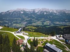
Eagle Walk Stage 03: Kaindlhütte - Kufstein

This stage takes hikers to the small town of Kufstein located on the banks of the Inn river – a town which has been celebrated in song and is steeped in history and character. Walkers make their way through the lush and verdant beauty of a pasture paradise with cosy huts and mountain restaurants before stopping for a rest at the Brentenjochhütte hut (delicious “Kiachl” are served every Saturday). With so many sights to marvel at, don't forget to keep an eye out for the nearly one thousand species of flowering plants native to the Kaiser Mountains.
Hintersteiner See
Kufstein
Wandelen
Normaal
4:00 u
12,5 km
160 Hoogtemeters