

Hiking tour
Astberg circular hiking route
Family-friendly, leisurely circular hike around the Astberg mountain
Easy
1,50 km
80 m
00:30 h


Easy
Route
1,50 km
80 m
00:30 h
1250 m
Starting Point
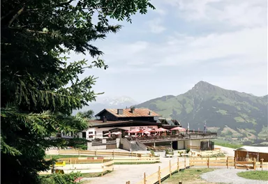
Astberg mountain station, Going (1.251 m)
End Point
Astberg mountain station, Going (1.251 m)
What to do in an emergency? Call emergency number
140 - Mountain Rescue (Bergrettung)
112 - European Emergency Number
133 - Police
144 - Ambulance
Many routes have rescue points at the hiking signs, which can be used as a clear location identification in an emergency.
The Alpine Club provides tips for optimal preparation for mountain hiking.
SOS-EU-Alp App
The SOS EU ALP app allows you to determine your location (x,y coordinates) via your smartphone. In an emergency, this location data can be sent directly to the responsible control center (Tyrol, South Tyrol or Bavaria).
Description
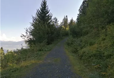
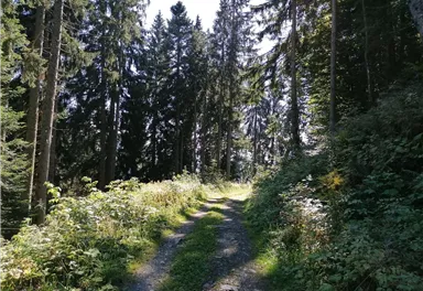
Then start your hike in front of the playground on the left downhill towards Hollenauer Kreuz. Follow the easy and wide path until you reach the junction "Schiabfahrt - Fußweg Asten". Continue tot the right and follow the signs for 'Astberg / Blattlalm'. The trail now leads through the forest around the Astberg.
In the middle of the path there is a viewing point with a lonely bench where you can take a short break. Keep right...
Best Season
Jan
Feb
Mar
Apr
May
Jun
Jul
Aug
Sep
Oct
Nov
Dec
Skill Level
Endurance
Family-friendly
Loop tour
More information at: www.wilderkaiser.info
Heading from St. Johann on the B178 road, take the first exit on the left after Going (Hotel Blattlhof) – this leads to the Astbergbahn chairlift. Turn left again at the end of this road. You will reach the Astbergbahn chairlift after approx. 300 m.


Current Weather
Today
2026-05-21
Morning
7 °C
Afternoon
9 °C
Evening
9 °C
Tomorrow
2026-05-22
Morning
10 °C
Afternoon
14 °C
Evening
13 °C
Saturday
2026-05-23
Morning
13 °C
Afternoon
16 °C
Evening
14 °C
Sunday
2026-05-24
Morning
14 °C
Afternoon
17 °C
Evening
15 °C
Monday
2026-05-25
Morning
14 °C
Afternoon
18 °C
Evening
16 °C
Tuesday
2026-05-26
Morning
16 °C
Afternoon
19 °C
Evening
16 °C
Wednesday
2026-05-27
Morning
13 °C
Afternoon
15 °C
Evening
13 °C
Thursday
2026-05-28
Morning
11 °C
Afternoon
13 °C
Evening
11 °C
Friday
2026-05-29
Morning
11 °C
Afternoon
13 °C
Evening
11 °C
Saturday
2026-05-30
Morning
11 °C
Afternoon
13 °C
Evening
11 °C
Sunday
2026-05-31
Morning
12 °C
Afternoon
13 °C
Evening
11 °C
Monday
2026-06-01
Morning
11 °C
Afternoon
12 °C
Evening
11 °C
Tuesday
2026-06-02
Morning
10 °C
Afternoon
10 °C
Evening
9 °C
Wednesday
2026-06-03
Morning
10 °C
Afternoon
10 °C
Evening
9 °C
Last updated at 05/21/2026, 02:00 PM
Contact
Contact
You have questions? We are happy to assist you.


