Oops, tour not found!

We are sorry, your requested page is not available. You can start a new search on this page!

0 Routes and tours

Ellmau-Scheffau winter trail

Ellmau-Scheffau winter trail

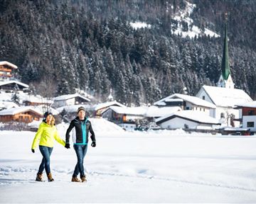
A wonderful winter hike along the valley, with a comfortable bus ride back to the starting point.

Hiking starting point Tourist Information Office, Ellmau (800 m)

Hiking starting point Tourist Information Office, Scheffau (737 m)

Hiking

2:15 h

6,5 km

40 Elevation gain

Bichlloipe

Bichlloipe
Bichlloipe
Bichlloipe

Cross-country skiing on an isolated plateau, surrounded by forest and winter meadows.

Cross-country skiing

Easy

1,3 km

30 Elevation gain

Ellmau village tour

Ellmau village tour
Ellmau village tour
Ellmau village tour

Postkarten circuit Ellmau Ellmau hiking info point – Kapellenpark – Marienkapelle – Ellmau Parish Church

Hiking starting point Tourist Info, Ellmau (800 m)

Hiking starting point Tourist Info, Ellmau (800 m)

Hiking

Easy

0:25 h

1,3 km

40 Elevation gain

Koller circular route

Koller circular route

Ancient path of the romans - a better stroll.

Hiking starting point Tourist Info, Söll (689 m)

Hiking starting point Tourist Info, Söll (689 m)

Hiking

Easy

1:00 h

3,0 km

55 Elevation gain

Prama circuit

Prama circuit
Prama circuit
Prama circuit

The Pramarunde circuit - a scenically beautiful circuit at all times of the year

Tourist Information Office, Going (766 m)

Tourist Information Office, Going (766 m)

Jogging

Easy

0:30 h

4,4 km

70 Elevation gain

Via ferrata s'Schuastagangl Steinplatte

Via ferrata s'Schuastagangl Steinplatte
Via ferrata s'Schuastagangl SteinplatteClosed
Via ferrata s'Schuastagangl Steinplatte

Attention! There is an increased risk of slipping on the ascents and descents due to snow fields! Walk at your own risk! The classic on the Steinplatte Waidring was rehabilitated in June 2023 and is a treat for via ferrata fans! The via ferrata "s'Schuastagangl" (C/D) offers wonderful panoramic views, crisp ascents and unforgettable mountain moments. The varied tour leads through steep rock faces and slippery passages up to the summit of the Waidringer Steinplatte (1,848m). Strength for steeper ascents and courage for ladder passages and the "Knieschloderer" variant with airy steps and a rope bridge are required!

Access time0,3333333333333333

Via ferrata

Difficulty levelC-D

Via ferrara length220,0 m

Kogl

Kogl
Kogl
Kogl

Cozy winter tour in Hochsöll with lift support, refreshments and view to the Hohe Salve.

Mountain station gondola Hexenwasser, Söll (1,150 m)

Mountain station gondola Hexenwasser, Söll (1,150 m)

Hiking

1:30 h

3,2 km

100 Elevation gain

MTB-Tour around Juffinger Jöchl

MTB-Tour around Juffinger Jöchl

A crisp, varied tour from Söll via the Lengau to Bad Häring and over the Werlberg, past the Juffinger Jöchl back to Söll. Between the individual forest sections, you are rewarded again and again with magnificent views of large parts of the Inntal valley.

Village centre, Söll (689 m)

Village centre, Söll (689 m)

Cycling

Difficult

24,0 km

900 Elevation gain

Sonnseitrunde circuit Ellmau

Sonnseitrunde circuit Ellmau

Ellmau hiking info point - Wimm - Riesen - Biedringer Alm - Biedringer Bauernhöfe - Ellmauer Kaiserbad - Ellmau hiking info point

Hiking starting point Tourist Info, Ellmau (800 m)

Hiking starting point Tourist Info, Ellmau (800 m)

Jogging

Easy

9,8 km

400 Elevation gain

Firster-Waldhof route

Firster-Waldhof route

Explore the districts of Paisslberg and Ried on a leisurely hike for everyone.

Hiking starting point Alpenschlössl, Söll (762 m)

Hiking starting point Alpenschlössl, Söll (762 m)

Hiking

Easy

1:30 h

4,4 km

100 Elevation gain

Astberg Trail

Astberg Trail
Astberg Trail
Astberg Trail

Varied beginner trail round between the Kaiser towns of Ellmau and Going.

Wanderstartplatz Tourismus Info, Ellmau

Wanderstartplatz Tourismus Info, Ellmau

Jogging

Easy

9,7 km

500 Elevation gain

Pölvenau circular route

Pölvenau circular route

Pleasant circular hiking trail through forests and meadows to the romantically situated moor lake.

Hiking starting point Franzlhof, Söll (703 m)

Hiking starting point Franzlhof, Söll (703 m)

Hiking

Intermediate

2:00 h

5,7 km

240 Elevation gain