


Sport climbing area
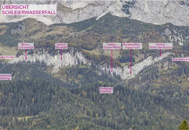
Schleier Waterfall crag
60-metre high rock dome – the Mecca for extreme climbers
What to do in an emergency? Call emergency number
140 - Mountain Rescue (Bergrettung)
112 - European Emergency Number
133 - Police
144 - Ambulance
Many routes have rescue points at the hiking signs, which can be used as a clear location identification in an emergency.
The Alpine Club provides tips for optimal preparation for mountain hiking.

SOS-EU-Alp App
The SOS EU ALP app allows you to determine your location (x,y coordinates) via your smartphone. In an emergency, this location data can be sent directly to the responsible control center (Tyrol, South Tyrol or Bavaria).
Description
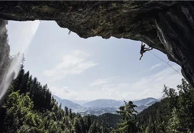
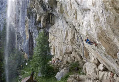
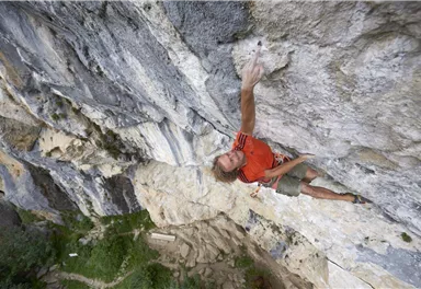
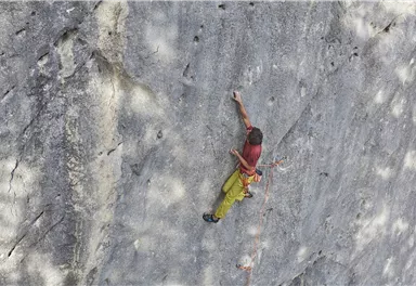
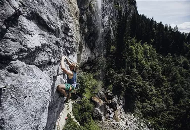
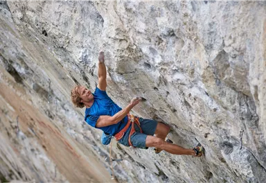
The “Schleier” (veil) amphitheatre, with its unique landscape, perfect rocks, south-facing location and large overhangs, is ideal for climbing all year round. There are more than 200 routes and lots of projects, including some of the toughest routes in Europe and it’s rare to find...
Best Season
Jan
Feb
Mar
Apr
May
Jun
Jul
Aug
Sep
Oct
Nov
Dec
Rocks
Kalk
Numbers of multi-pitch routes
226
Exposure S
Walking time to entry point min.
1 h
Walking time to entry point max.
1 h 15 min
Route length from
10 m
Route length to
55 m
Wall slope vertical
Wall slope overhanging
Roof slope
Number of difficulty 2 routes
0
Number of difficulty 3 routes
0
Number of difficulty 4 routes
0
Number of difficulty 5 routes
2
Number of difficulty 6 routes
36
Number of difficulty 7 routes
87
Number of difficulty 8 routes
87
Number of difficulty 9 routes
6
80 KaiserJet and 865+866 VVT-Regiobuslines: Ellmau Dorf/Bauhof and Going am Wilden Kaiser Dorf
Please book the taxi by 8 pm at the latest on the day before by calling: +43 (0)664 88222598, or alternatively +43 (0) 5358 21010
With the Wilder Kaiser GuestCard, the on-demand taxi service ist free of charge.
More information at: www.wilderkaiser.info/mobility
Heading from Wörgl or Kufstein on the B178 road, take the Going Prama exit before you reach the Stanglwirt hotel. When you reach the first junction, turn right in the direction of the bathing lake. Keep following the road towards the Kaisergebirge mountain range until you reach the next junction, which is located between two farmhouses. Turn left here and follow the road until you reach the hiking starting point and the car park.
Hüttling car park, Going (pay & display)
The car park at the hiking starting point in Hüttling is a day car park, which means that no ticket can be purchased for several days. The parking ticket is therefore only valid on the day of issue! It is a public car park from May to October. During the winter months from November to April the car park is not attended. During this time the use is at your own risk!
Camping and permanent parking is prohibited on this car park. (Vehicles that are parked illegally will be reported to the police and towed.)
Videos

Current Weather
Today
2026-10-06
Morning

9 °C
Afternoon
14 °C
Evening
11 °C
Tomorrow
2026-10-07
Morning
10 °C
Afternoon
14 °C
Evening
13 °C
Thursday
2026-10-08
Morning

10 °C
Afternoon

11 °C
Evening

6 °C
Friday
2026-10-09
Morning

2 °C
Afternoon
4 °C
Evening

4 °C
Saturday
2026-10-10
Morning

5 °C
Afternoon
8 °C
Evening
6 °C
Sunday
2026-10-11
Morning
4 °C
Afternoon

7 °C
Evening
5 °C
Monday
2026-10-12
Morning
4 °C
Afternoon
8 °C
Evening
7 °C
Tuesday
2026-10-13
Morning
7 °C
Afternoon
11 °C
Evening
9 °C
Wednesday
2026-10-14
Morning
8 °C
Afternoon
12 °C
Evening
9 °C
Thursday
2026-10-15
Morning
7 °C
Afternoon
10 °C
Evening
8 °C
Friday
2026-10-16
Morning

7 °C
Afternoon
9 °C
Evening
7 °C
Saturday
2026-10-17
Morning
6 °C
Afternoon
10 °C
Evening
7 °C
Sunday
2026-10-18
Morning
6 °C
Afternoon
8 °C
Evening
7 °C
Monday
2026-10-19
Morning
5 °C
Afternoon
7 °C
Evening
6 °C
Last updated at 10/06/2026, 02:00 AM
Contact
Contact
You have questions? We are happy to assist you.


