

Kaiserkrone long-distance hike
Kaiserkrone - stage 3
Kaindlhütte - Bettlersteig - Anton-Karg-Haus - Hans-Berger-Haus - Stripsenjochhaus
Medium
9,30 km
840 m
05:00 h


Medium
Route
9,30 km
840 m
560 m
05:00 h
1577 m
Starting Point
Hintersteiner See, Scheffau (889 m)
End Point
Stripsenjochhaus, St. Johann in Tirol (1,577 m)
What to do in an emergency? Call emergency number
140 - Mountain Rescue (Bergrettung)
112 - European Emergency Number
133 - Police
144 - Ambulance
Many routes have rescue points at the hiking signs, which can be used as a clear location identification in an emergency.
The Alpine Club provides tips for optimal preparation for mountain hiking.
SOS-EU-Alp App
The SOS EU ALP app allows you to determine your location (x,y coordinates) via your smartphone. In an emergency, this location data can be sent directly to the responsible control center (Tyrol, South Tyrol or Bavaria).
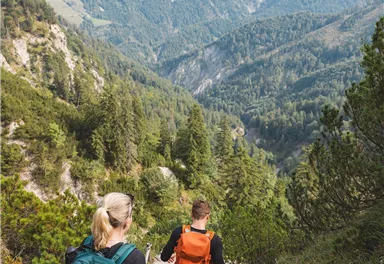
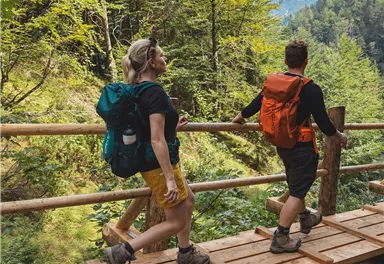
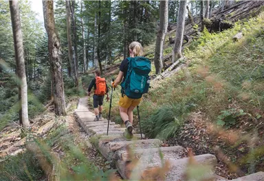
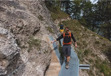
Description
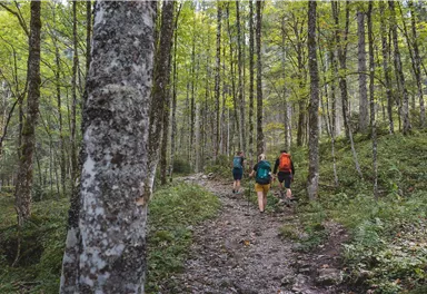
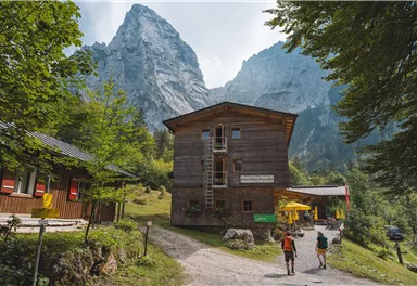
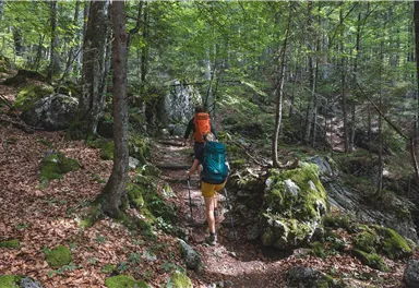
Continue east on trail 827 until you reach the entrance to the Bettlersteig trail. In a series of sharp bends, this leads past the Talofenschlucht gorge and the north face of the Hackenköpfe mountains. It begins with a steep descent, mostly on steps and across eight ditches, with one passage secured using a wire rope and iron clamps. Heading shortly uphill, you will then reach the Strasswalch Jagdhütte mountain hut below the Strasswalchschlucht gorge and continue further into the Kaisertal valley on the Bettlersteig trail. This will bring you to the Anton-Karg-Haus mountain hut (also...
Best Season
Jan
Feb
Mar
Apr
May
Jun
Jul
Aug
Sep
Oct
Nov
Dec
Skill Level
Endurance
Multiday hike
Multi-Day Tour Feature
Etappe
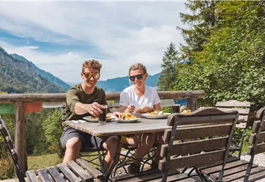
Additions for overnight stay at mountain hut:
Mountain hut sleeping bag, indoor shoes, toiletries and towel, personal medication, headlamp, Alpine Club ID Card, cash, charger for mobile phone The hiking routes between the huts are often rather long, we recommend taking plenty of food and drink and booking your overnight stays well in advance.
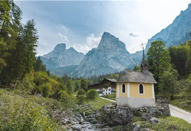
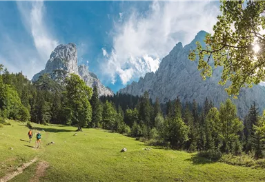
Experience the fascination of the Wilder Kaiser with its imposing and historic rock faces when crossing from north to south.
For detailed information, see the corresponding alternative route.
Current Weather
Today
2026-05-21
Morning
7 °C
Afternoon
9 °C
Evening
9 °C
Tomorrow
2026-05-22
Morning
10 °C
Afternoon
14 °C
Evening
13 °C
Saturday
2026-05-23
Morning
13 °C
Afternoon
16 °C
Evening
14 °C
Sunday
2026-05-24
Morning
14 °C
Afternoon
17 °C
Evening
15 °C
Monday
2026-05-25
Morning
14 °C
Afternoon
18 °C
Evening
16 °C
Tuesday
2026-05-26
Morning
16 °C
Afternoon
19 °C
Evening
16 °C
Wednesday
2026-05-27
Morning
13 °C
Afternoon
15 °C
Evening
13 °C
Thursday
2026-05-28
Morning
11 °C
Afternoon
13 °C
Evening
11 °C
Friday
2026-05-29
Morning
11 °C
Afternoon
13 °C
Evening
11 °C
Saturday
2026-05-30
Morning
11 °C
Afternoon
13 °C
Evening
11 °C
Sunday
2026-05-31
Morning
12 °C
Afternoon
13 °C
Evening
11 °C
Monday
2026-06-01
Morning
11 °C
Afternoon
12 °C
Evening
11 °C
Tuesday
2026-06-02
Morning
10 °C
Afternoon
10 °C
Evening
9 °C
Wednesday
2026-06-03
Morning
10 °C
Afternoon
10 °C
Evening
9 °C
Last updated at 05/21/2026, 02:00 PM
Contact
Contact
You have questions? We are happy to assist you.


