

Hiking tour
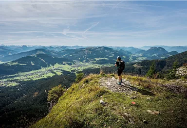
Tauernblick panorama circular hiking route
Closed
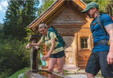
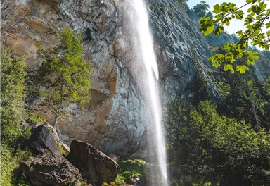
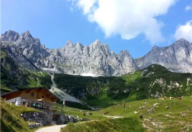
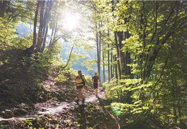
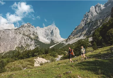
Wilder Kaiser hike to a series of special locations. Featuring the natural spectacle of the Schleier Waterfall and a view of the Gaudeamushütte mountain hut.
Medium
13,60 km
980 m
06:00 h


Medium
Route
13,60 km
980 m
06:00 h
1568 m
Starting Point
Hüttling, Going (820 m)
End Point
Hüttling, Going (820 m)
What to do in an emergency? Call emergency number
140 - Mountain Rescue (Bergrettung)
112 - European Emergency Number
133 - Police
144 - Ambulance
Many routes have rescue points at the hiking signs, which can be used as a clear location identification in an emergency.
The Alpine Club provides tips for optimal preparation for mountain hiking.
SOS-EU-Alp App
The SOS EU ALP app allows you to determine your location (x,y coordinates) via your smartphone. In an emergency, this location data can be sent directly to the responsible control center (Tyrol, South Tyrol or Bavaria).
Closure Information
Description
Continue along the steep incline of the forest road until you reach the Schleier Waterfall intersection. This marks the start of the ascent via...
Best Season
Jan
Feb
Mar
Apr
May
Jun
Jul
Aug
Sep
Oct
Nov
Dec
Skill Level
Endurance
Loop tour
More information at: www.wilderkaiser.info
Heading from Wörgl or Kufstein on the B178 road, take the Going Prama exit before you reach the Stanglwirt hotel. When you reach the first junction, turn right in the direction of the bathing lake. Keep following the road and make another right turn towards the bathing lake after approx. 400 m. The car park is located on the right-hand side.
Camping and permanent parking is prohibited on this car park.


Current Weather
Today
2026-05-18
Morning
5 °C
Afternoon
8 °C
Evening
6 °C
Tomorrow
2026-05-19
Morning
3 °C
Afternoon
7 °C
Evening
6 °C
Wednesday
2026-05-20
Morning
6 °C
Afternoon
8 °C
Evening
7 °C
Thursday
2026-05-21
Morning
7 °C
Afternoon
10 °C
Evening
8 °C
Friday
2026-05-22
Morning
8 °C
Afternoon
12 °C
Evening
11 °C
Saturday
2026-05-23
Morning
10 °C
Afternoon
14 °C
Evening
11 °C
Sunday
2026-05-24
Morning
11 °C
Afternoon
15 °C
Evening
13 °C
Monday
2026-05-25
Morning
10 °C
Afternoon
12 °C
Evening
10 °C
Tuesday
2026-05-26
Morning
11 °C
Afternoon
16 °C
Evening
13 °C
Wednesday
2026-05-27
Morning
12 °C
Afternoon
17 °C
Evening
12 °C
Thursday
2026-05-28
Morning
11 °C
Afternoon
14 °C
Evening
11 °C
Friday
2026-05-29
Morning
11 °C
Afternoon
14 °C
Evening
11 °C
Saturday
2026-05-30
Morning
10 °C
Afternoon
13 °C
Evening
11 °C
Sunday
2026-05-31
Morning
10 °C
Afternoon
12 °C
Evening
11 °C
Last updated at 05/18/2026, 02:00 AM
Contact
Contact
You have questions? We are happy to assist you.


