Lama circuit Ellmau

Lama circuit Ellmau

Lama circuit Ellmau

Description

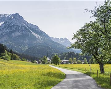
You start this moderately challenging circuit in Ellmau’s village park and go past the church towards Gasthof Au. Immediately after the inn turn right and walk along the Weißache river past the football ground to the Ellmauer Hof. After the hotel, run/walk through the underpass heading towards Haflingertränke. When you reach the hotel, you can call in for refreshments or carry on walking/running and, after a short climb, bear left into a beautiful section of forest. Then, at the crossroads, you walk/run to the left in the direction of Auwald forest, which you cross and return to the starting point.

Read more

Information

  • Running shoes or trail running shoes (depending on the route), comfortable, breathable clothing, poss. lightweight rucksack with water bottle and snacks

  • Heading from Wörgl or Kufstein on the B178 road, take the first exit to Ellmau and then take the first exit at the roundabout. Drive along the bypass, then turn towards the centre of Ellmau when you reach the end (between MPreis and the Sporthotel). Continue straight on until you see the Tourist Information Office on the right-hand side (short-stay parking zone). The hiking starting point is located opposite this on the left-hand side.

    Heading from St. Johann on the B178 road, take the first exit to Ellmau and drive straight on through the town until you see the Tourist Information Office on the right-hand side (short-stay parking zone). The hiking starting point is located opposite this on the left-hand side.

  • Public car parks in Ellmau centre or west - for free.

Read more

More tours

Sonnseitrunde circuit Ellmau

Sonnseitrunde circuit Ellmau

Hiking starting point Tourist Information Office, Ellmau (820 m)

Hiking starting point Tourist Information Office, Ellmau (820 m)

9,8 km

Ellmau hiking info point - Wimm - Riesen - Biedringer Alm - Biedringer Bauernhöfe - Ellmauer Kaiserbad - Ellmau hiking info point

Jogging

Easy

400 Elevation gain

Astberg Trail

Astberg Trail
Astberg Trail
Astberg Trail

Wanderstartplatz Tourismus Info, Ellmau

Wanderstartplatz Tourismus Info, Ellmau

10,2 km

Varied beginner trail round between the Kaiser towns of Ellmau and Going.

Jogging

Easy

520 Elevation gain

Hartkaiserweg trail Ellmau

Hartkaiserweg trail Ellmau

Hiking starting point Tourist Information Office, Ellmau (820 m)

Hartkaiser summit station, Ellmau (1,555 m)

7,9 km

Ellmau village park - Hartkaiserbahn valley station - Bergschenke - Rübezahlalm - Jägerhütte - Hartkaiser summit station

Jogging

Easy

810 Elevation gain

Schattseittrail

Schattseittrail
Schattseittrail
Schattseittrail

Tourismus Info, Söll

Tourismus Info, Söll

12,8 km

The Schattseit trail, mystical and refreshing in equal measure, is a section of the infamous Kaisermarathon, probably the toughest mountain marathon in the Alps.

Jogging

Easy

330 Elevation gain

Contact

If you have any questions,we are happy to help.

+43 50509
or