Oops, tour not found!

We are sorry, your requested page is not available. You can start a new search on this page!

0 Routes and tours

MTB-Tour around Hohe Salve

MTB-Tour around Hohe Salve

The varied loop takes you on leisurely valley cycle paths as well as a mountain evaluation on the MTB routes 265 and 350 once around the Hohe Salve lookout mountain.

Tourismus Info, Söll

Tour

Cycling

Intermediate

36,5 km

880 Elevation gain

Bichlloipe

Bichlloipe
Bichlloipe
Bichlloipe

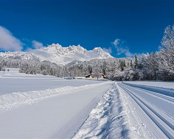
Cross-country skiing on an isolated plateau, surrounded by forest and winter meadows.

Cross-country skiing

Easy

1,3 km

30 Elevation gain

Bichlach-Lake-Tour

Bichlach-Lake-Tour
Partially openBichlach-Lake-Tour
Bichlach-Lake-Tour

A scenic circuit past Gieringer Weiher pond, Schwarzsee lake and Going bathing lake.

Tourist Info, Going (764 m)

Tourist Info, Going (764 m)

Cycling

Intermediate

40,1 km

460 Elevation gain

Hochschwendt circuit

Hochschwendt circuit

This easy family hike takes you via the Bergdoktorhaus to the Berggasthof Hochschwendt mountain inn.

Wanderstartplatz Tourist Info, Ellmau (800m)

Wanderstartplatz Tourist Info, Ellmau (800m)

Hiking

Easy

2:45 h

8,7 km

270 Elevation gain

Söll – Hintersteiner See

Söll – Hintersteiner See
Partially openSöll – Hintersteiner See
Söll – Hintersteiner See

From the flowery village to the water jewel of the Alps.

Hiking starting point Franzlhof, Söll (703 m)

Seestüberl restaurant, Hintersteiner See, Scheffau (890 m)

Hiking

Intermediate

3:15 h

9,5 km

460 Elevation gain

Hausberg trail (no. 8)

Hausberg trail (no. 8)

Hiking trail no. 8 to the Hausberg via the Marienkapelle (St Mary’s Chapel)

Hiking starting point Tourist Information Office, Ellmau (798 m)

Brenner Alm, Ellmau (1,236 m)

Hiking

Easy

1:30 h

3,5 km

500 Elevation gain

Gruttenhütte circuit

Gruttenhütte circuit

Panoramic circular walk in the Wilder Kaiser leading to the highest mountain hut in the region.

Hiking starting point Tourist Info, Ellmau (800 m)

Hiking starting point Tourist Info, Ellmau (800 m)

Hiking

Intermediate

6:00 h

15,7 km

870 Elevation gain

Eagle Walk Stage 02: Gaudeamushütte - Hintersteinersee

Eagle Walk Stage 02: Gaudeamushütte - Hintersteinersee
OpenEagle Walk Stage 02: Gaudeamushütte - Hintersteinersee
Eagle Walk Stage 02: Gaudeamushütte - Hintersteinersee

Is it about the journey or the destination? You decide. There is nothing like a pristine mountain lake for relief from summer's heat. You might find it incomparably refreshing to cool off in lovely Hintersteinersee Lake at the end of your hiking day. With that in mind, and surrounded by the mesmerizing peaks of Kaiser Range, you will walk across mountain meadows, dwarf pine areas, beech and mixed woodlands as well as rock scrambles, passing Grutten Hut on your way to picture-postcard Hintersteinersee Lake. This is the cleanest and most beautiful mountain lake in the whole of Tirol. The pristine lake covers 56 hectares of spring-fed waters and measures 36 metres at its deepest point. Hintersteinersee Lake is private property; swimming is allowed at its north-western beach. Before taking a plunge, why not dip your finger in holy water? The Baroque ceiling frescos by Matthias Kirchner at Bärnstatt Chapel opposite Bärnstatt Inn are well worth seeing.

Gaudeamushütte

Hintersteiner See

Hiking

Intermediate

6:00 h

14,5 km

800 Elevation gain

Kaiserkrone - around the Wilder Kaiser in 5 days

Kaiserkrone - around the Wilder Kaiser in 5 days

Wild and free - 5 days of hiking on old paths around the Wilder Kaiser The five-day hike from hut to hut is one of the most beautiful multi-day circular tours in Tirol. It takes mountain walkers along a route of around 58 kilometres, featuring ascents and descents with a difference in altitude of approximately 4,000 metres as they circle around the imposing Wilder Kaiser massif.

Hiking starting point Hüttling, Going (820 m)

Hiking starting point Hüttling, Going (820 m)

Hiking

Intermediate

27 h

57,7 km

4000 Elevation gain

MTB-Tour around Juffinger Jöchl

MTB-Tour around Juffinger Jöchl

A crisp, varied tour from Söll via the Lengau to Bad Häring and over the Werlberg, past the Juffinger Jöchl back to Söll. Between the individual forest sections, you are rewarded again and again with magnificent views of large parts of the Inntal valley.

Village centre, Söll (689 m)

Village centre, Söll (689 m)

Cycling

Difficult

24,0 km

900 Elevation gain

Schattseitloipe

Schattseitloipe
Schattseitloipe
Schattseitloipe

Enjoy winter silence and an imperial panorama in Söll.

parking area Ahornsee, Söll (693 m)

parking area Ahornsee, Söll (693 m)

Cross-country skiing

Intermediate

5,3 km

80 Elevation gain

Going – Gruttenhütte circular walk

Going – Gruttenhütte circular walk

A unique hike to the highest mountain hut in the Wilder Kaiser region featuring a panoramic view.

Hiking starting point Going center (former tourist information Going) (764 m)

Hiking starting point Going center (former tourist information Going) (764 m)

Hiking

Intermediate

6:00 h

14,0 km

890 Elevation gain

Eagle Walk Stage 01: St. Johann in Tirol - Gaudeamushütte

Eagle Walk Stage 01: St. Johann in Tirol - Gaudeamushütte

Sturdy boots will help keep your ankles and feet happy on this hike, full of the best things Tirol has to offer: well-maintained trails, wildflowers galore and waterfalls beckon the adventurous hiker ready for a strenuous climb with breathtaking views of lofty Wilder Kaiser Mountain Range as your reward. The nature reserve’s landscape will win you over with its diverse beauty. The pasture regions are covered with soft grassy meadows, and hikers are greeted by lofty Wilder Kaiser Mountain Range with rugged Maukspitze, Ackerlspitze, Regalpspitze and Törlspitze Peaks, all “Two-Thousanders” that average 2,000 metres altitude. Trailhead is Rummlerhof Inn, northwest of the village centre of St. Johann. After a successful first segment, why not take a rest at Gaudeamus Hut, raise your glass and sing: “Gaudeamus igitur – Let us be happy!” For many hikers this is far enough, contentment has already set in. Adventurous souls continue on the trail that works its way up across Klamml Gorge to Grutten Hut, which entails another 400 metres of climbing.

Rummlerhof, St.Johann in Tirol

Gaudeamushütte

Hiking

Intermediate

5:00 h

13,0 km

1060 Elevation gain