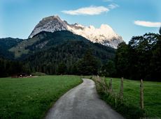
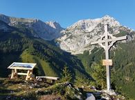
Hoppala, route niet gevonden

De door u opgevraagde pagina is niet beschikbaar. U bent welkom om een nieuwe zoekopdracht op deze pagina te starten.

0 Routes & tochten

Pölvenau circular route

Pölvenau circular route
Gedeeltelijk openPölvenau circular route
Pölvenau circular route

Pleasant circular hiking trail through forests and meadows to the romantically situated moor lake.

Hiking starting point Franzlhof, Söll (703 m)

Hiking starting point Franzlhof, Söll (703 m)

Wandelen

Normaal

2:00 u

5,7 km

240 Hoogtemeters

Kaiserkrone - stage 5

Kaiserkrone - stage 5

Gasteig – Wilder-Kaiser-Steig – Ursulablick – Gscheuerkopf – Graspoint-Hochalm – Graspoint-Niederalm – Going, Hüttling

Gasteig (750 m)

Hiking starting point Hüttling, Going (820 m)
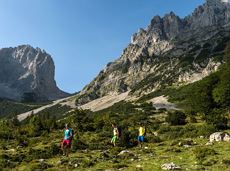
Wandelen

Normaal

5:15 u

10,8 km

840 Hoogtemeters

Blaiken circular walk

Blaiken circular walk

A gentle walk to ancient farmsteads with a refreshment stop in a welcoming inn.

Hiking starting point Tourist Info, Scheffau (738 m)

Hiking starting point Tourist Info, Scheffau (738 m)

Wandelen

Gemakkelijk

1:30 u

3,8 km

80 Hoogtemeters

Kaiserkrone - stage 2

Kaiserkrone - stage 2

Gruttenhütte - Kaiser-Hochalm - Steiner-Hochalm - Jägersteig - Walleralm - Hochegg - Kaindlhütte

Gruttenhütte, Ellmau (1,620 m)

Hintersteiner See, Scheffau (889 m)

Wandelen

Normaal

5:30 u

13,5 km

560 Hoogtemeters

Ellmau Stone Circle circuit

Ellmau Stone Circle circuit

Head through well-shaded forests of green to reach the Ellmau Stone Circle. This is a place with a special energy, making it an inviting option for taking some time to relax.

Hiking starting point Wochenbrunner Alm, Ellmau (1,085 m)

Hiking starting point Wochenbrunner Alm, Ellmau (1,085 m)

Wandelen

Normaal

1:00 u

2,4 km

120 Hoogtemeters

Moon toboggan run

Moon toboggan run
Moon toboggan run
Moon toboggan run

Exciting adventure stations for family tobogganing on the Hohe Salve.

Cable car valley station, Söll (725 m)

Cable car valley station, Söll (725 m)

Rodelen

Gemakkelijk

4,0 km

Koller circular route

Koller circular route

Ancient path of the romans - a better stroll.

Hiking starting point Tourist Info, Söll (689 m)

Hiking starting point Tourist Info, Söll (689 m)

Wandelen

Gemakkelijk

1:00 u

3,0 km

55 Hoogtemeters

Bichlach-Lake-Tour

Bichlach-Lake-Tour
Gedeeltelijk openBichlach-Lake-Tour
Bichlach-Lake-Tour

A scenic circuit past Gieringer Weiher pond, Schwarzsee lake and Going bathing lake.

Tourist Info, Going (764 m)

Tourist Info, Going (764 m)

Fietsen

Normaal

40,1 km

460 Hoogtemeters

Gruttenhütte circuit

Gruttenhütte circuit

Panoramic circular walk in the Wilder Kaiser leading to the highest mountain hut in the region.

Hiking starting point Tourist Info, Ellmau (800 m)

Hiking starting point Tourist Info, Ellmau (800 m)

Wandelen

Normaal

6:00 u

15,7 km

870 Hoogtemeters

Hartkaiser circuit Ellmau

Hartkaiser circuit Ellmau

Hartkaiserbahn summit station - Ellmis Zauberwald - Tanzbodensee lake - Hartkaiserbahn summit station

Hartkaiser summit station, Ellmau (1,555 m)

Hartkaiser summit station, Ellmau (1,555 m)

Hardlopen

Gemakkelijk

3,4 km

120 Hoogtemeters

Village tour Scheffau

Village tour Scheffau

Round tour through Scheffau with vitalising stations for refreshment and relaxation.

Hiking starting point Tourist Info, Scheffau (738 m)

Hiking starting point Tourist Info, Scheffau (738 m)

Wandelen

Gemakkelijk

1:15 u

4,3 km

90 Hoogtemeters

Eagle Walk Stage 02: Gaudeamushütte - Kaindlhütte

Eagle Walk Stage 02: Gaudeamushütte - Kaindlhütte

Is it about the journey or the destination? Well, one of the destinations of this stage is definitely the Hintersteiner See lake and its views. Surrounded by stunning mountain vistas, dwarf pine scrubland and beech forests, the lake is one of the cleanest and most beautiful mountain lakes in Tirol. The private pristine gem covers 56 hectares and measures 36 metres at its deepest point. With this picture-perfect backdrop, hikers will complete the remaining distance to the Kaindlhütte hut in no time.

Gaudeamushütte

Hintersteiner See

Wandelen

Normaal

6:30 u

15,1 km

888 Hoogtemeters

Hochlechen circular route

Hochlechen circular route

Old path - now renovated and featuring a pleasant series of ascents and descents.

Hiking starting point Bergbahn, Söll (725 m)

Hiking starting point Bergbahn, Söll (725 m)

Wandelen

Normaal

4:30 u

13,5 km

470 Hoogtemeters