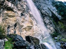
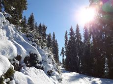
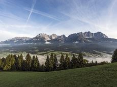
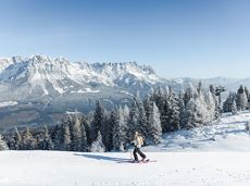
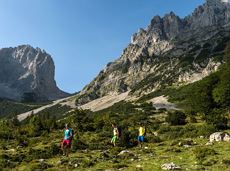
Hoppala, route niet gevonden

De door u opgevraagde pagina is niet beschikbaar. U bent welkom om een nieuwe zoekopdracht op deze pagina te starten.

0 Routes & tochten

“Moor & more” Rocky Way

“Moor & more” Rocky Way

An extensive exploration of “Moor & more”. The puzzle tour in the Wilder Kaiser forest is sure to be lots of fun, even for older children.

Hiking starting point Hüttling, Going (820 m)

Hiking starting point Hüttling, Going (820 m)

Wandelen

Gemakkelijk

3:00 u

8,0 km

380 Hoogtemeters

Kaiserkrone - around the Wilder Kaiser in 5 days

Kaiserkrone - around the Wilder Kaiser in 5 days

Wild and free - 5 days of hiking on old paths around the Wilder Kaiser The five-day hike from hut to hut is one of the most beautiful multi-day circular tours in Tirol. It takes mountain walkers along a route of around 58 kilometres, featuring ascents and descents with a difference in altitude of approximately 4,000 metres as they circle around the imposing Wilder Kaiser massif.

Hiking starting point Hüttling, Going (820 m)

Hiking starting point Hüttling, Going (820 m)

Wandelen

Normaal

27 u

57,7 km

4000 Hoogtemeters

Winter wonderland

Winter wonderland
Winter wonderland
Winter wonderland

Romantic forest walk in tranquil surroundings.

Hiking starting point Tourist Info, Ellmau (800 m)

Hiking starting point Tourist Info, Ellmau (800 m)

Wandelen

Gemakkelijk

5:30 u

12,7 km

470 Hoogtemeters

Natural playground Rehbachklamm

Natural playground Rehbachklamm

Hikers, young and old alike, will find in this wild romantic gorge natural playgrounds such as bridges and balancing beams by streams and ponds.

Hiking starting point Tourist Info, Scheffau (738 m)

Hiking starting point Tourist Info, Scheffau (738 m)

Wandelen

Gemakkelijk

1:15 u

3,5 km

130 Hoogtemeters

Prama circular hiking route

Prama circular hiking route

Easier and more level circular walk through the sunny district of Prama for walkers or families with pushchairs.

Hiking starting point Going center (former tourist information Going) (764 m)

Hiking starting point Going center (former tourist information Going) (764 m)

Wandelen

Gemakkelijk

1:00 u

3,9 km

60 Hoogtemeters

Piste tour route no. 2 - Söll

Piste tour route no. 2 - Söll
GeslotenPiste tour route no. 2 - Söll
Piste tour route no. 2 - Söll

Difficult piste tour via the downhill, route no. 40a to Hochsöll Hexenwasser mountain station & further on via the Keat downhill route no. 43 to the Keat alpine pastures.

Cable Car Söll, ski touring car park

Mountain station, Hexenwasser gondola or Keat Almen

Skitocht

Moeilijk

1:30 u

4,0 km

762 Hoogtemeters

Pistentour Hartkaiser

Pistentour Hartkaiser
OpenPistentour Hartkaiser
Pistentour Hartkaiser

Mittelschwierige Aufstiegsroute entlang der Piste Nr. 80 auf den Hartkaiser.

Hartkaiserbahn Talstation,

Hartkaiserbahn Bergstation, Ellmau (1.520 m)

Skitocht

Normaal

2:00 u

3,5 km

700 Hoogtemeters

Tannbichl Kapellen Runde

Tannbichl Kapellen Runde

Nice circular hike through Going with visits to numerous chapels.

Hiking starting point Going center (former tourist information Going) (764 m)

Hiking starting point Going center (former tourist information Going) (764 m)

Wandelen

Gemakkelijk

2:45 u

9,3 km

210 Hoogtemeters

Hike to Wochenbrunner Alm

Hike to Wochenbrunner Alm

Hike from the centre of Ellmau, along trail no. 14, through the "Spatlahner gorge" up to the Wochenbrunner Alm.

Hiking starting point Tourist Information Office, Ellmau (800 m)

Hiking starting point Tourist Information Office, Ellmau (800 m)

Wandelen

Gemakkelijk

1:30 u

4,4 km

285 Hoogtemeters

Prama circuit

Prama circuit
Prama circuit
Prama circuit

The Pramarunde circuit - a scenically beautiful circuit at all times of the year

Tourist Information Office, Going (766 m)

Tourist Information Office, Going (766 m)

Hardlopen

Gemakkelijk

0:30 u

4,4 km

70 Hoogtemeters

3-day mountain hut tour - overall itinerary

3-day mountain hut tour - overall itinerary

Going, Hüttling - Schleierwasserfall - Obere Regalm - Baumgartenköpfl (Bergsteigergrab) - Gaudeamushütte - Ellmauer Tor - Hintere Goinger Halt - Jubiläumssteig - Gruttenhütte - Kaiser-Hochalm - Steiner-Hochalm - Hinterschießling Alm - Rehbachklamm - Scheffau, Dorf

Hiking starting point Hüttling, Going (820 m)

Scheffau village (738 m)

Wandelen

Moeilijk

14:00 u

24,6 km

2060 Hoogtemeters

Koller circular route

Koller circular route

Ancient path of the romans - a better stroll.

Hiking starting point Tourist Info, Söll (689 m)

Hiking starting point Tourist Info, Söll (689 m)

Wandelen

Gemakkelijk

1:00 u

3,0 km

55 Hoogtemeters

Eagle Walk Stage 03: Kaindlhütte - Kufstein

Eagle Walk Stage 03: Kaindlhütte - Kufstein

This stage takes hikers to the small town of Kufstein located on the banks of the Inn river – a town which has been celebrated in song and is steeped in history and character. Walkers make their way through the lush and verdant beauty of a pasture paradise with cosy huts and mountain restaurants before stopping for a rest at the Brentenjochhütte hut (delicious “Kiachl” are served every Saturday).

Hintersteiner See

Kufstein

Wandelen

Normaal

4:00 u

12,5 km

160 Hoogtemeters

Rehbach tour

Rehbach tour
Rehbach tour
Rehbach tour

Exciting round trip for adults and children through the Rehbach gorge.

Hiking starting point Tourist Info, Scheffau (738 m)

Hiking starting point Tourist Info, Scheffau (738 m)

Wandelen

Normaal

2:00 u

5,5 km

280 Hoogtemeters

MTB-Tour around Hohe Salve

MTB-Tour around Hohe Salve

The varied loop takes you on leisurely valley cycle paths as well as a mountain evaluation on the MTB routes 265 and 350 once around the Hohe Salve lookout mountain.

Tourismus Info, Söll

Tour

Fietsen

Normaal

36,5 km

880 Hoogtemeters

Salvenblick hiking round

Salvenblick hiking round

Comfortable round with a magnificent view of the Hohe Salve.

Mountain station gondola Hexenwasser, Söll (1,150 m)

Mountain station gondola Hexenwasser, Söll (1,150 m)

Wandelen

Gemakkelijk

0:35 u

1,8 km

50 Hoogtemeters