


 Deutsch


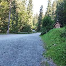
Parking lot Hüttling, Going (subject to charge)
Open - Today
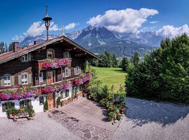
Going am Wilden Kaiser
Read more
The composition of the trail varies between forest roads, meadow paths, forest trails and short sections of asphalt.
Rucksack, hiking/mountaineering boots, hiking gear (breathable), sun protection (sunglasses, sun cream, headgear), waterproofs (hardshell), water bottle, food for eating on the way, hiking poles if desired, plastic bag for waste, hiking map
Read more
KaiserJet stop “Going Badesee” or "Going Dorf" or Postbus stop "Going Stanglwirt" oder "Going Dorf" and further on by the "Hiking bus Hüttling" to the hiking starting point.
More information at: www.wilderkaiser.info
Heading from St. Johann on the B178 road, take the Going Prama exit immediately after passing the Stanglwirt hotel. When you reach the first junction, turn right in the direction of the bathing lake. Keep following the road towards the Kaisergebirge mountain range until you reach the next junction, which is located between two farmhouses. Turn left here and follow the road until you reach the hiking starting point and the car park.
Heading from Wörgl or Kufstein on the B178 road, take the Going Prama exit before you reach the Stanglwirt hotel. When you reach the first junction, turn right in the direction of the bathing lake. Keep following the road towards the Kaisergebirge mountain range until you reach the next junction, which is located between two farmhouses. Turn left here and follow the road until you reach the hiking starting point and the car park.
Hüttling car park, Going (820 m) - pay & display
It is a day car park, which means that no ticket can be purchased for several days. The parking ticket is therefore only valid on the day of issue! It is a public car park from May to October. During the winter months from November to April the car park is not attended. During this time the use is at your own risk! Camping and permanent parking is prohibited on this car park. (Vehicles that are parked illegally will be reported to the police and towed.)
Read more
Fitness
Technical
Experience
01
Jan
02
Feb
03
Mrz
04
Apr
05
May
06
Jun
07
Jul
08
Aug
09
Sep
10
Oct
11
Nov
12
Dec
Open - Today
Going am Wilden Kaiser

Cosed - Open from 19.05.2024
Going am Wilden Kaiser
(0043) 664 88690750
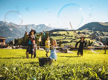
Hike to the Hexenwasser and get rewarded with a view.
Bergbahn valley station, Söll (724 m)
Bergbahn valley station, Söll (724 m)
Hiking
Easy
3:00 h
7,9 km
410 Elevation gain
Off the beaten track up to the Köpfing farmhouse.“Der Bergdoktor” (The Mountain Doctor) is a famous German-Austrian TV series, which is produced in the Wilder Kaiser region.
Bergdoktor parking lot, Söll
Bergdoktor parking lot, Söll
Hiking
Easy
3:00 h
8,4 km
370 Elevation gain

A tour of the main filming locations of the TV series “Der Bergdoktor” (The Mountain Doctor) in Ellmau, with a refreshment stop at the inn used during filming
Hiking starting point Tourist Info, Ellmau (798 m)
Hiking starting point Tourist Info, Ellmau (798 m)
Hiking
Easy
2:15 h
7,5 km
200 Elevation gain
From Going to the Astberg with a small altitude loop & impressive panoramic view.
Hiking starting point Going center (former tourist information Going) (764 m)
Hiking starting point Going center (former tourist information Going) (764 m)
Hiking
Easy
3:30 h
8,6 km
560 Elevation gain
This easy family hike takes you via the Bergdoktorhaus to the Berggasthof Hochschwendt mountain inn.
Wanderstartplatz Tourist Info, Ellmau (800m)
Wanderstartplatz Tourist Info, Ellmau (800m)
Hiking
Easy
2:45 h
8,7 km
270 Elevation gain
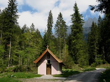
Nice circular hike through Going with visits to numerous chapels.
Hiking starting point Going center (former tourist information Going) (764 m)
Hiking starting point Going center (former tourist information Going) (764 m)
Hiking
Easy
2:45 h
9,3 km
210 Elevation gain
2024-05-14
10 °C
2024-05-15
19 °C
2024-05-16
18 °C
2024-05-17
13 °C
