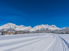
Hoppala, route niet gevonden

De door u opgevraagde pagina is niet beschikbaar. U bent welkom om een nieuwe zoekopdracht op deze pagina te starten.

0 Routes & tochten

Wochenbrunnweg

Wochenbrunnweg
Wochenbrunnweg
Wochenbrunnweg

A wild and romantic walk through the Kaiserwald forest with its wildlife park and cosy, traditional Tirolean parlour.

Hiking starting point Tourist Info, Ellmau (800 m)

Hiking starting point Tourist Info, Ellmau (800 m)

Wandelen

Normaal

3:30 u

9,0 km

300 Hoogtemeters

Bergdoktor tour of Ellmau & Going

Bergdoktor tour of Ellmau & Going

A tour of the main filming locations of the TV series “Der Bergdoktor” (The Mountain Doctor) in Ellmau and Going, with a refreshment stop at the inn used during filming

Hiking info point, Tourist Info Ellmau (800 m)

Hiking info point, Tourist Info Ellmau (800 m)

Wandelen

Gemakkelijk

3:15 u

11,4 km

180 Hoogtemeters

Ellmau Stone Circle circuit

Ellmau Stone Circle circuit

Head through well-shaded forests of green to reach the Ellmau Stone Circle. This is a place with a special energy, making it an inviting option for taking some time to relax.

Hiking starting point Wochenbrunner Alm, Ellmau (1,085 m)

Hiking starting point Wochenbrunner Alm, Ellmau (1,085 m)

Wandelen

Normaal

1:00 u

2,4 km

120 Hoogtemeters

Schwendter Sonnenplateau circular winter hiking route

Schwendter Sonnenplateau circular winter hiking route

Picturesque circular route on the sunny side of Going in unspoilt natural surroundings through snow-covered fields offering wonderful views of Going and the Wilder Kaiser region.

Hiking starting point Going center (former tourist information Going) (764 m)

Hiking starting point Going center (former tourist information Going) (764 m)

Wandelen

Gemakkelijk

1:45 u

4,8 km

80 Hoogtemeters

Schattseittrail

Schattseittrail
Schattseittrail
Schattseittrail

The Schattseit trail, mystical and refreshing in equal measure, is a section of the infamous Kaisermarathon, probably the toughest mountain marathon in the Alps.

Tourismus Info, Söll

Tourismus Info, Söll

Hardlopen

Gemakkelijk

12,8 km

330 Hoogtemeters

MTB-Tour 364 Walleralm

MTB-Tour 364 Walleralm

A short MTB tour to the Walleralm mountain inn, easily combined with other routes.

Parkplatz Pension Maier, Scheffau (925 m)

Parkplatz Walleralm, Söll (685 m)

Fietsen

Normaal

3,3 km

260 Hoogtemeters

Moon toboggan run

Moon toboggan run
Moon toboggan run
Moon toboggan run

Exciting adventure stations for family tobogganing on the Hohe Salve.

Cable car valley station, Söll (725 m)

Cable car valley station, Söll (725 m)

Rodelen

Gemakkelijk

4,0 km

Cross country connection Oberstegen/Söll–Scheffau

Cross country connection Oberstegen/Söll–Scheffau

2 villages - you fancy quiete and a very rural athmosphere - Scheffau is the place to go, or, you opt for a great variety of gastronomy and restaurants - then Söll is good to go. No matter how, your decision is always superb. The ski hiking route is purely flat, which also means it's great for everybody.

restaurant Oberstegen, Söll

village, Scheffau

Langlaufen

Gemakkelijk

1,4 km

15 Hoogtemeters

Kaiser view circular walk

Kaiser view circular walk

Extended walk through the landscape of Scheffau and Söll

Hiking starting point Tourist Info, Scheffau (738 m)

Hiking starting point Tourist Info, Scheffau (738 m)

Wandelen

Gemakkelijk

3:30 u

8,8 km

210 Hoogtemeters

Panoramic circuit Brandstadl–Hartkaiser

Panoramic circuit Brandstadl–Hartkaiser

This familyfriendly hike leads you along the panoramic trail from the Brandstadl mountain in Scheffau to the Hartkaiser mountain in Ellmau.

Brandstadlbahn mountain station, Scheffau (1,650 m) or Hartkaiserbahn mountain station, Ellmau (1.550 m)

Brandstadlbahn mountain station, Scheffau (1,650 m) or Hartkaiserbahn mountain station, Ellmau (1.550 m)

Wandelen

Gemakkelijk

1:50 u

6,0 km

170 Hoogtemeters

Ackerlhütten circular hike

Ackerlhütten circular hike

Intermediate circular hike with breathtaking views on the surrounding mountains. Attention: Trail no 828 is closed due to danger of falling rocks. Detour via path no. 816 and 827 via the Obere Regalm to the Baumgartenköpfl.

Hiking starting point Tannbichl, Going (857 m)

Hiking starting point Tannbichl, Going (857 m)

Wandelen

Normaal

4:45 u

9,8 km

760 Hoogtemeters

Rauher Kopf

Rauher Kopf
Rauher Kopf
Rauher Kopf

Over hill and dale through idyllic nature up to the Rauhen Kopf.

Astberg Bergstation

Astberg Bergstation

Wandelen

Normaal

4:45 u

13,1 km

620 Hoogtemeters

Scheffau – Gruttenhütte

Scheffau – Gruttenhütte

Hike to the Gruttenhütte with great views to the Ellmauer Halt and the entire region.

Hiking starting point Tourist Info, Scheffau (738 m)

Gruttenhütte, Ellmau (1,620 m)

Wandelen

Normaal

6:30 u

16,4 km

990 Hoogtemeters

Rübezahlschnitzweg

Rübezahlschnitzweg
Rübezahlschnitzweg
Rübezahlschnitzweg

Family hike on Austria’s longest sculpture trail

Hartkaiser summit station, Ellmau (1,555 m)

Rübezahl-Alm, Ellmau (1,174 m)

Wandelen

Normaal

1:00 u

2,5 km

50 Hoogtemeters

Kaiserkrone - alternative route crossing through the Ellmauer Tor (Eggersteig trail - Jubiläumssteig trail)

Kaiserkrone - alternative route crossing through the Ellmauer Tor (Eggersteig trail - Jubiläumssteig trail)

Stripsenjochhaus – Eggersteig – Steinerne Rinne – Ellmauer Tor – Jubiläumssteig – Gruttenhütte

Stripsenjochhaus, St. Johann in Tirol (1,577 m)

Gaudeamushütte, Going (1,263 m)

Wandelen

Moeilijk

5:00 u

6,3 km

590 Hoogtemeters