


 Deutsch
 English
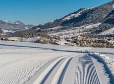
Quellen circular route

Enjoy the scenic area of the Hohe Salve where the Söll waters originate.
Exit Keat chairlift, Söll (1,533 m)
Exit Keat chairlift, Söll (1,533 m)
Wandelen
Normaal
3:45 u
10,3 km
530 Hoogtemeters
De door u opgevraagde pagina is niet beschikbaar. U bent welkom om een nieuwe zoekopdracht op deze pagina te starten.
Enjoy the scenic area of the Hohe Salve where the Söll waters originate.
Exit Keat chairlift, Söll (1,533 m)
Exit Keat chairlift, Söll (1,533 m)
Wandelen
Normaal
3:45 u
10,3 km
530 Hoogtemeters

mountain station Salvistabahn / Kleine Salve
Middle station Salvistabahn Itter
Wandelen
Normaal
2:45 u
7,4 km
360 Hoogtemeters

Short circular walk at the snow-white Brandstadl mountain with panorama view.
Brandstadlbahn summit station, Scheffau (1,643 m)
Brandstadlbahn summit station, Scheffau (1,643 m)
Wandelen
Gemakkelijk
0:30 u
1,3 km
40 Hoogtemeters

A unique hike to the highest mountain hut in the Wilder Kaiser region featuring a panoramic view.
Hiking starting point Going center (former tourist information Going) (764 m)
Hiking starting point Going center (former tourist information Going) (764 m)
Wandelen
Normaal
6:00 u
14,0 km
890 Hoogtemeters

Moderate tour to the Schleier Waterfall, a great outdoor experience.
Tourist Info, Going (764 m)
Tourist Info, Going (764 m)
Fietsen
Normaal
6,6 km
410 Hoogtemeters

Up for a wild witch’s ride? Day and night: off you go!
Cable car valley station, Söll (725 m)
Cable car valley station, Söll (725 m)
Rodelen
Normaal
3,0 km

Varied and challenging loop over the Scheffauer summit.
Kaindlhütte, Scheffau (1,293 m)
Scheffauer (2,111 m)
Wandelen
Moeilijk
8:30 u
13,0 km
1400 Hoogtemeters
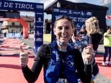
With the Söller Zehner (1st competition in the Tour de Tirol) the circuit is run three times!
Hiking starting point Tourist Info, Söll (689 m)
Hiking starting point Tourist Info, Söll (689 m)
Hardlopen
Gemakkelijk
3,3 km
80 Hoogtemeters

A winter hiking route connects the villages of Söll and Scheffau.
Hiking starting point Tourist Info, Scheffau (737 m)
Hiking starting point Tourist Info, Söll (689 m)
Wandelen
Normaal
2:45 u
7,1 km
70 Hoogtemeters

Stripsenjochhaus – Eggersteig – Steinerne Rinne – Ellmauer Tor – Jubiläumssteig – Gruttenhütte
Stripsenjochhaus, St. Johann in Tirol (1,577 m)
Gaudeamushütte, Going (1,263 m)
Wandelen
Moeilijk
5:00 u
6,3 km
590 Hoogtemeters

The Kitzbüheler Horn Via Ferrata offers a Magnificent Climbing Adventure for Less Experienced Climbers. Enjoy Spectacular Views and Adrenaline Rushes while being Safe and Secure throughout Your Journey.
Via ferrata

This tour is rich in variety and includes slabs, water grooves, as well as a strong overhang and a traverse with an undercling passage.
Alpine klimroutes

More than 190 sport climbing routes, difficulty levels 3 to 9a+
Sportklimmen
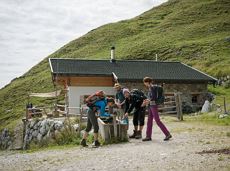
Sturdy boots will help keep your ankles and feet happy on this hike, full of the best things Tirol has to offer: well-maintained trails, wildflowers galore and waterfalls beckon the adventurous hiker ready for a strenuous climb with breathtaking views of lofty Wilder Kaiser Mountain Range as your reward. The nature reserve’s landscape will win you over with its diverse beauty. The pasture regions are covered with soft grassy meadows, and hikers are greeted by lofty Wilder Kaiser Mountain Range with rugged Maukspitze, Ackerlspitze, Regalpspitze and Törlspitze Peaks, all “Two-Thousanders” that average 2,000 metres altitude. Trailhead is Rummlerhof Inn, northwest of the village centre of St. Johann. After a successful first segment, why not take a rest at Gaudeamus Hut, raise your glass and sing: “Gaudeamus igitur – Let us be happy!” For many hikers this is far enough, contentment has already set in. Adventurous souls continue on the trail that works its way up across Klamml Gorge to Grutten Hut, which entails another 400 metres of climbing.
Rummlerhof, St.Johann in Tirol
Gaudeamushütte
Wandelen
Normaal
5:00 u
13,0 km
1060 Hoogtemeters

Hike from the centre of Ellmau, along trail no. 14, through the "Spatlahner gorge" up to the Wochenbrunner Alm.
Hiking starting point Tourist Information Office, Ellmau (800 m)
Hiking starting point Tourist Information Office, Ellmau (800 m)
Wandelen
Gemakkelijk
1:30 u
4,4 km
285 Hoogtemeters

Cozy winter tour in Hochsöll with lift support, refreshments and view to the Hohe Salve.
Mountain station gondola Hexenwasser, Söll (1,150 m)
Mountain station gondola Hexenwasser, Söll (1,150 m)
Wandelen
Gemakkelijk
1:30 u
3,2 km
100 Hoogtemeters

An adventure hike from Ellmau village centre to the Wochenbrunner Alm mountain hut from where you can enjoy stunning views and the Ellmau Stone Circle.
Hiking starting point Tourist Info, Ellmau (800 m)
Hiking starting point Tourist Info, Ellmau (800 m)
Wandelen
Gemakkelijk
4:30 u
13,5 km
530 Hoogtemeters
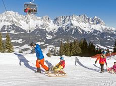
A mountain with lots of tobogganing options and good refreshment stops.
Astbergbahn Talstation, Going (805 m)
Astbergbahn Talstation, Going (805 m)
Rodelen
Normaal
3,2 km

Kufstein – Brentenjoch – Kaindlhütte
Kaiserlift summit station, Kufstein (1,255 m)
Kaindlhütte, Scheffau (1,293 m)
Wandelen
Gemakkelijk
1:30 u
2,9 km
220 Hoogtemeters

The heart of the tour is the deep, wonderful-to-climb chimney, which lends the tour an Alpine character.
Alpine klimroutes

Wochenbrunner Alm – Gruttenhühtte
Hiking starting point Wochenbrunner Alm, Ellmau (1,085 m)
Gaudeamushütte, Going (1,263 m)
Wandelen
Normaal
1:45 u
2,6 km
530 Hoogtemeters

Ellmau Tourist Information Office - football pitch - Ellmauer Hof - KaiserBad - Hausbach farms - Ellmau Tourist Information Office
Tourist Information Office, Ellmau (820 m)
Tourist Information Office, Ellmau (820 m)
Fietsen
Gemakkelijk
8,2 km
110 Hoogtemeters

A leisurely circular trail along the sunny side of Ellmau. This is a lovely walk along the picturesque Kaiserloipe with views of the majestic mountains. An easy hike for the whole family.
Hiking starting point Tourist Info, Ellmau (800 m)
Hiking starting point Tourist Info, Ellmau (800 m)
Wandelen
Gemakkelijk
2:00 u
5,8 km
50 Hoogtemeters
From Going to the Astberg with a small altitude loop & impressive panoramic view.
Hiking starting point Going center (former tourist information Going) (764 m)
Hiking starting point Going center (former tourist information Going) (764 m)
Wandelen
Gemakkelijk
3:30 u
8,6 km
560 Hoogtemeters

Alpine klimroutes

Ellmau village park - Hartkaiserbahn valley station - Bergschenke - Rübezahlalm - Jägerhütte - Hartkaiser summit station
Hiking starting point Tourist Info, Ellmau (800 m)
Hartkaiser summit station, Ellmau (1,555 m)
Hardlopen
Normaal
8,2 km
720 Hoogtemeters

Short hike to the waterfall in the Breuergraben along the Schwarzache.
Brandstadlbahn valley station, Scheffau (681 m)
Brandstadlbahn valley station, Scheffau (681 m)
Wandelen
Gemakkelijk
1:00 u
3,0 km
150 Hoogtemeters

Gentle walking or running course in Ellmau
Hiking starting point Tourist Info, Ellmau (800 m)
Hiking starting point Tourist Info, Ellmau (800 m)
Hardlopen
Gemakkelijk
0:20 u
3,0 km
54 Hoogtemeters

Cross-country skiing on an isolated plateau, surrounded by forest and winter meadows.
Langlaufen
Gemakkelijk
1,3 km
30 Hoogtemeters

Going, Hüttling - Schleierwasserfall - Obere Regalm - Baumgartenköpfl (Bergsteigergrab) - Gaudeamushütte - Ellmauer Tor - Hintere Goinger Halt - Jubiläumssteig - Gruttenhütte - Kaiser-Hochalm - Steiner-Hochalm - Hinterschießling Alm - Rehbachklamm - Scheffau, Dorf
Hiking starting point Hüttling, Going (820 m)
Scheffau village (738 m)
Wandelen
Moeilijk
14:00 u
24,6 km
2060 Hoogtemeters

A wonderful tour up to the Astberg lake via the Hollenauer Cross with dream views
Astbergbahn valley station, Going (805 m)
Astbergsee, Going (1.251m)
Wandelen
Gemakkelijk
3,0 km
465 Hoogtemeters
Embark on a sunny cross-country safari in the snowfields around the Sölllandl.
Spar super market Söll
Spar super market Söll
Langlaufen
Normaal
5,9 km
70 Hoogtemeters

Alpine klimroutes

A nice run around the crystal-clear lake Hintersteiner See.
Starting point Seestüberl, Scheffau (822 m)
Starting point Seestüberl, Scheffau (882 m)
Hardlopen
Gemakkelijk
5,2 km
180 Hoogtemeters

A tour of the main filming locations of the TV series “Der Bergdoktor” (The Mountain Doctor) in Ellmau, with a refreshment stop at the inn used during filming
Hiking starting point Tourist Info, Ellmau (798 m)
Hiking starting point Tourist Info, Ellmau (798 m)
Wandelen
Gemakkelijk
2:15 u
7,5 km
200 Hoogtemeters

Calling bike fans of all ability levels! The Kaiser circular cycling route is an 80-kilometre bike route through the spectacular scenery of the Kaisergebirge mountain range. An excellent network of well-signposted trails (a mix of asphalt and gravel paths) leads past idyllic nature, breathtaking panoramas and cultural sights. For relaxing moments in between stages, cool lakes and local restaurants invite you to linger and enjoy.
anywhere along the tour
anywhere along the tour
Fietsen
Normaal
83,0 km
700 Hoogtemeters

Via ferrata

This segment will take you to the small town of Kufstein located on the banks of the Inn River – a town which has been celebrated in song and is steeped in history and character. Walk through the lush and verdant beauty of a pasture paradise with cosy huts and mountain restaurants to take a rest (delicious “Kiachl” are served at Brentenjoch Hut every Saturday). With so many sights to see, you should not forget to keep an eye on the wayside – as nearly a thousand of different flowering plants grow in the Kaiser Mountains. A highlight of this segment is the “Wilder Kaiser” chair lift ride – a great chance to wind down and recharge your batteries after having had plenty of wonderful experiences at the heart of nature. The lift ride takes you down to Sparchen, a district of Kufstein.
Hintersteiner See
Kufstein
Wandelen
Normaal
4:21 u
12,4 km
160 Hoogtemeters

Looping the village of Söll, the sight seeing hike!
Hiking starting point Tourist Info, Söll (689 m)
Hiking starting point Tourist Info, Söll (689 m)
Wandelen
Gemakkelijk
1:00 u
3,7 km
50 Hoogtemeters

Past inn, farm and chapel in the Kaiser countryside.
Hiking starting point Going Center (former Tourist informatin Going)
Hiking starting point Going Center (former Tourist informatin Going)
Langlaufen
Gemakkelijk
1,2 km
10 Hoogtemeters