


 Deutsch
 Nederlands
MTB Tour Söll - Hintersteiner See Lake
Closed
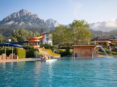
Picture-postcard panoramic scenery to Hintersteiner See lake, a natural gem.
Villag Center, Söll (689 m)
Hintersteiner See Lake, Scheffau (889 m)
Cycling
Intermediate
9,4 km
430 Elevation gain
We are sorry, your requested page is not available. You can start a new search on this page!
Picture-postcard panoramic scenery to Hintersteiner See lake, a natural gem.
Villag Center, Söll (689 m)
Hintersteiner See Lake, Scheffau (889 m)
Cycling
Intermediate
9,4 km
430 Elevation gain

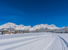
Imperial glide during the day and at night - on the only night trail.
Cross-country skiing
Easy
1,2 km
30 Elevation gain

Cross-country skiing in imperial style with two options: moderately challenging or just for pleasure.
Cross-country skiing
Easy
5,5 km
50 Elevation gain

Challenging adventure hike to the Ellmauer Tor
Hiking starting point Wochenbrunner Alm, Ellmau (1,085 m)
Ellmauer Tor, Ellmau (2,001 m)
Hiking
Intermediate
5:00 h
7,7 km
900 Elevation gain

Number of rope lengths12
Access time2,0
Alpine climbing route
Multi-rope length difficulty levels6+ (6-/A0)

Two very demanding, fantastic lookout peaks on the Wilder Kaiser, which are not to be underestimated.
Hiking starting point Wegscheid, Scheffau (883 m)
Hiking starting point Wegscheid, Scheffau (883 m)
Hiking
Difficult
9:00 h
11,0 km
1440 Elevation gain

Gentle walking or running course in Ellmau
Hiking starting point Tourist Info, Ellmau (800 m)
Hiking starting point Tourist Info, Ellmau (800 m)
Jogging
Easy
0:20 h
3,0 km
54 Elevation gain

Hike from the centre of Ellmau, along trail no. 14, through the "Spatlahner gorge" up to the Wochenbrunner Alm.
Hiking starting point Tourist Information Office, Ellmau (800 m)
Hiking starting point Tourist Information Office, Ellmau (800 m)
Hiking
Easy
1:30 h
4,4 km
285 Elevation gain

A tour of the main filming locations of the TV series “Der Bergdoktor” (The Mountain Doctor) in Ellmau, with a refreshment stop at the inn used during filming
Hiking starting point Tourist Info, Ellmau (798 m)
Hiking starting point Tourist Info, Ellmau (798 m)
Hiking
Easy
2:15 h
7,5 km
200 Elevation gain

A varied circular cycling route around hohe Salve mountain with plenty of refreshment stops.
anywhere along the tour
anywhere along the tour
Cycling
Intermediate
62,0 km
650 Elevation gain

A wild and romantic walk through the Kaiserwald forest with its wildlife park and cosy, traditional Tirolean parlour.
Hiking starting point Tourist Info, Ellmau (800 m)
Hiking starting point Tourist Info, Ellmau (800 m)
Hiking
Intermediate
3:30 h
9,0 km
300 Elevation gain

There are 3 steep rises which are moderable with e-bikes.
Cable car valley station, Söll (725 m)
Au Hoch-Alm, Söll (1.600 m)
Cycling
Intermediate
8,9 km
860 Elevation gain

This well-secured sport climbing route features interesting lines in prime rock.
Number of rope lengths9
Access time2,0
Alpine climbing route
Multi-rope length difficulty levels8+

Gruttenhütte - Kaiser-Hochalm - Steiner-Hochalm - Hinterschießling Alm - Rehbachklamm - Scheffau, Dorf
Gruttenhütte, Ellmau (1,620 m)
Scheffau village (889 m)
Hiking
Intermediate
4:30 h
11,4 km
190 Elevation gain

A mountain with lots of tobogganing options and good refreshment stops.
Astbergbahn Talstation, Going (805 m)
Astbergbahn Talstation, Going (805 m)
Tobogganing
Intermediate
3,0 km

Atmospheric forest walk along the snow-white creek.
Hiking starting point Tourist Info, Scheffau (738 m)
Hiking starting point Tourist Info, Scheffau (738 m)
Hiking
Intermediate
2:00 h
4,2 km
160 Elevation gain

A roundhike with family-picnic in a meadow. Tip: bring a pair of binoculars to see the chamois on the rocks.
Hiking starting point Jägerwirt, Scheffau (883 m)
Hiking starting point Jägerwirt, Scheffau (883 m)
Hiking
Intermediate
2:00 h
5,1 km
350 Elevation gain

Explore the sunny foot of the Pölven mountain.
Cross-country skiing
Easy
0,9 km
Ellmau hiking info point - Wimm - Riesen - Biedringer Alm - Biedringer Bauernhöfe - Ellmauer Kaiserbad - Ellmau hiking info point
Hiking starting point Tourist Info, Ellmau (800 m)
Hiking starting point Tourist Info, Ellmau (800 m)
Jogging
Easy
9,8 km
400 Elevation gain

Number of rope lengths4
Access time2,0
Alpine climbing route
Multi-rope length difficulty levels7-

From the flowery village to the water jewel of the Alps.
Hiking starting point Franzlhof, Söll (703 m)
Seestüberl restaurant, Hintersteiner See, Scheffau (890 m)
Hiking
Intermediate
3:15 h
9,5 km
460 Elevation gain

Scenic and varied circular hike.
Hiking starting point Going center (former tourist information Going) (764 m)
Hiking starting point Going center (former tourist information Going) (764 m)
Hiking
Intermediate
4:00 h
11,0 km
500 Elevation gain

Turnoff to Granderalm – Schleier Waterfall – Going, Hüttling
First turnoff after the Granderalm
Hiking starting point Hüttling, Going (820 m)
Hiking
Intermediate
2:00 h
3,1 km
40 Elevation gain

This is a very well secured sport climbing route in excellent rock conditions.
Number of rope lengths10
Access time2,0
Alpine climbing route
Multi-rope length difficulty levels8+
Following the Stampfangerbach stream on the way to Filzalm lake
Hiking starting point Bergbahn, Söll (725 m)
Hiking starting point Bergbahn, Söll (725 m)
Hiking
Intermediate
3:15 h
9,0 km
620 Elevation gain

From Hochsöll (Hexenwasser theme park) and Filzalmsee lake to Brixen im Thale.
Hexenwasser theme park Söll Hohe Salve
Brixen im Thale valley station
Cycling
Intermediate
9,3 km
200 Elevation gain

Winter hike with picturesque views of the Wilder Kaiser to the 'Wolfsegg' plateau
Hiking starting point Going center (former tourist information Going) (764 m)
Hiking starting point Going center (former tourist information Going) (764 m)
Hiking
Easy
1:30 h
4,0 km
65 Elevation gain

Number of rope lengths6
Access time2,0
Alpine climbing route
Multi-rope length difficulty levels6+

Wochenbrunner Alm – Gruttenhühtte
Hiking starting point Wochenbrunner Alm, Ellmau (1,085 m)
Gaudeamushütte, Going (1,263 m)
Hiking
Intermediate
1:45 h
2,6 km
530 Elevation gain

Historical route pleasant to walk for everyone.
Hiking starting point Tourist Info, Söll (689 m)
Hiking starting point Tourist Info, Söll (689 m)
Hiking
Easy
1:00 h
3,0 km
40 Elevation gain

Climb to the best viewpoint in the mountains, where the Wilder Kaiser is within touching distance.
Hiking starting point Going center (former tourist information Going) (764 m)
Hiking starting point Going center (former tourist information Going) (764 m)
Hiking
Intermediate
4:30 h
10,7 km
360 Elevation gain

Very demanding round tour to the two eastern peaks in the Wilder Kaiser.
Hiking starting point Tannbichl, Going (857 m)
Hiking starting point Tannbichl, Going (857 m)
Hiking
Difficult
9:00 h
13,0 km
1570 Elevation gain

A unique hike to the highest mountain hut in the Wilder Kaiser region featuring a panoramic view.
Hiking starting point Going center (former tourist information Going) (764 m)
Hiking starting point Going center (former tourist information Going) (764 m)
Hiking
Intermediate
6:00 h
14,0 km
890 Elevation gain

The most adventurous route to the highest hut on the Wilder Kaiser.
Wochenbrunner Alm, Ellmau (1,085 m)
Wochenbrunner Alm, Ellmau (1,085 m)
Hiking
Intermediate
3:15 h
5,5 km
550 Elevation gain

By bike through the culinary region Wilder Kaiser.
anywhere along the tour
anywhere along the tour
Cycling
Intermediate
38,3 km
560 Elevation gain

Number of rope lengths14
Access time2,0
Alpine climbing route
Multi-rope length difficulty levels6+/A0
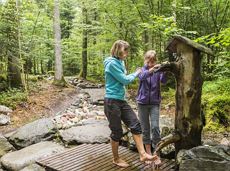
Refreshing walk through the Kneipp facilities and adventures in the Rehbachklamm gorge
Hiking starting point Tourist Info, Scheffau (738 m)
Hiking starting point Tourist Info, Scheffau (738 m)
Hiking
Intermediate
2:00 h
7,1 km
330 Elevation gain
Short, promising cross-country ski circuit with combination options.
Cross-country skiing
Intermediate
2,2 km
40 Elevation gain

A crisp, varied tour from Söll via the Lengau to Bad Häring and over the Werlberg, past the Juffinger Jöchl back to Söll. Between the individual forest sections, you are rewarded again and again with magnificent views of large parts of the Inntal valley.
Village centre, Söll (689 m)
Village centre, Söll (689 m)
Cycling
Difficult
24,0 km
900 Elevation gain

Ellmau hiking info - Church - Gasthof Au - Forstmeile Ellmau
Hiking starting point Tourist Info, Ellmau (800 m)
Hiking starting point Tourist Info, Ellmau (800 m)
Jogging
Easy
5,5 km
150 Elevation gain